
Sentiero degli Dei access point (Maiori trailhead)
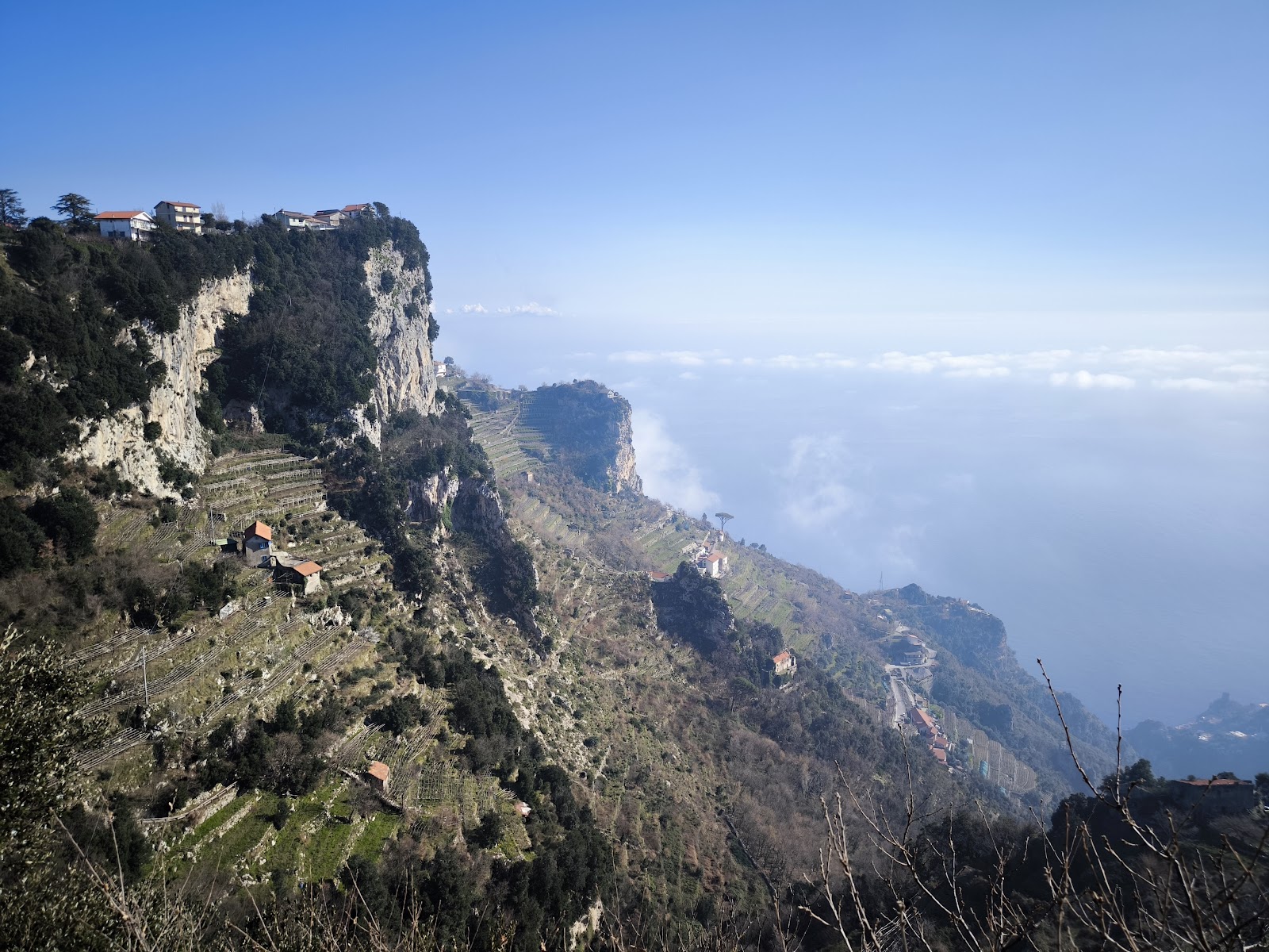
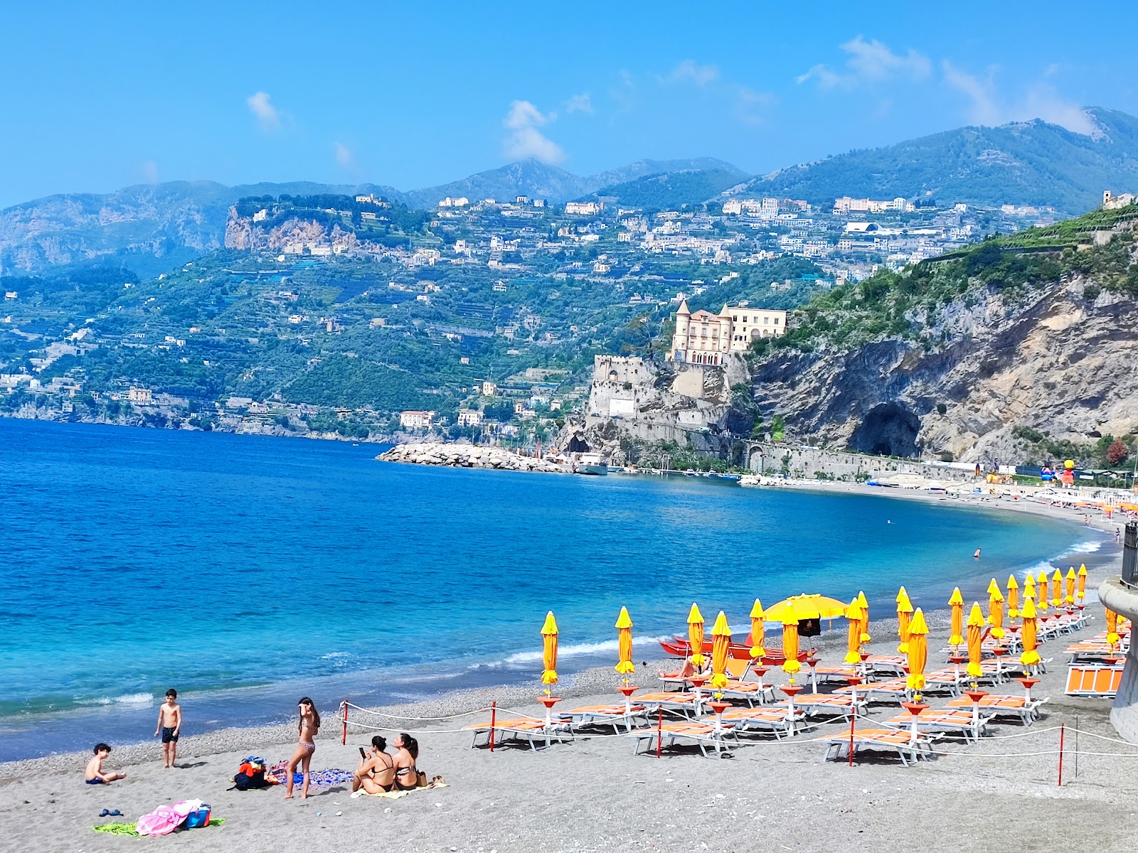
The flight of steps off Via Casale Alto in Maiori is easy to miss — a narrow staircase rising between walls, with tiles and yellow spray-painted arrows pointing the way up. This is where the trail begins if you're starting from the coast itself, climbing through terraced lemon groves toward Torre and eventually Minori, a route that predates the road below by centuries.
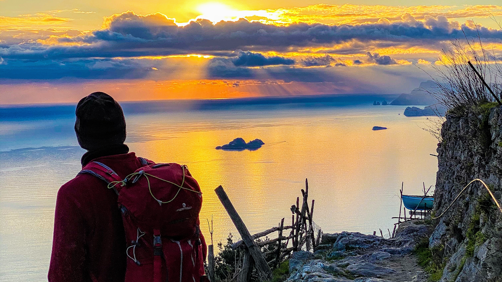
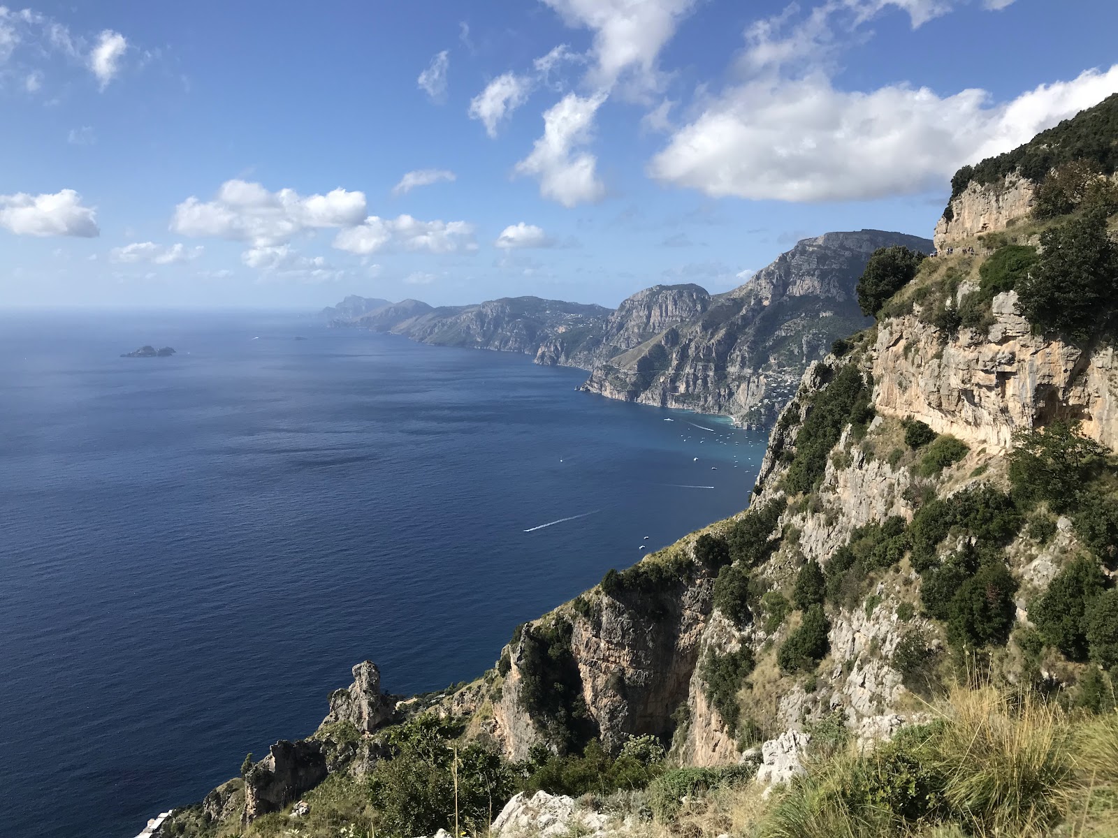
The Sentiero degli Dei — the Path of the Gods — was once the only reliable link between these cliff-hung villages, and the reason it existed at all was partly defensive: a high route that let people melt into the mountains when pirates appeared on the water below. Amphorae, coins and graves from the early Roman imperial period have surfaced along these slopes, evidence that the path is older than any name given to it.
💛 What travellers fall for
People who've done this route more than once tend to start earlier than they think necessary — the exposed sections turn punishing by mid-morning in summer. They also note that the donkeys you pass on the path are working animals, not props; give them room. Yellow paint on rock is your navigation system, and it's reliable.
The story behind Sentiero degli Dei access point (Maiori trailhead)
Before the coastal road was cut into the cliffs, the high paths were how people moved between Maiori, Minori, and the villages above. The route served commerce and escape in equal measure — when North African raiders worked the Tyrrhenian coast, the mountain tracks were the only way out. That dual purpose, practical and urgent, shaped where the path runs and why it climbs so steeply so quickly.
Archaeological finds along these slopes — amphorae, coins, graves, fragments of Roman-era streets — suggest the route was already established in the early centuries of the empire. No single founder or construction date is recorded; the path accumulated over generations of use, each village adding its own steps and shortcuts.
Good to know
Begin at Via Casale Alto in Maiori; allow an hour to reach Torre and connect onward to Minori. Bus #5120 from Salerno passes through Maiori. No water or food on the path — carry 1.5 to 2 litres. The trail is free and open year-round but closes during wildfire risk or landslide conditions.
April to May and September to October give you the most reliable conditions — cooler air, manageable sun, and the landscape at its greenest or most golden. Summer is hot and largely shadeless on the exposed ridges; winter brings rain, wind, and occasional snow at elevation, with a real risk of muddy, unstable ground.
Where is Sentiero degli Dei access point (Maiori trailhead)?
More tickets & tours for Sentiero degli Dei access point (Maiori trailhead)
Book directly at the provider
What travellers say about Sentiero degli Dei access point (Maiori trailhead)
Absolutely stunning views!!! Went there at around noon, started at Bomerano, and ended in Nocelle, which is where the hike officially ends, then I walked to Positano. It was mostly downhill, and took me about 2h 40 mins at a leisurely pace and stopping to take lots of photos. I am quite an inexperienced hiker, and not very athletic, but if I tried harder, I could easily get it under 2 hours. However, it can very for everybody, with most people taking 3-6 hours to complete based on which direction they’re going. I felt that the most challenging part of the hike was not even the official hike itself, but it was the steps from Nocelle down to Positano, which are thousands of steps. It started off fine, but really got more difficult as it progressed. My soles were a bit sore after. From Nocelle to Positano it took an hour.”, bringing the total to around 4 hours. Definitely bring a good pair of shoes, bring some food, and at least 1-2 litres of water. Also research well on how to get there. It was so worth it!!!
Such beautiful scenery. Quicker than we thought. Started at Bomerano, walked to Nocelle and then down the steps to Positano. However we needed to walk the road the rest of the way so thinking maybe we took a wrong turn as it did appear there was a higher route from Nocelle to Positano.
The hike is very easy but extremely scenic! You will walk the whole track accompanied by breathtaking views of the coast. It starts in Bomerano village from the town's square. There are plenty of signs and you won't get lost. The square is also a good spot to prepare for the hike. You can have take sway panini made at a local shop and have breakfast at one of the many caffes there. Let you need any additional gear, there's a specialized shop as well with shoes, hiking poles, hats, bags, etc. The entire hike is about 4 to 5 hours long. You will cross the Nocelle village where you can stop for a refreshment before the 1400+ steps descent beack to the sea level. Ah, about that. I strongly recommend doing this track on the Bomerano -> Positano direction. The opposite way is nothing but suffering.
Planned to take the train from Bomerano to Nocelle, however we made a last minute decision to take the stairs down to Positano and skip Nocelle. The walk down to the Positano level from the official trail took about 25 min - shorter than expected. It was another 35 min to get to the main Positano area after getting down to the bottom. Did the trail on an overcast day which prevented us from taking in the views fully.
Great hike! Wonderful views! A bit crowded though. Definitely a more touristy hike but still wonderful! It took me and my spouse 2hr to complete the hike down to Positano.
More of Maiori
Discover where to stay, what to do and the best deals for your trip.
Explore Maiori →More attractions in Maiori
All of Maiori →

Background adapted from Wikipedia (CC BY-SA) · map data © OpenStreetMap contributors · ratings & place photos via Google · other photos with per-image credit. Ticket links may earn us a commission at no extra cost to you.