
Bláhnúkur (Blue Peak)
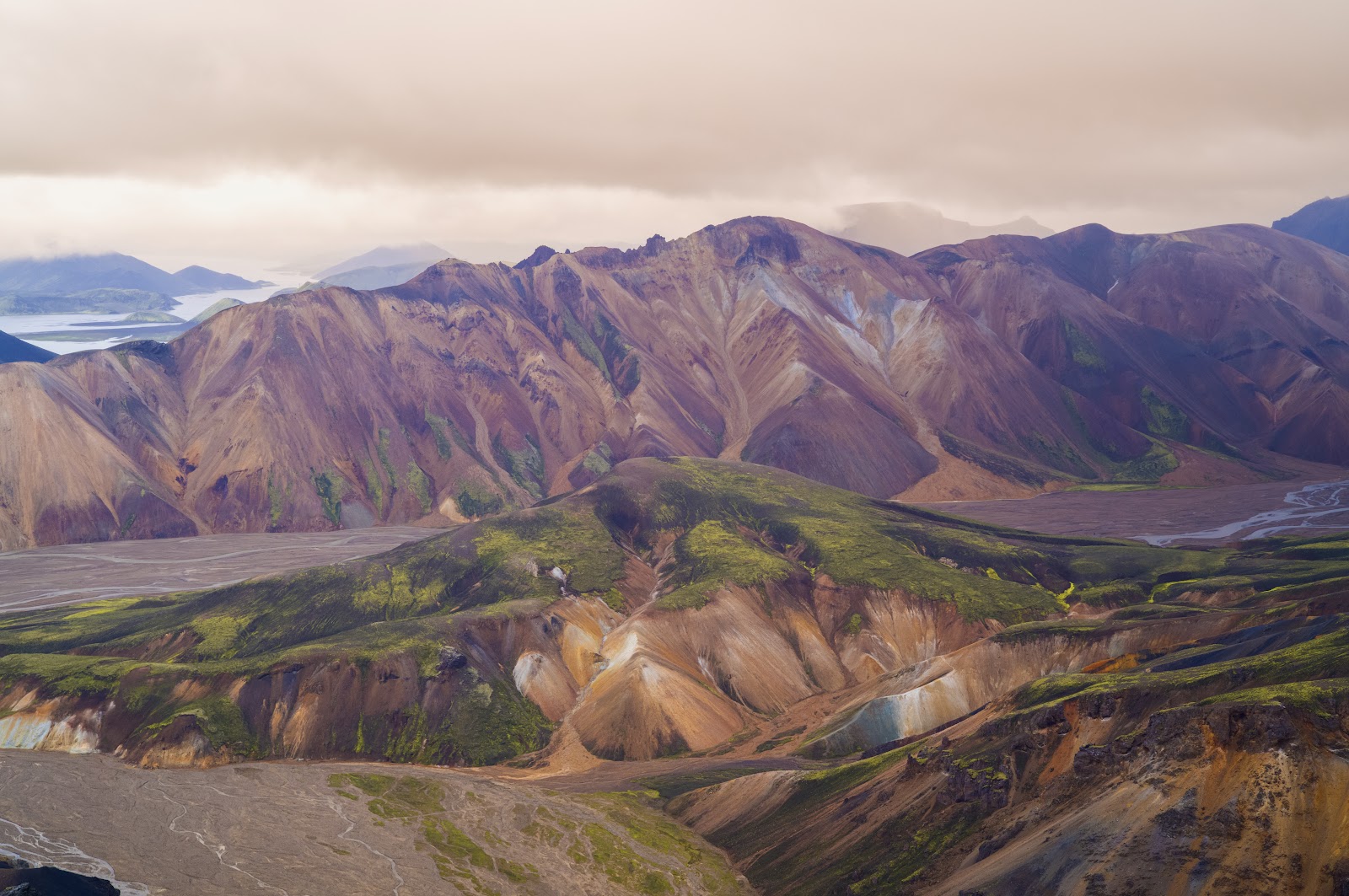
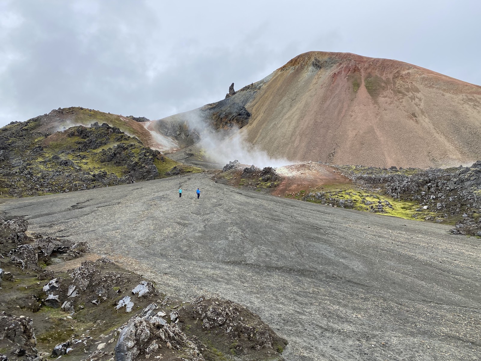
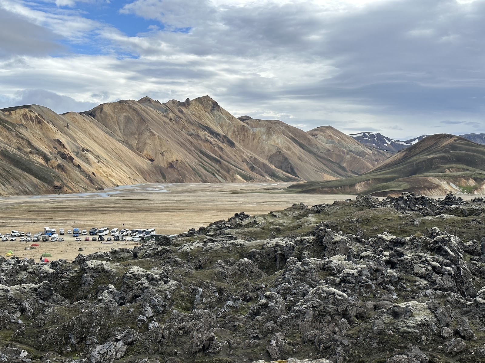
Stand at the Landmannalaugar campground and Bláhnúkur is the thing your eye keeps returning to — a steep, blue-grey mass rising above the lava field and steam vents, its colour coming not from the sky but from the rhyolite and volcanic ash in the rock itself. On a clear day, five glaciers are visible from its 945-metre summit.
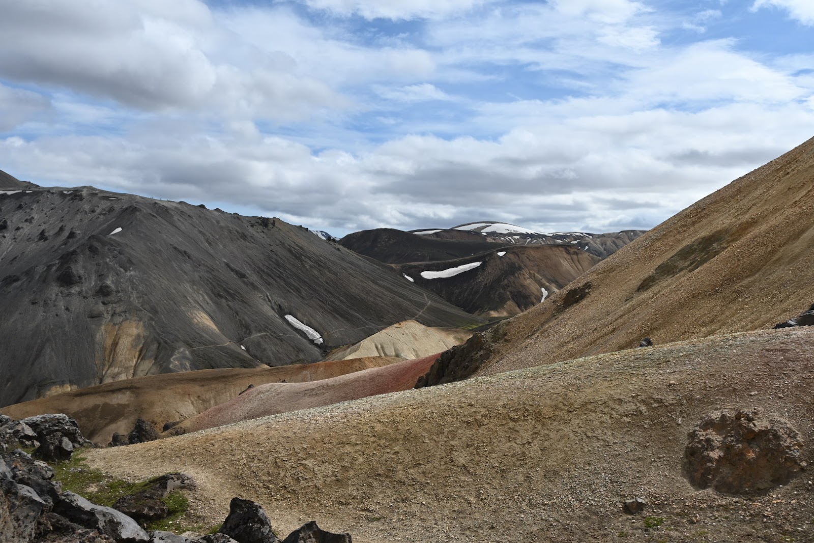
The hike up is 6.1 kilometres round trip, rated hard, and earns that rating honestly. Switchbacks give way to short, punishing ascents, and the northwest descent toward Brennisteinsalda — where accidents happen regularly — demands slow, deliberate footwork. The trailhead is a flat 0.8-kilometre walk from camp, marked with a sign at the mountain's base.
💛 What travellers fall for
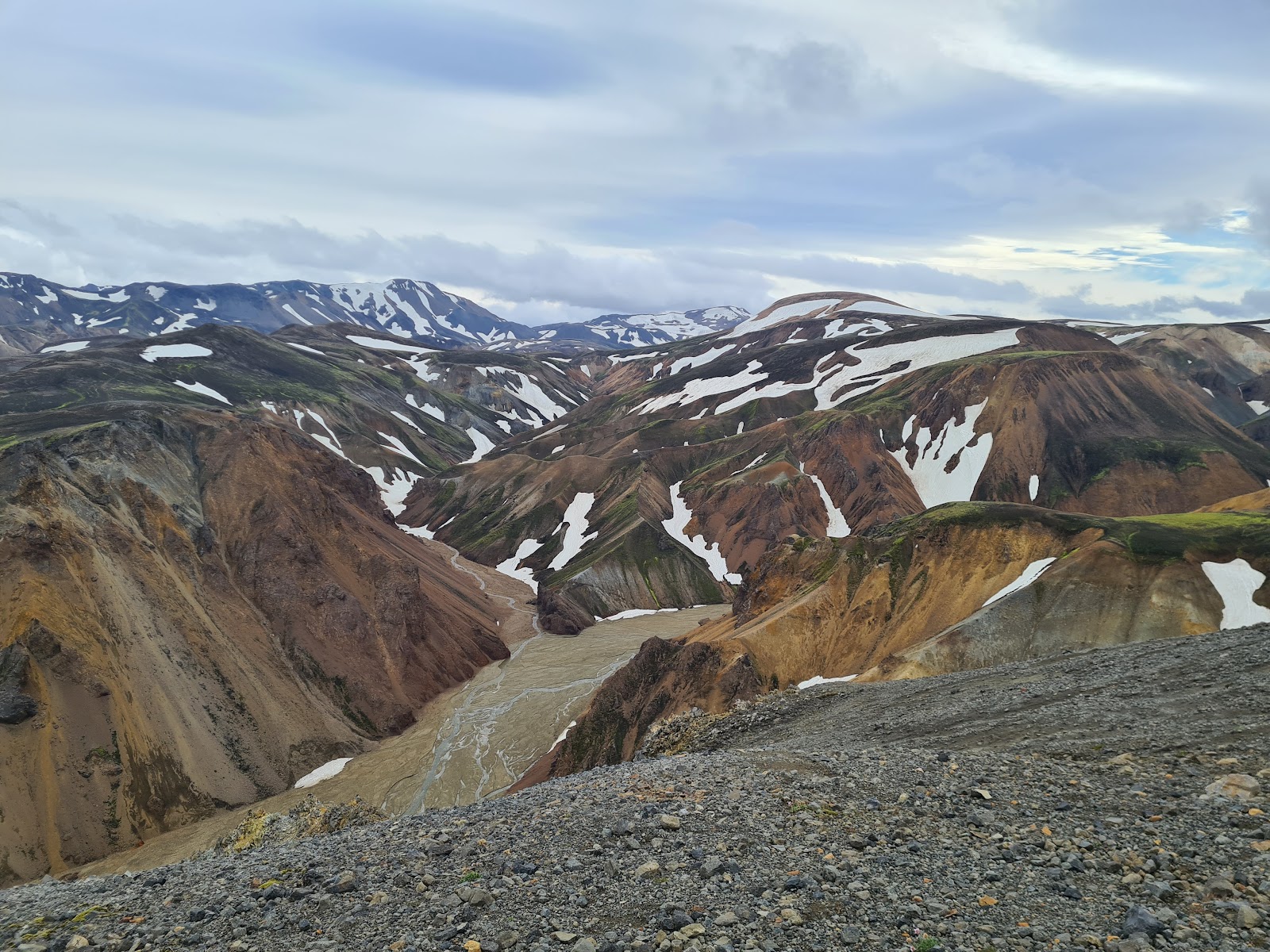
People who've done it more than once tend to agree on a few things: start early before afternoon cloud rolls in, treat the northwest descent with more respect than you think it needs, and pick up the 300-ISK map at the warden's desk not because it's detailed but because the warden will tell you what the trail is actually like that morning.
The story behind Bláhnúkur (Blue Peak)
Bláhnúkur formed somewhere around 108,000 years ago — give or take 22,000 — during the last glacial period, when a volcano pushed upward through more than 400 metres of ice in what geologists call a subglacial effusive eruption. The ice shaped everything: the steep flanks, the compressed profile, the particular mineral-rich rhyolite that gives the peak its blue-grey cast. It belongs to the Torfajökull volcanic system, one of Iceland's largest.
Torfajökull itself last erupted in 1477, and that event left its own mark on the landscape directly below Bláhnúkur — the Laugahraun lava field that now separates the peak from Grænagil Canyon to the east. The two formations, one ancient and ice-carved, one historically recent and raw, sit within walking distance of each other.
Good to know
Road F208 requires a 4WD and is closed outside roughly mid-June to mid-September. Parking at Landmannalaugar is limited and requires advance reservation — the bus from Reykjavik is the easier call. Budget three to four hours for the full loop.
The highland interior where Bláhnúkur sits is accessible only between mid-June and early September, when snow clears from the roads and trails. Even in summer, the summit is frequently fogged in and weather can shift from calm to wind-driven rain within an hour — layers and waterproofing are not optional.
Where is Bláhnúkur (Blue Peak)?
More tickets & tours for Bláhnúkur (Blue Peak)
Book directly at the provider
What travellers say about Bláhnúkur (Blue Peak)
A must, epic hike in Iceland, combined with Brennisteinsalda Loop. Review from September 10th, 2025. I highly advise starting with Blahnjukur, or Black Mountain first. The steep elevation climb in comparison felt more difficult. Overall combining this with the Loop was our favorite hike in our 15 day Icelandic journey. The views are impeccable, the climb feels surreal as a hiker. We dealt with rain and then snow at the top of the mountain. The trail is maintained, with moments you feel truly one with Iceland’s ruggedness. Often times you need to remember the color of the trail posts at parts of the loop, and ensure you are following them. The central highlands of Iceland’s beauty cannot be described and I’d highly recommend people spend as much time here as possible. Bring appropriate gear for any unexpected situation.
Get ready to cross the river! Just like the challenges before reaching the mountain hike, this is part of the adventure apparently. Building bridges could make it easier, especially when it rains and the river overflows—but for now if you up for it
(June 22, 2025) The uphill section is quiet steep and long but doable for us. The views along the trail are truly amazing, and there are a few river crossings to tackle. Don’t forget to bring a towel!
Lovely view but the "1.3km" that the trail sign claimed is total BS. Maybe as the crow flies but it's 4x that with all the switchbacks and the 926m of elevation gained. You have to be fit and confident in your hiking shoes to do the hike. It's all very loose gravel and sand(volcanic ash). But in the end a good hike and you can see very far.
Nice mountain (945 meters). Views at surrounding hills are stunning if the weather is good. Hike to the top is quite steep at some sections but nothing to be worry about. It takes about 1 hour to the top from Landmannalaugar campsite. Be aware of strong wind. I definitely recommend this hike if you have only one day for this place.
More of Iceland
Discover where to stay, what to do and the best deals for your trip.
Explore Iceland →More attractions in Iceland
All of Iceland →
Background adapted from Wikipedia (CC BY-SA) · map data © OpenStreetMap contributors · ratings & place photos via Google · other photos with per-image credit. Ticket links may earn us a commission at no extra cost to you.