
Brennisteinsalda
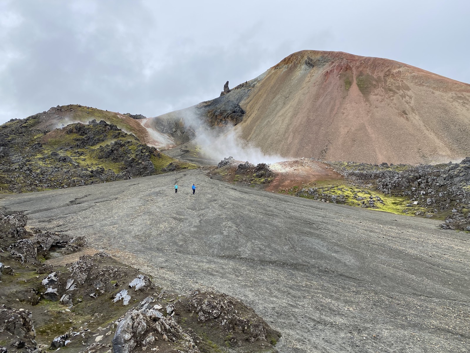
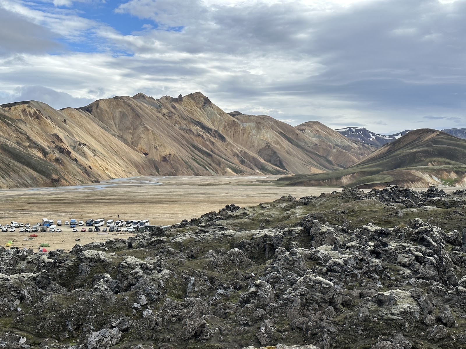
The name means 'sulphur wave', and within the first few minutes on the trail you understand why. Steam punches through fissures in the rock, the air thickens with the smell of volcanic sulphur, and the mountain in front of you is striped red, yellow, black and green — iron oxide, sulphides, lava and lichen all competing for the same slope.
Brennisteinsalda sits at around 855 metres inside the Torfajökull volcanic system in Iceland's southern highlands, and the six-kilometre loop to its summit is one of the more visually concentrated hikes in the country. Follow the green trail markers up, and the Laugahraun obsidian lava field spreads out below you as you climb.
💛 What travellers fall for
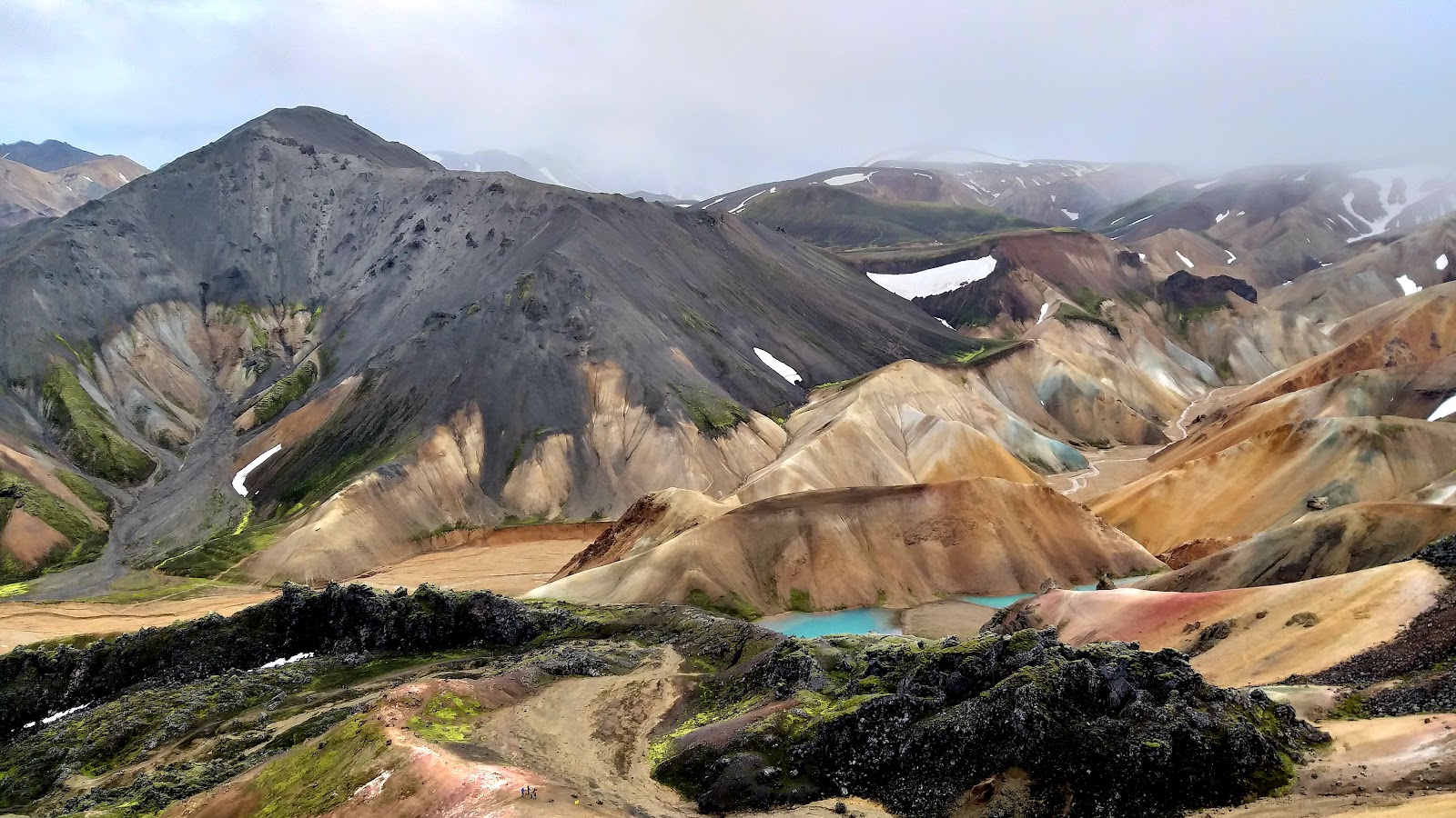
People who've done it more than once tend to go early — the parking reservation system means the trailhead stays manageable, but the light on the rhyolite is best before midday. Most combine it with Bláhnúkur for a roughly ten-kilometre day, though they're quick to mention the descent north from Brennisteinsalda's summit is genuinely slippery and deserves full attention.
The story behind Brennisteinsalda
Brennisteinsalda is part of the Torfajökull volcanic system, one of Iceland's most geothermally active zones. Its last recorded eruption was in 1341, and the nearby Vondugil valley holds rhyolite formations estimated to have shaped around 1477 — geology that moves on a timescale that makes human record-keeping feel provisional.
Serious documentation of the area came in the 19th century, when geologist Þorvaldur Thoroddsen travelled the Icelandic highlands and recorded its volcanic activity and mineral formations. His work brought scientific attention to a landscape that Icelanders had long known as difficult, geothermally restless terrain.
Good to know
Access is via Road 208, requiring a 4x4 or high-clearance SUV; the road closes in winter and typically reopens June through September. A parking reservation is required before you arrive. The loop takes around two and a half hours at a moderate pace. No entrance fee applies.
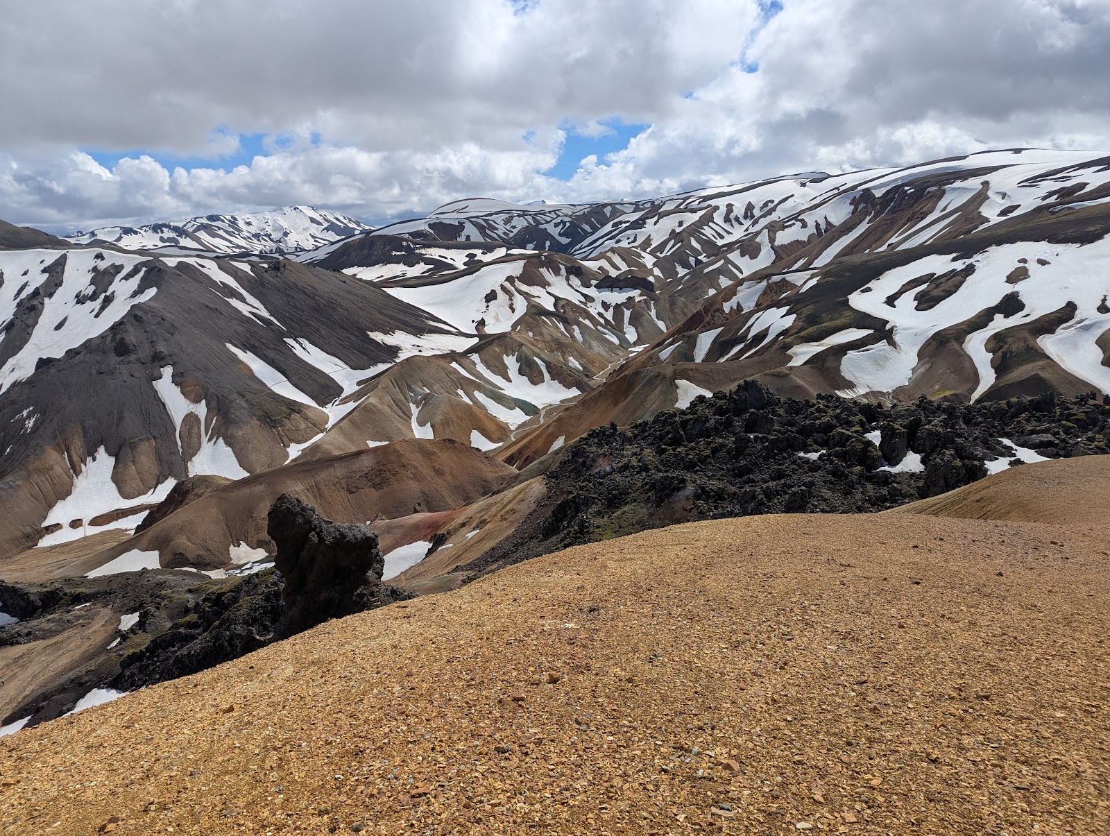
July and August are the most reliable months, when trails are snow-free and daylight is long. The highlands run cooler than the south coast, and weather shifts fast — fog and wind can close in on the exposed upper slopes within an hour, so waterproof and windproof layers are worth carrying even on a clear morning.
Where is Brennisteinsalda?
More tickets & tours for Brennisteinsalda
Book directly at the provider
What travellers say about Brennisteinsalda
Often called “the Sulphur Wave,” is one of Iceland’s most vividly colored volcanic mountains, located in the Landmannalaugar region of the Highlands. Standing before it feels like stepping into another world — the slopes glow in surreal shades of red, orange, yellow, green, and blue, all created by the area’s geothermal activity, rhyolite rock, and sulphur deposits. The contrast against the black lava fields and patches of bright green moss is nothing short of breathtaking. Hiking around Brennisteinsalda is an unforgettable experience. The most popular route is a loop that connects with parts of the Laugavegur Trail, offering constantly changing scenery — steaming vents, mineral-streaked hills, and sweeping views over Landmannalaugar’s otherworldly landscape. The trails are generally well-marked, but the terrain can be uneven and exposed, so sturdy boots and layered clothing are essential. The sulphur vents also give off a distinct smell, which some find strong but adds to the raw geothermal feel of the place. Weather in this area can change rapidly, even in summer, so visitors should always be prepared for sudden wind, rain, or fog. The roads leading to Landmannalaugar are F-roads, meaning they are only accessible by 4x4 vehicles, and river crossings may be required depending on conditions. Despite its remote location, Brennisteinsalda is absolutely worth the effort. The mountain encapsulates everything that makes Iceland’s highlands so unique — color, contrast, and the sense that you’re standing on a living, breathing planet. It’s a place where art and geology merge seamlessly, and no photograph can truly capture how surreal it feels to stand there in person.
Brennisteinsalda, combined with blahnjukur is one of the most epic hikes in this world. The rainbow colors of the mineral deposits were radiating, regardless of the September rainy weather. We did have to do one minuet river crossing, always pack appropriately for the weather (extra gear, socks, etc). Overall, this loop was fantastic, make sure you bring your swimsuit to relax in Landmannaugar afterwards :). I will note, the mornings it is typically empty, while in the afternoon as folks return from their hikes it was packed. Weather and Hike from September 10th 2025
One of the two most popular peaks to hike in Landmannalaugar and for good reason! Fairly short hike with great views all the way up (and down). I would recommend doing this second if you also plan to hike Blue Peak. Highly recommend this hike - even if you don't do it, walk around the lava fields and just soak in the amazing colours of the mountains.
Like no where else in the world. We followed the advice of a family who posted their adventures of Landmannanlauger several years ago. We hiked this volcanic mountain referred to as the Blue Peak the summer of 2023. There are several river crossings to get here so we drove a large 4x4 for our family trip. We also enlisted a local, Kolbeinn Helga, who used to work search and rescue in the Highland area to help us navigate the trails for my family of 10 persons. During our hike, loud thunder rolled our way which concerned us. Kolbeinn put our nerves to ease when he informed us that it wasn't thunder but just an earthquake related to the recent volcanic activity. O.K.... it didn't really put us at ease since the sound was followed a few seconds later by the sound of thousands of rocks from the area now rolling down hill. Not on our peak thankfully. The initial ascent is steep but not scary and the views from the peaks are breathtaking. I spent a few months before traveling to Iceland obtaining a drone permit for Landmannanlauger since it is a no drone area. It was not difficult, you just need lead time to work with the Icelandic Environmental agency. Truly, this was one of the most amazing hikes our family has ever done.
Great day hike for amazing views at the top and fun scrambling through lava fields. There is a nice loop option from the camp ground. Stick to the path which is very well marked to preserve the flora.
More of Iceland
Discover where to stay, what to do and the best deals for your trip.
Explore Iceland →More attractions in Iceland
All of Iceland →

Background adapted from Wikipedia (CC BY-SA) · map data © OpenStreetMap contributors · ratings & place photos via Google · other photos with per-image credit. Ticket links may earn us a commission at no extra cost to you.