
Quiriguá Archaeological Park
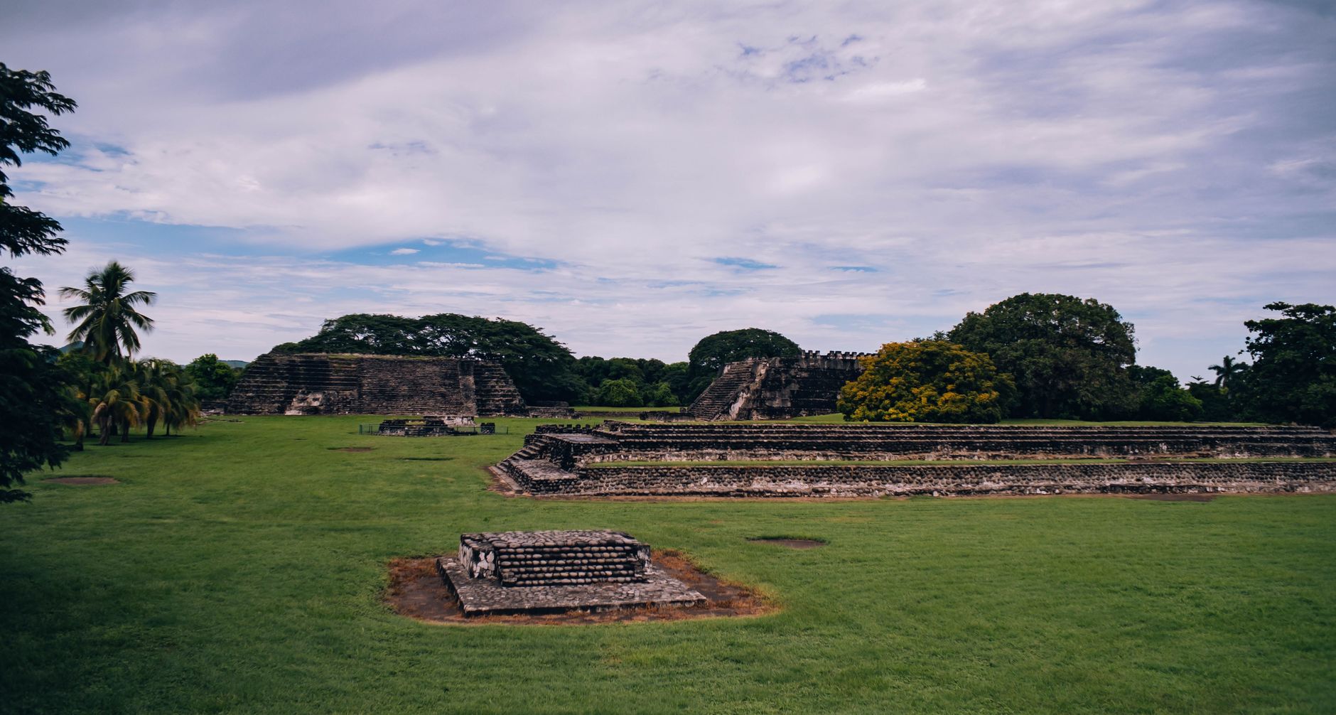
Stand in the Great Plaza at Quiriguá and the scale of the stelae stops you mid-step. Stela E — carved from a single block of red sandstone and rising 10.6 metres from base to tip — has a reasonable claim to being the largest free-standing stone monument in the New World, and it was quarried five kilometres away and raised here in the 8th century. Seventeen monuments in all occupy this 34-hectare park in the lowland department of Izabal, their surfaces still legible with low-relief portraits and calendrical text.
Quiriguá sits 75 metres above sea level in what is now banana-plantation country — the United Fruit Company once owned the land surrounding it — and that agricultural flatness makes the jungle pocket around the ceremonial core feel deliberate, preserved. Thatched shelters protect the stelae from rain; the Great Turtle Altar, Zoomorph P, crouches in the open like something that swam up from another age.
How Quiriguá Archaeological Park came to be
People were living at Quiriguá by around 200 CE, and construction on the acropolis had begun by roughly 550. The city's defining moment came in 738 CE when its king, K'ak' Tiliw Chan Yopaat — known to later scholars as Cauac Sky — captured and executed Waxaklajun Ub'ah K'awil, the ruler of the more powerful Copán. That act of audacity broke Quiriguá free from Copán's orbit and opened six decades of ambitious building: the Great Plaza, the Acropolis, and most of the stelae date from Cauac Sky's reign of 723–784 CE.
After 810 CE the historical record goes silent and the site was abandoned. Frederick Catherwood sketched two of the stelae in the 19th century, and Alfred Maudslay photographed them in 1881. Systematic excavation came later, with a major University of Pennsylvania and National Geographic project running from 1974 to 1979. UNESCO inscribed Quiriguá as a World Heritage Site in 1981.
Who and what shaped it
People who shaped it
Landmark buildings
See Quiriguá Archaeological Park in motion
Plan your visit
On the map
When to go
The Izabal lowlands are warm and humid year-round, with a rainy season running roughly May through October. Visiting in the dry months — November through April — means less mud on the paths and better light for photographing the sandstone carvings, though even in the wet season mornings tend to clear.
Right now
Background & history adapted from Wikipedia (CC BY-SA) · specs from Wikidata (CC0) · weather from Open-Meteo · map data © OpenStreetMap contributors · photos from Wikimedia Commons / Unsplash with per-image credit. No third-party reviews or social posts reproduced.