
Parco della Maremma (Uccellina) visitor gateway
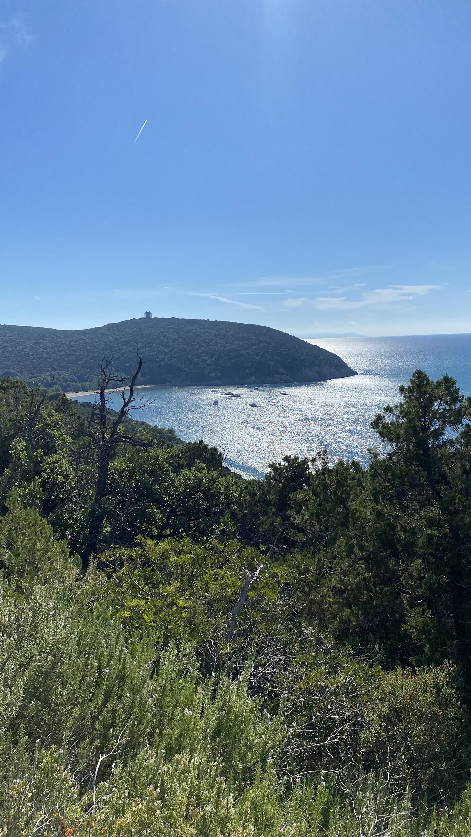
The visitor centre at Alberese is a modest building on Via del Bersagliere, but step through it and you're at the edge of something genuinely old — coastline, macchia, marsh and the dark shapes of the Uccellina hills rising to 417 metres at Poggio Lecci. This is Tuscany's first regional park, established in 1975, and it protects a stretch of the Maremma coast that has been lived in, raided, farmed and half-forgotten across fifty thousand years.
Two dozen caves, the broken towers of a medieval coastal defence network, an abandoned abbey, and somewhere in the scrub, the last working butteri — Maremma's traditional herders — still moving cattle the way they always have.
💛 What travellers fall for
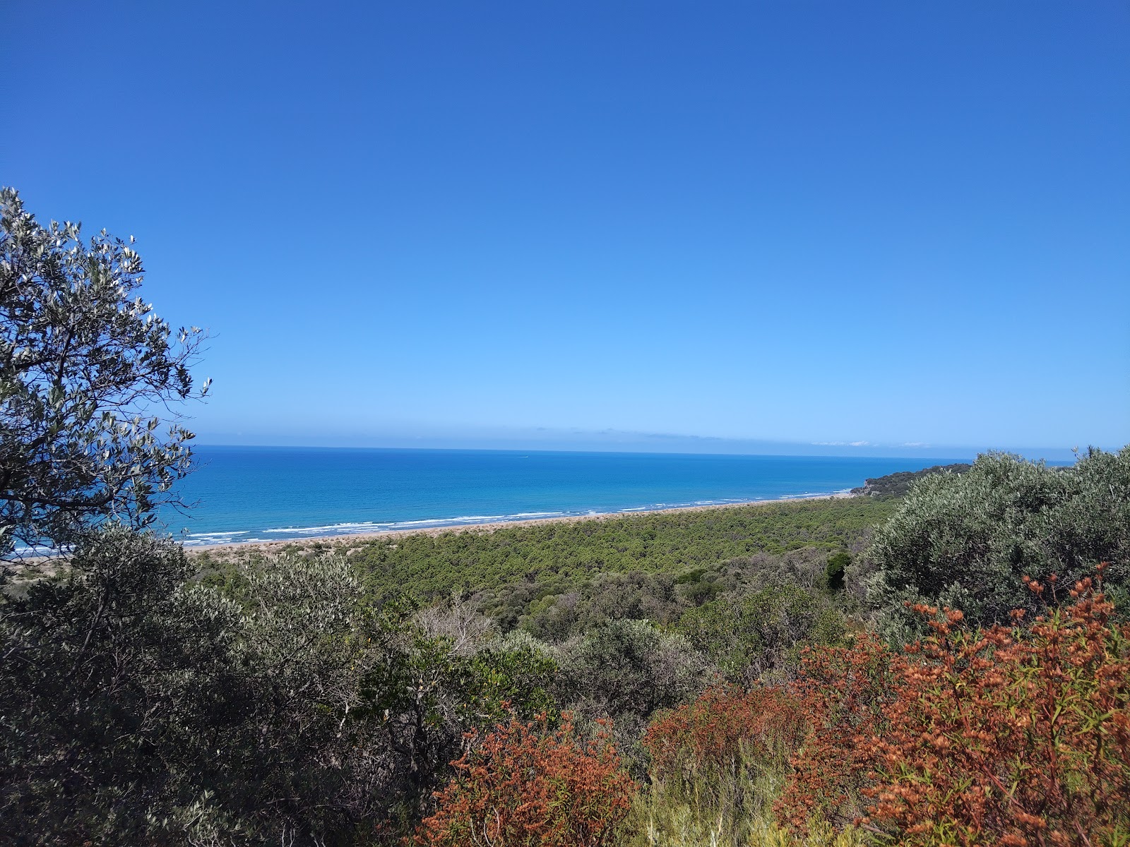
People who come back tend to split between two routes: the A2 'Le Torri' walk (7 km, manageable) for the watchtowers and sea light, and the A1 up to San Rabano abbey (7.8 km, a proper uphill) for the silence at the ruins. Both reward an early start. The Line 17 bus from the visitor centre saves the walk to the trailhead.
The story behind Parco della Maremma (Uccellina) visitor gateway
People have been sheltering in these hills since the Middle Palaeolithic, roughly 50,000 years ago. The Abbey of San Rabano rose around the year 1000, its triapsidal church taking shape over the following two centuries. It survived until the Black Death of 1348 began its slow unravelling, and by 1475 the monks were gone; the building was permanently abandoned in the sixteenth century and sat untouched for four hundred years before restoration work began.
The watchtowers along the coast — Collelungo, Cala Forno, Torre dell'Uccellina and others — tell a different story: in April 1543, the Saracen pirate Barbarossa raided this shore and carried off a local woman, Margherita Marsili, who later became bride of Sultan Soliman II. The regional government formally protected the area in 1975, and the park received the European Diploma for protected areas in 1992.
Good to know
The park is open year-round, but from mid-June to mid-September access is guided tours only due to fire risk — book ahead. Spring (mid-April to mid-June) and September are the sweet spots. Tickets run €5–€20 by route; the San Rabano trail takes around five hours.
Summers are dry and warm, with August averaging 25°C and little rain, but the fire risk closes free access to trails from mid-June through mid-September. Spring and early autumn bring temperatures between 17–25°C, manageable light, and far fewer people; November can be wet, and January cool but rarely cold.
Where is Parco della Maremma (Uccellina) visitor gateway?
More tickets & tours for Parco della Maremma (Uccellina) visitor gateway
Book directly at the provider
What travellers say about Parco della Maremma (Uccellina) visitor gateway
We had a very nice tour with a guide. I gave them a three star because they should have better informed us about the presence of mosquitos (beyond the normal in summer!) and how to dress appropriately.
Friendly service (in Italian and English as far as I could judge). I was among the first clients so no long waiting times but I looks like it could get a bit chaotic later in the day/in high season, as the same person was providing information on the trails etc., and selling the tickets. Toilets available there.
First of all, this is not meant to be a criticism of the park itself or the lady at the information desk. The lady was extremely friendly and helpful. But the insignificant park police officer wasreally bad. We parked in the information desk parking lot. As you do when you want to get information there. This was apparently too much for the park police officer and one of the employees. Without even saying hello, we were insulted and threatened with a fine. Maybe you shouldn't bite the hand that feeds you. Very unpleasant!
The parc is very nice and natural. But there were some things bothering us. We waited 45 min in the car line, until we saw that we actually didn't have to wait for the hiking routes. Good signs would have been nice. Same on the hiking route, we walked the A2, (which was supposed to be "easy" but wasn't) and the routes weren't properly signed. At some points there were the names of the sights not the routes.
(Rating only the visitors center, not the park!) Disaster…. Unfriendly stuff, all the time just asking about paying the tickets. Of course we paid for the NP, but it would be more useful, if the lady told us to bring locker for bicycle in case we wanna swim. Also no proper information about open routes in park…
More of Grosseto
Discover where to stay, what to do and the best deals for your trip.
Explore Grosseto →More attractions in Grosseto
All of Grosseto →
Background adapted from Wikipedia (CC BY-SA) · map data © OpenStreetMap contributors · ratings & place photos via Google · other photos with per-image credit. Ticket links may earn us a commission at no extra cost to you.