
Ilha de Tavira
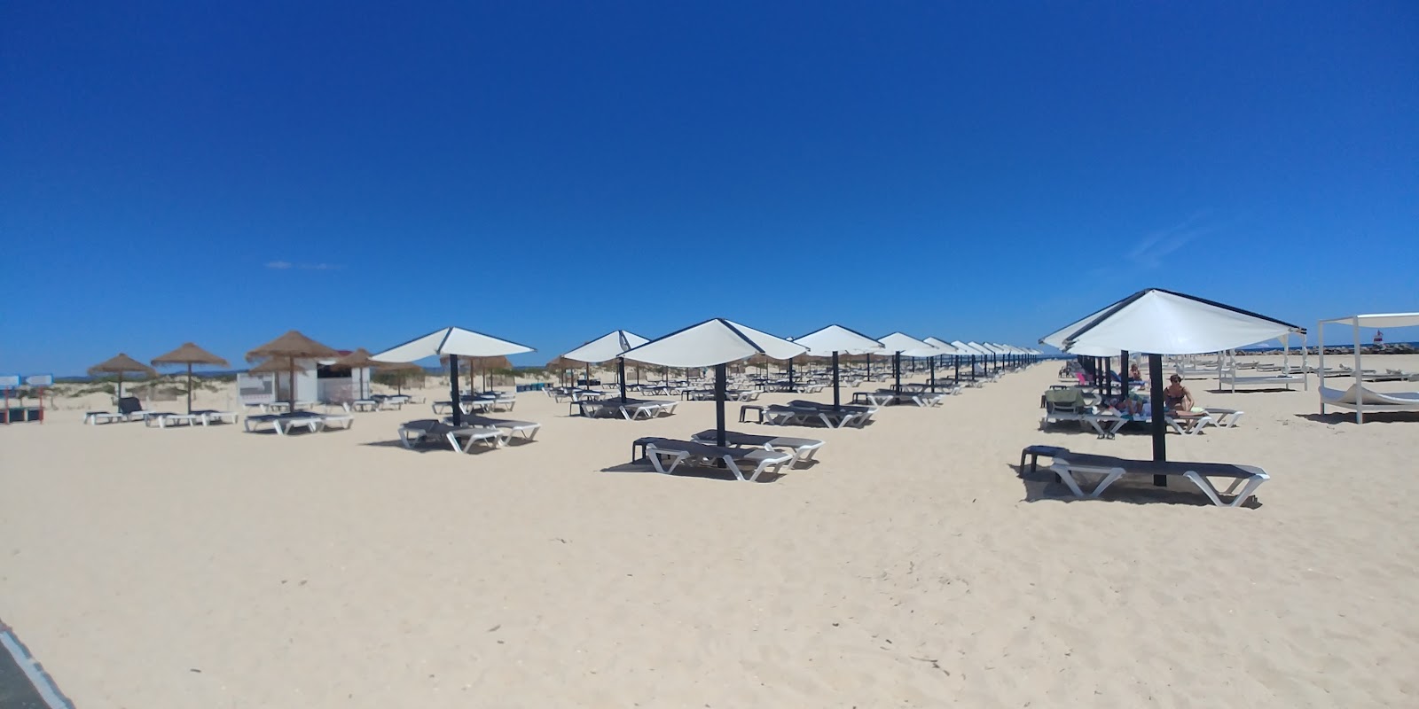
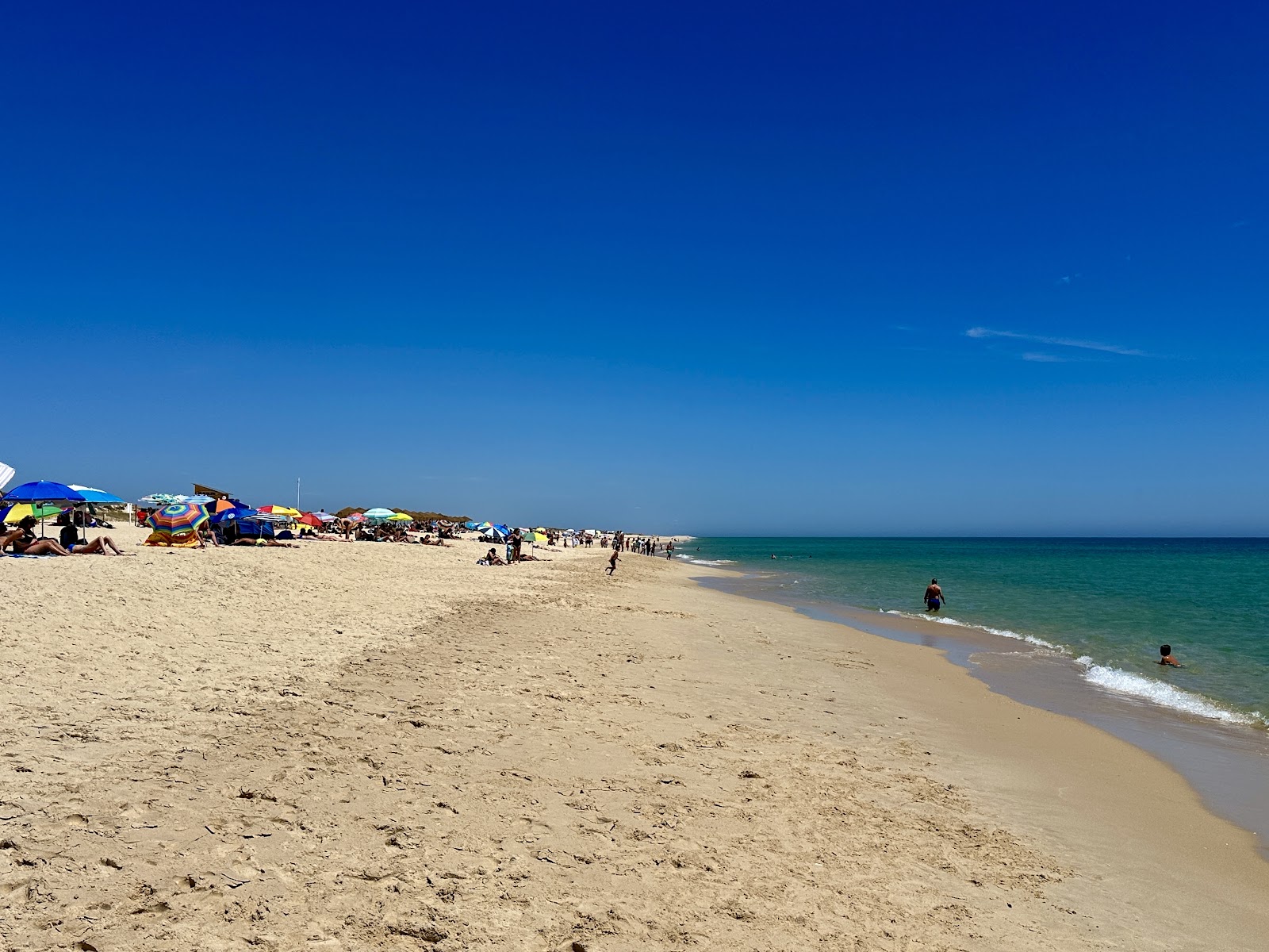
The ferry from Quatro Águas takes ten minutes, and for most of that crossing you're watching herons pick through the salt marsh while the water turns from brown to shallow jade. Ilha de Tavira is a barrier island in the Ria Formosa lagoon system — eleven kilometres long, rarely more than a kilometre wide, and fronted by a long Atlantic beach with Blue Flag water that stays bracingly cold even in August.
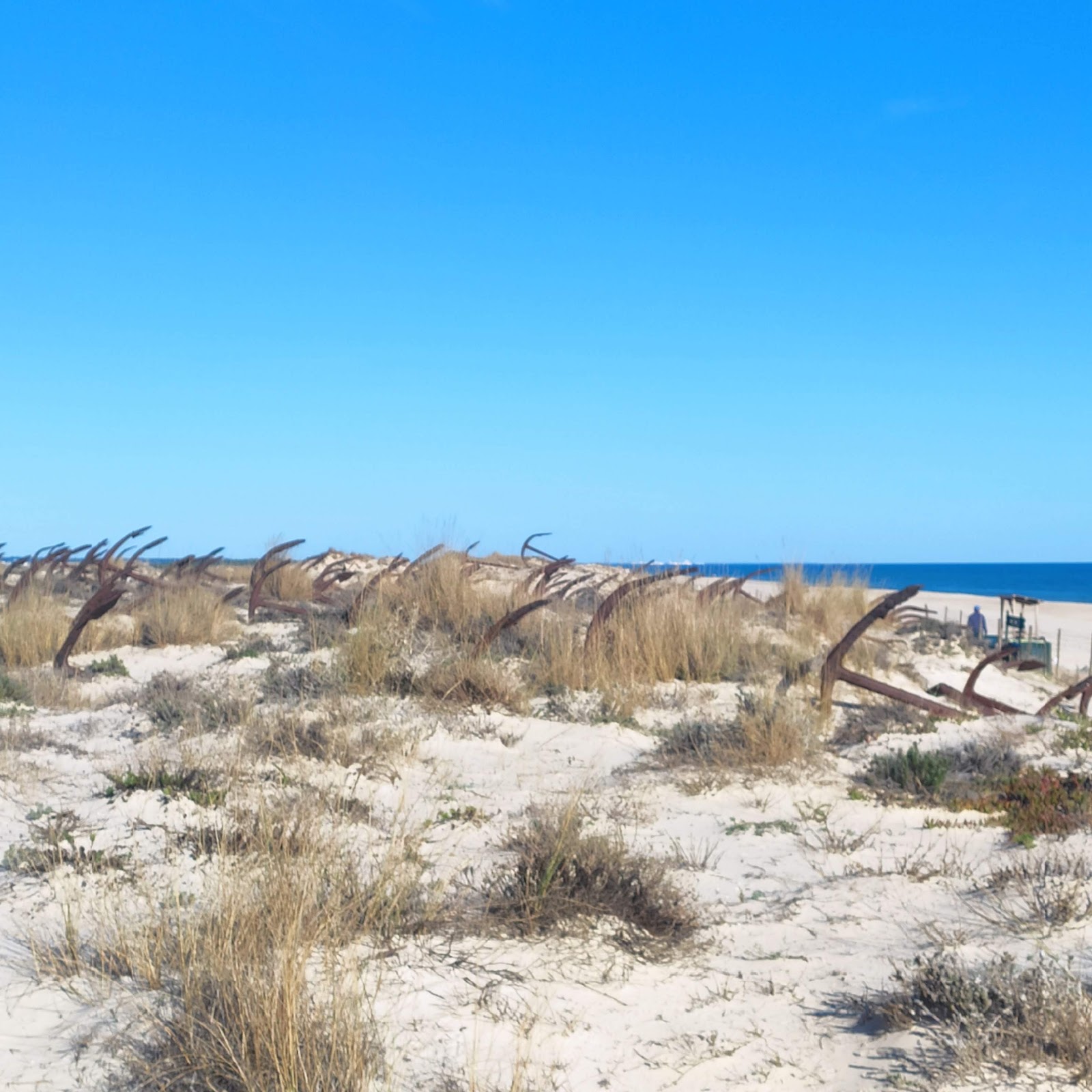
Most people arrive at the landing stage, walk the 350 metres to the nearest stretch of sand, and stop there. That's worth knowing, because ten minutes further west the crowd thins considerably, and forty minutes gets you to Praia do Barril and its strange, rusted monument.
💛 What travellers fall for
People who come back tend to take the longer route: the floating bridge from Pedras d'El Rei, then the narrow-gauge train through the marsh, arriving at Barril rather than the main ferry landing. Lunch at Zé Maria or Ilha Formosa, a walk west past the anchor cemetery, back by the last boat. The sequence matters.
The story behind Ilha de Tavira
From 1841 until 1967, the beach at Barril was a working tuna station. Around eighty families lived on the island seasonally, using the almadrava — a net-and-anchor technique with roots in Phoenician fishing practice — to intercept the Atlantic bluefin on their annual migration through the strait.
By the 1960s the tuna runs had collapsed, the station closed, and the heavy iron anchors that had held the nets were dragged up the beach and arranged in rows. They're still there: a few hundred of them, oxidising slowly in the dune grass. The fishermen's huts that once housed the workers now contain restaurants.
Good to know
Silnido ferries run year-round from Cais das Quatro Águas (€1.90 return); the city-centre pier on Rua José Pires Padinha operates late March through October (€2.50 return). Hourly in winter, more frequent in summer. A campsite opens June to September. Parasol and lounger hire runs €12 a day.
May through September is dry and sunny, with July and August pushing 30–33°C on land — though the sea rarely exceeds 22°C even at peak summer. Spring and October offer temperatures in the low-to-mid twenties with far fewer people. Winter days are mild at around 15–16°C, but December brings the most rain and the ferries run only once an hour.
Where is Ilha de Tavira?
More tickets & tours for Ilha de Tavira
Book directly at the provider
What travellers say about Ilha de Tavira
We did an 18k hike from the center of Tavira in Feburary, which included Tavira island. Instead of taking the ferry from the center of Tavira town, we walked a couple of kilometers to Cais das Quatro Águas, and took a ferry from there. That ferry ride is only 5 minutes long and cost us 1.70 euro each. After arriving on the island, we stopped at the first open restaurant and had a very good lunch. It's the restaurant with the grey cushioned couches and chairs. After lunch we had a very long beach beach walk (after taking our shoes off) Westward. We saw tons of shells but very few people. Eventually we reached Praia do Barril beacj and had coffees at the snack bar. From this beach we accessed the mainland via a causeway. There is also a small mini-train service that covers about 1.5km of this portion, but we chose to walk. Back on the mainland, we headed east back to Tavira, while passing through through the beautiful fishing village of Santa Luzia.
Damn, this is a nice beach, it's mid November and feels and looks like summer, but without crowds. Super easy ferry, the ride itself is nice. We're heading out again today after a cafe stop. Suns out, guns out as they say. I can see why everybody loves Tavira in particular and the Algarve in general.
* Nice sandy beach * Very beautiful small fishing village nearby to have some drinks and snacks.
Great beaches n restaurants, nice day out
One of the Algarve’s most inviting and laid-back beach destinations, perfect for a relaxed day trip or a longer seaside escape. Accessible by ferry from Tavira, the island offers a long stretch of soft golden sand, calm turquoise waters, and a peaceful, undeveloped vibe that contrasts nicely with some of the busier resort beaches in the region. The beach is wide and clean, with plenty of space even during high season if you walk a bit away from the main drop-off point. The water is generally calm and great for swimming, and the surrounding nature is part of the Ria Formosa Natural Park, adding to the sense of tranquility and beauty. Near the ferry landing area, you’ll find a few casual restaurants, snack bars, and small shops where you can grab food, drinks, or rent umbrellas and loungers. The facilities are basic but sufficient—don’t expect luxury, but you’ll have what you need for a comfortable beach day. If you’re willing to walk farther down the island, you’ll find quieter spots and even some clothing-optional areas. It’s a great place to escape the crowds and enjoy a more natural beach experience. Keep in mind that there are no ATMs on the island and not every vendor accepts cards, so bringing some cash is a good idea. Also, shade is limited unless you rent an umbrella or bring your own. Overall, Ilha de Tavira is a beautiful and peaceful place to spend a day by the sea. It combines natural charm with just enough convenience and remains one of the hidden gems of the eastern Algarve.
More of Tavira
Discover where to stay, what to do and the best deals for your trip.
Explore Tavira →More attractions in Tavira
All of Tavira →
Background adapted from Wikipedia (CC BY-SA) · map data © OpenStreetMap contributors · ratings & place photos via Google · other photos with per-image credit. Ticket links may earn us a commission at no extra cost to you.