
Semur-en-Auxois

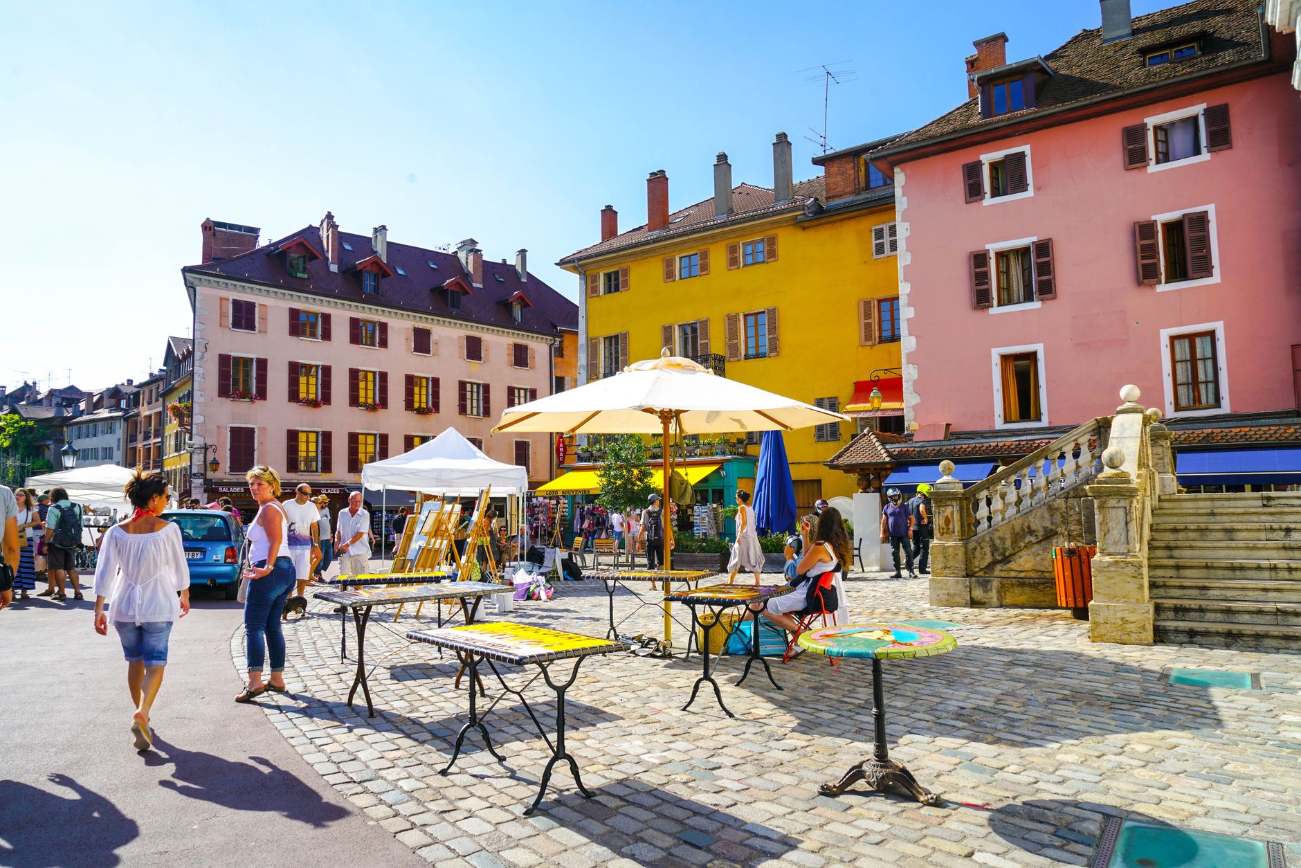
Semur-en-Auxois sits on a granite promontory above a tight loop of the Armançon river, its four medieval towers still standing after seven centuries of weather and politics. The town is compact enough that you can walk its full medieval circuit in an hour, reading the layout almost like a diagram — the keep, the collegiate church, the old gate with its portcullis groove still worn into the stone.
What makes it worth slowing down for is the specificity of what survived. The Tour de l'Orle d'Or rises 44 metres with walls five metres thick, and carries a long vertical crack from the day in 1602 when Henry IV ordered the castle demolished. History here has a visible scar.
💛 What travellers fall for
People who return tend to time it for Sunday morning: the market sets up early and the light on the granite towers is good before the day warms. The roadbook 'Sans les armes sur la piste du lion' from the tourist office — a euro and a half — is worth picking up; it structures the old town walk without turning it into a lecture.
Experiences you don't want to miss



Deals in Semur-en-Auxois
Book directly at the provider

How Semur-en-Auxois came to be
The name comes from the Latin 'senes muros' — the old walls — which tells you something about how ancient the fortification already seemed when the town first appeared in writing in 722 AD, in the founding charter of Flavigny Abbey. A castle stood here from the 7th century, and by 1276 Robert II, Duke of Burgundy, had granted the settlement full town privileges, making it capital of the bailiwick of Auxois.
The collegiate church of Notre-Dame was founded in 1225, its flamboyant Gothic porch completed in the 1470s and later restored by Viollet-le-Duc in the 19th century. The four great towers of the castle were built in the late 13th century in Philippian style; they survived Louis XI's occupation in 1478 but not Henry IV's order in 1602, when the ramparts were largely pulled down — leaving the crack in the Orle d'Or tower that you can still trace with your eye from the street.
Who and what shaped it
People who shaped it
Landmark buildings
See Semur-en-Auxois in motion
Plan your visit
On the map
When to go
July is the warmest and sunniest month, averaging a maximum of 27°C with over 250 hours of sunshine — the town is at its most walkable from June through September. Winters are cold and frequently cloudy, with January highs around 6°C and a wind that comes off the surrounding plateau with some conviction.
Right now
Background & history adapted from Wikipedia (CC BY-SA) · specs from Wikidata (CC0) · weather from Open-Meteo · map data © OpenStreetMap contributors · photos from Wikimedia Commons / Unsplash with per-image credit. No third-party reviews or social posts reproduced.