
Saint-Cyprien
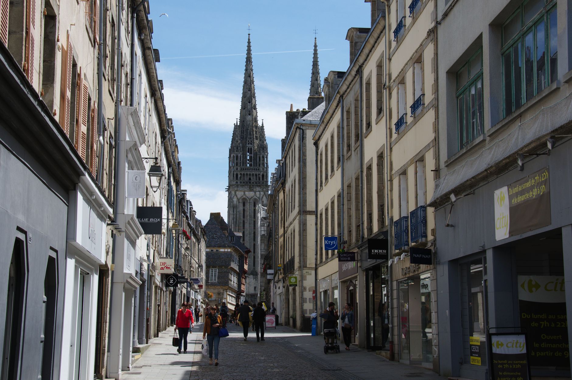
Saint-Cyprien sits on a limestone ridge above the Dordogne river, its abbey church's fortified bell tower visible from the valley floor long before you reach the village. Around 1,600 people live here, which means the Sunday market still feels like it belongs to the town rather than to tourism — walnut oil, duck confits, and old men who know each other.
The streets of the Montmartre district above the church are narrow by necessity: for centuries, people built as close together as possible, sheltering within the village walls. That logic is still readable in the stone today.
💛 What travellers fall for
People who return tend to arrive on Sunday morning before the market crowds, then stay for a slow lunch on Rue Gambetta. The nighttime guided tours on certain Tuesdays in July and August come up often — the church and its fortified tower read very differently under dark sky. Book at the tourist office, which is open Sundays in season.
Experiences you don't want to miss


Deals in Saint-Cyprien
Book directly at the provider


How Saint-Cyprien came to be
The town's origin traces to a hermit named Cyprien who settled in the Fages caves around 620 AD. Stories of miracles at his tomb drew other monks, and a monastic community formed. By 1076 the Augustine priory was significant enough that Bertrand de Got, Archbishop of Bordeaux and future Pope Clement V, placed it under his jurisdiction.
Saint-Cyprien's position on the border between the Kingdom of France and English-held Aquitaine made it a target during the Hundred Years War — General Talbot, commanding British troops, kept a house here. The Wars of Religion brought worse: Protestant armies ransacked and burned the village and abbey in 1568. A partial rebuilding came in 1685; the abbey was sold as a national asset in 1791 and later served, somewhat bathetically, as a tobacco warehouse. The church was listed as a Monument Historique in 1923.
Who and what shaped it
People who shaped it
Landmark buildings
See Saint-Cyprien in motion
Plan your visit
On the map
When to go
Summers are warm and dry — August highs reach around 30°C, with July the driest month, making it the most comfortable window for walking the path out to the Fages caves or lingering at the Sunday market. Winters are cool rather than harsh, with January highs around 13°C and nights dipping to 4°C.
Right now
Background & history adapted from Wikipedia (CC BY-SA) · specs from Wikidata (CC0) · weather from Open-Meteo · map data © OpenStreetMap contributors · photos from Wikimedia Commons / Unsplash with per-image credit. No third-party reviews or social posts reproduced.