
Ramparts of Mont Saint-Michel

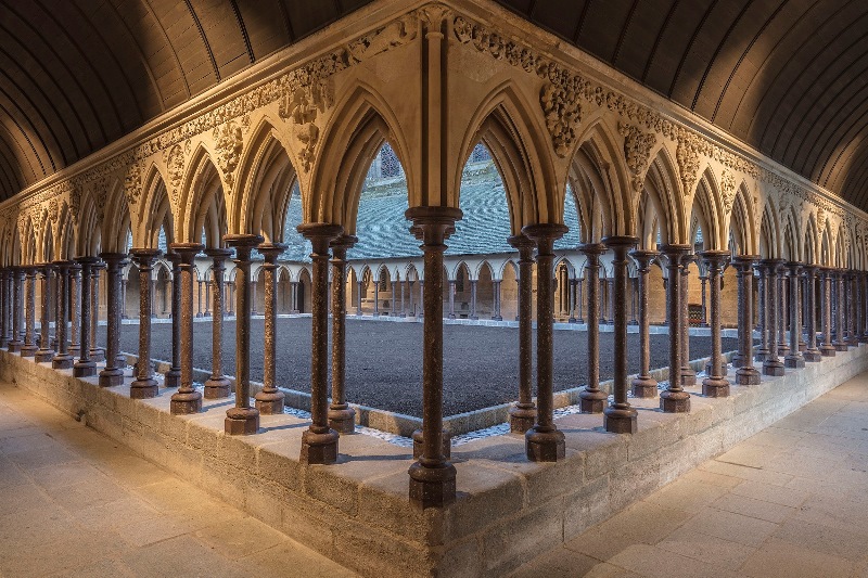
The ramparts of Mont Saint-Michel run the full circuit of the island — eight gates, three posterns, three bastions — forming a granite belt that took centuries to close. Walk the wall-walk and you see the bay on one side and the tangle of rooftops below the abbey on the other, a geometry that makes the whole island's logic suddenly legible.
Most visitors stream straight up the Grande Rue toward the abbey and never think to step out onto the rampart path. That means the views from the walls — the tidal flats, the distant mainland, the silhouette of the mount itself — belong mostly to the people who know to look for them.

💛 What travellers fall for
Those who come back tend to time the rampart walk for early morning or evening, when the crowds have thinned on the Grande Rue below. The Porte de l'Avancée is the natural starting point; from there the wall-walk opens up quickly and the bay fills your peripheral vision in a way that the narrow lanes never allow.
The story behind Ramparts of Mont Saint-Michel
Before 1204, the mount relied on the abbey's own stone walls and little else. A Breton raid that year changed the calculation, and proper military fortifications began going up. The three entrance gates — Porte de l'Avancée, Porte du Boulevard, and Porte du Roi — were built between 1337 and 1453, the same decades that saw the English besiege the mount. That siege ran from 1423 to 1434; the mount held.
Charles VI oversaw the most significant reinforcement of the towers and successive courtyards. The machicolations that give the walls their outward uniformity were added in the 15th century, though the fabric beneath them spans the 13th to the 18th. The final addition came under Louis XIV, when military architect Vauban added Tour Boucle. The whole ensemble was classified as a Historic Monument in 1874, following a two-year campaign by architect Édouard Corroyer.
Good to know
Walking the ramparts is free and requires no ticket. Arrive before 10 am or after 4 pm to avoid the worst of the day-trip congestion. The shuttle 'Le Passeur' connects the main car park to the island in minutes. Saint-Pierre Church and the quieter eastern rampart sections are easy to add without backtracking.
Summer temperatures rarely exceed 20–21°C, but cloudy and rainy days are common even in July and August — a wind off the bay can make the wall-walk feel considerably cooler than the calendar suggests. Spring and autumn are mild and less crowded; the quietest months are November through March, when the light on the tidal flats has a particular clarity.
Where is Ramparts of Mont Saint-Michel?
Location
- In Mont Saint-Michel
- 48.6356, -1.5110
- Open in Google Maps
Rating
4.7 ★ · 15,094 Google reviews
More tickets & tours for Ramparts of Mont Saint-Michel
Book directly at the provider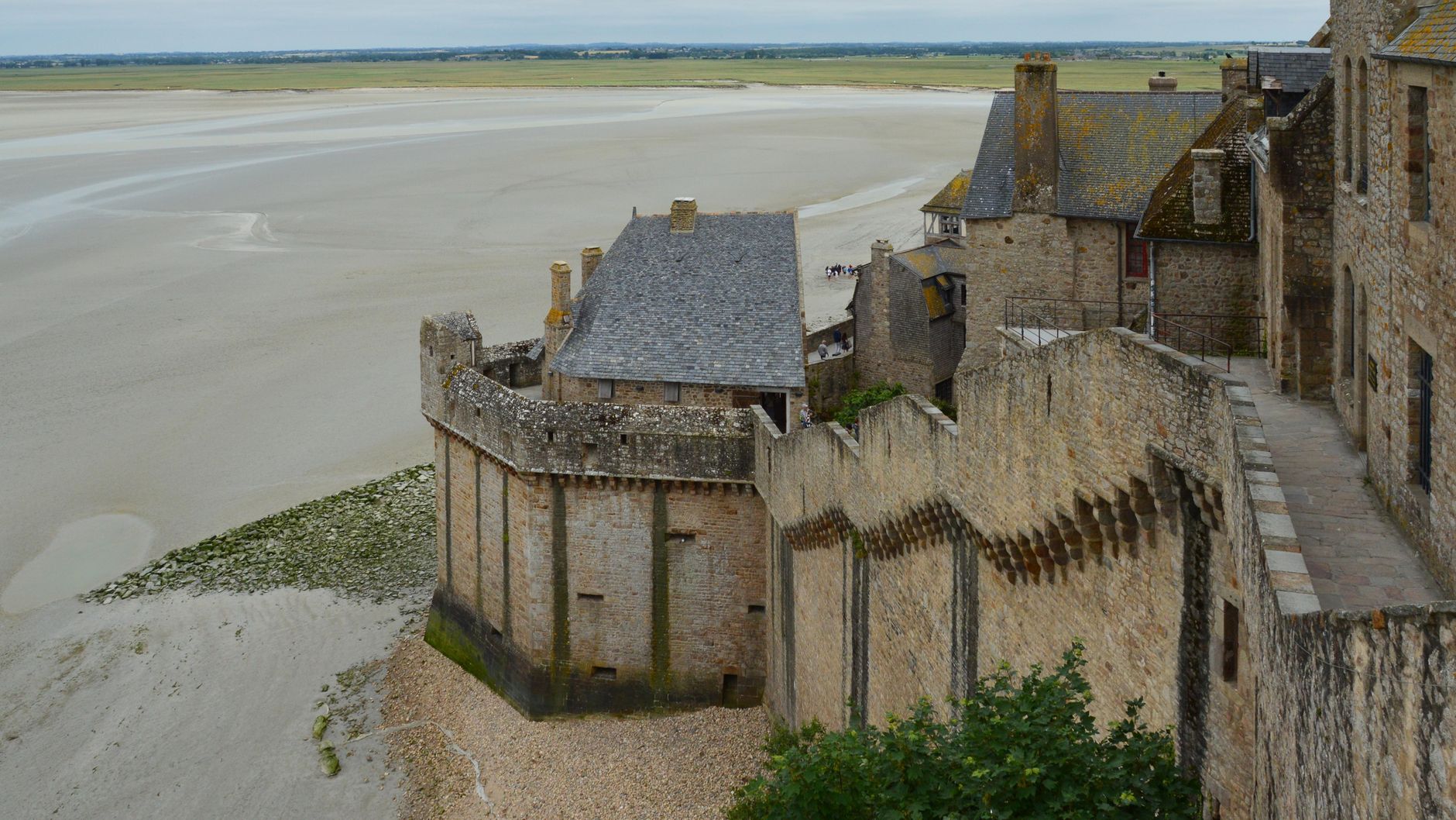
What travellers say about Ramparts of Mont Saint-Michel
Amazing place. Just so busy, very crowded, however well organised. It's good idea to walk there and take the free bus back. You need hour or so to walk around the village ( walking round the village is free).
Mont Saint-Michel is amazing! Views from the fields are stunning. Arrive early at the abbey to avoid crowds. Shuttles run frequently, which is handy. Parking cost €20 for 5 hours. A small tip: eat outside the castle for better value. We had an interesting trip and highly recommend visiting here!
Highly recommend the audio tour. It was very interesting and gave great information you would not know just by walking through. Extremely busy place. We also dod the extra museums there and enjoyed them.
This is a place you have to see! There is a lot of steps here to climb but well worth it. Shops sideline the main entrance and there is always something to see. Toilets are just inside to the left and further up to the right. They are somewhat few and far between so use them as needed. The crowds are terrible as when groups, bus tours, school tours are in there. There, one must have patience. Weather can be unpredictable so take appropriate clothing as it is, and can be windy out there. Once parked, you can grab a shuttle which will take you closer, otherwise it can be a bit of a walk. Caution is to be taken as there is quicksand in the area when the tide is out, if you venture out that way. I think that you are required to have a guide if you go out there and it would be strongly suggested.
I visited Mont-Saint-Michel Abbey alone, which I had long wanted to do. It was truly wonderful and inspiring. The biggest issue in my life is my own death and the death of a loved one, which I will experience someday. I wanted to deepen my consideration about it, so I visited Mont-Saint-Michel Abbey and prayed silently. As I walked around the Abbey, I thought about this issue. Although I have not found an "answer" about this issue, the experience of praying at Mont-Saint-Michel Abbey gently enveloped me. This experience is a treasure of my life. I will never forget it. May God bless all the people of the world!
More of Mont Saint-Michel
Discover where to stay, what to do and the best deals for your trip.
Explore Mont Saint-Michel →More attractions in Mont Saint-Michel
All of Mont Saint-Michel →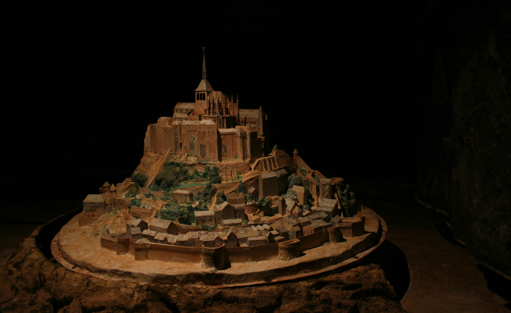
Background adapted from Wikipedia (CC BY-SA) · map data © OpenStreetMap contributors · ratings & place photos via Google · other photos with per-image credit. Ticket links may earn us a commission at no extra cost to you.