
Partnachklamm
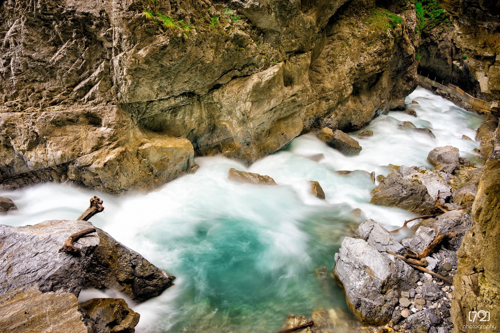
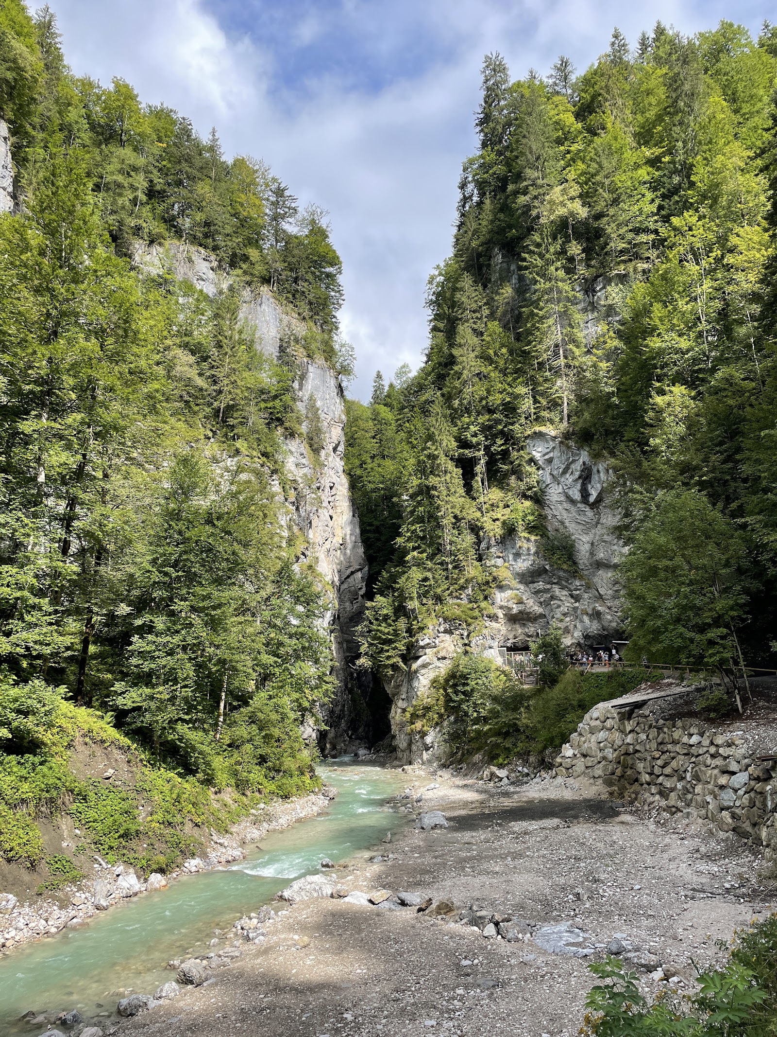
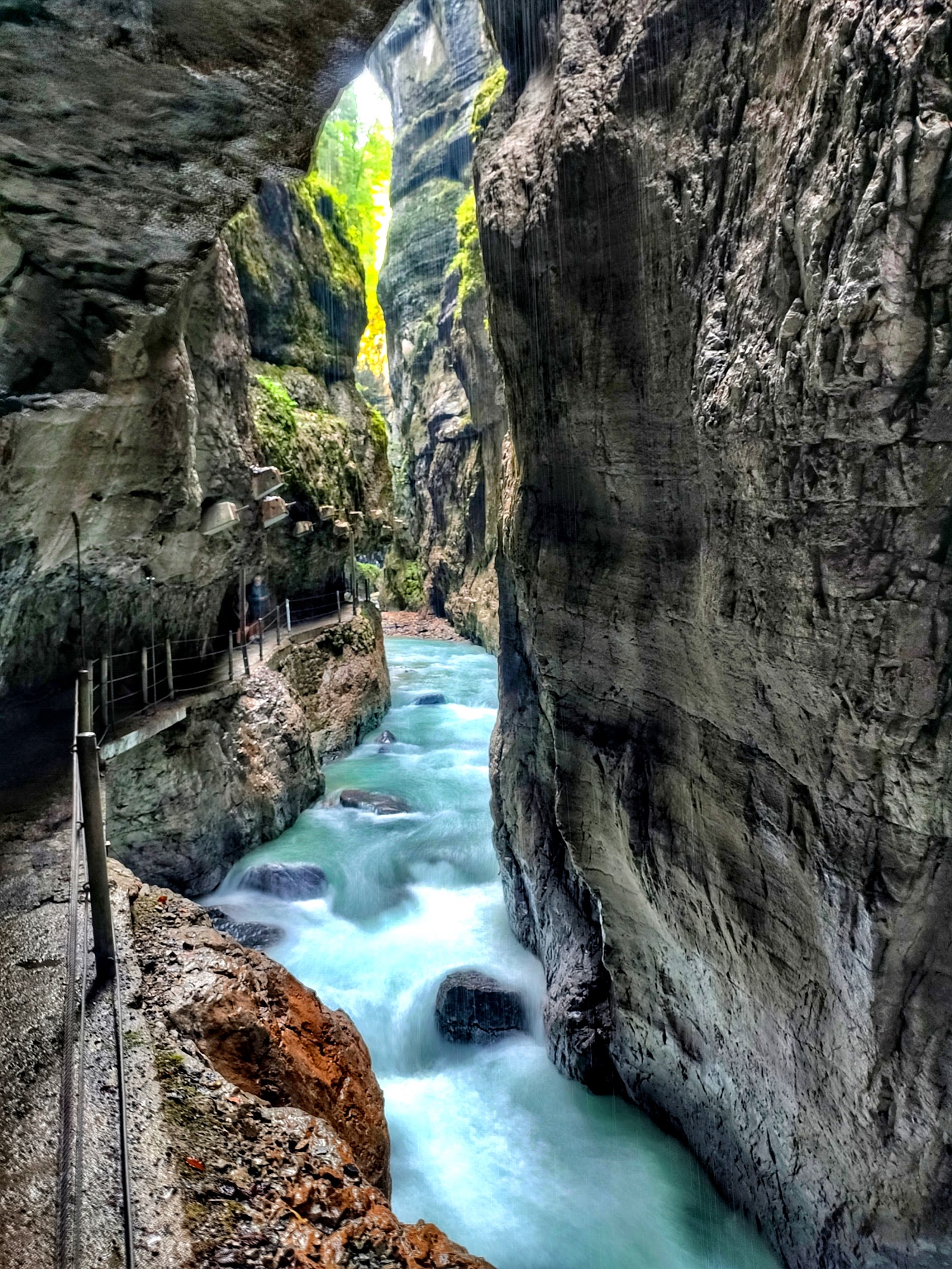
The Partnach River has been cutting through this limestone gorge for longer than anyone has been counting, and the result is a canyon 702 metres long and, in places, more than 80 metres deep — walls close enough that you can touch both sides in the narrow passages, tunnels dark enough that your eyes take a moment to adjust. The path runs at torrent level, spray in the air, the sound of water filling everything.
What changes the experience is the season. Come in summer and the gorge is cool and dripping on the hottest Bavarian days. Come in winter and the Partnach's water freezes into icicle formations along the rock face — the crowds thin, the colours shift, and the whole place feels like something else entirely.
💛 What travellers fall for
People who return tend to time their arrival carefully: weekdays before 10:30 in the morning, or after 3 in the afternoon, when the tour groups have cleared out. After the gorge, the short uphill walk to Kaiserschmarrn Alm is worth the effort — steep for 20 minutes, then a bench and something warm. Taller visitors (over 1.75 m) should know the tunnel ceilings are low in stretches.
The story behind Partnachklamm
The gorge opened to visitors as a formal natural monument in 1912, though the Partnach had been put to work long before that — in the early 19th century, loggers used the river as a 'Trift' route, floating timber down through the canyon. That log-drifting continued until the early 1960s. An iron bridge followed the tourist opening in 1914, and by 1930 the gorge had been made accessible in winter for the first time.
On 1 June 1991, roughly 5,000 cubic metres of rock broke away from the southern face, blocking both the path and the watercourse. No one was hurt. The solution was to blast a 108-metre tunnel through the obstruction, completed in 1992 and fitted with viewing windows so the rock itself becomes part of the route. The gorge has been designated a national geotope since 2006.
Good to know
From Garmisch-Partenkirchen station, bus lines 1 or 2 to Skistadion, then a 25-minute walk or horse carriage to the entrance. Adult entry is €10; free on your birthday with ID. Baby carriages and rollators can't navigate the path. Allow a full two hours rather than just the 20-minute gorge walk.
Winter (roughly November through March) produces the most dramatic conditions — freezing temperatures turn the water into icicle cascades along the walls, and visitor numbers drop significantly. Spring carries the highest closure risk as snowmelt can raise water levels dangerously. Summer is busy and often sunny, but the gorge stays cool inside regardless of the temperature above. Autumn brings foliage and smaller crowds; a jacket is useful in any season, and in winter you'll feel the cold sharply when you stop moving.
Where is Partnachklamm?
Location
- In Garmisch-Partenkirchen
- 47.4667, 11.0833
- Open in Google Maps
Rating
4.7 ★ · 17,225 Google reviews
More tickets & tours for Partnachklamm
Book directly at the provider
What travellers say about Partnachklamm
Partnachklamm is one of the most impressive natural attractions I have visited in Bavaria. Walking through the narrow gorge feels almost magical, with towering rock walls on both sides and the powerful Partnach River rushing beneath you. The sound of the water, the waterfalls flowing down the cliffs, and the tunnels carved into the rock make the whole experience unforgettable. The gorge is about 700 meters long and over 80 meters deep in some places, which makes the scenery even more spectacular. (Partnachklamm) What I loved most is that the walk is relatively easy and suitable for most visitors, yet it feels like a real adventure. Every few meters there is another amazing viewpoint and photo opportunity. If you continue beyond the gorge, you can enjoy beautiful mountain trails and stunning Alpine views. (Travel with Hayden) I highly recommend visiting Partnachklamm if you love nature, hiking, or simply want to experience one of Bavaria’s most beautiful landscapes. It is a unique place that combines the power of nature with breathtaking scenery and is definitely worth the trip.
We had absolutely beautiful experience at Partnachklamm recently! The walk through the narrow gorge with the sound of rushing water, waterfalls, and huge rock walls was breathtaking. The atmosphere feels magical and it’s definitely one of the most impressive nature spots in Bavaria. A bit crowded during peak hours, but still totally worth visiting. You can also buy tickets online to avoid waiting in the queues.
The views were breathtaking. If you're walking from the parking lot by the olympic ski jump area, the walk is about 20-30 minutes depending if you have little ones who walk. Entry fee was €10/person. You can continue to walk after the gorge, but they have a nice stream where you can enjoy the water. Definitely recommend. We paid at the self service kiosk which saved time instead of waiting in line
The pristine blue waters coming directly from the Alps is a Divine sight for the sore eyes! I have been there quite a few times and I love spotting the dipping bird around the stream. If you take taxi to reach here, they have the permission to take you directly to the entrance of the gorge which is really useful if you have elders who can’t walk long or don’t have enough time. The return bus can be easily caught every hour from the bus stop near Olympic sky stadium.
The Partnachklamm was stunning to see. There’s a path on the side of the water with some tunnels that you have to go through. At the end you have a beautiful view of the mountain. Bring good shoes because the path can be wet at some areas. Parking is close by (few minutes walk), €5 for the whole day. Entry of the Gorge is €10 per person.
More of Garmisch-Partenkirchen
Discover where to stay, what to do and the best deals for your trip.
Explore Garmisch-Partenkirchen →More attractions in Garmisch-Partenkirchen
All of Garmisch-Partenkirchen →

Background adapted from Wikipedia (CC BY-SA) · map data © OpenStreetMap contributors · ratings & place photos via Google · other photos with per-image credit. Ticket links may earn us a commission at no extra cost to you.