
Hollywood Sign
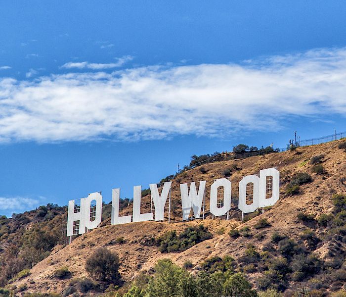
The letters are bigger than you expect — 45 feet tall, each one roughly the height of a four-storey building — and yet from most of Los Angeles they read as something almost delicate against the brown scrub of Mount Lee. That gap between the sign's fame and its physical reality is part of what makes it worth seeking out.
You can't walk up to it. The sign sits on restricted land, surveilled by infrared cameras and two-way radios, and the closest the trails bring you is behind and above. The famous view — letters laid out across the hillside, the basin spreading below — belongs to those looking up from the city, not down from the slope.
💛 What travellers fall for
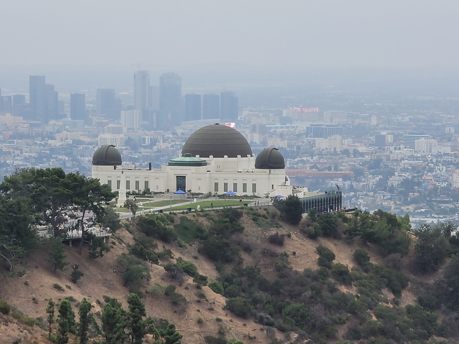
People who've done this more than once tend to skip the canyon-road traffic entirely. The DASH Observatory bus costs fifty cents and drops you at Griffith Observatory, which gives you the sign framed against the full spread of the city. Early morning, before the tour vans arrive, the light comes in low and the letters throw actual shadows.
The story behind Hollywood Sign
In 1923, a syndicate of Los Angeles real-estate developers — among them Times publisher Harry Chandler and investors Eli Clark and Sydney Woodruff — paid $21,000 to erect a temporary billboard on the southern slope of Mount Lee. Thomas Fisk Goff of the Crescent Sign Company designed the 50-foot letters, originally studded with some 4,000 light bulbs that flashed in sequence: HOLLY, WOOD, LAND. It was an advertisement for a hillside housing development, nothing more.
The "LAND" came down in 1949. By 1978, the remaining letters had deteriorated badly, and a February windstorm finished the job. A fundraising campaign rebuilt the sign in steel and concrete — nine donors, $27,778 each — with individual letters sponsored by figures including Alice Cooper, who took an O in memory of Groucho Marx. The Hollywood Sign Trust, formed that same year as a nonprofit, has managed it since.
Good to know
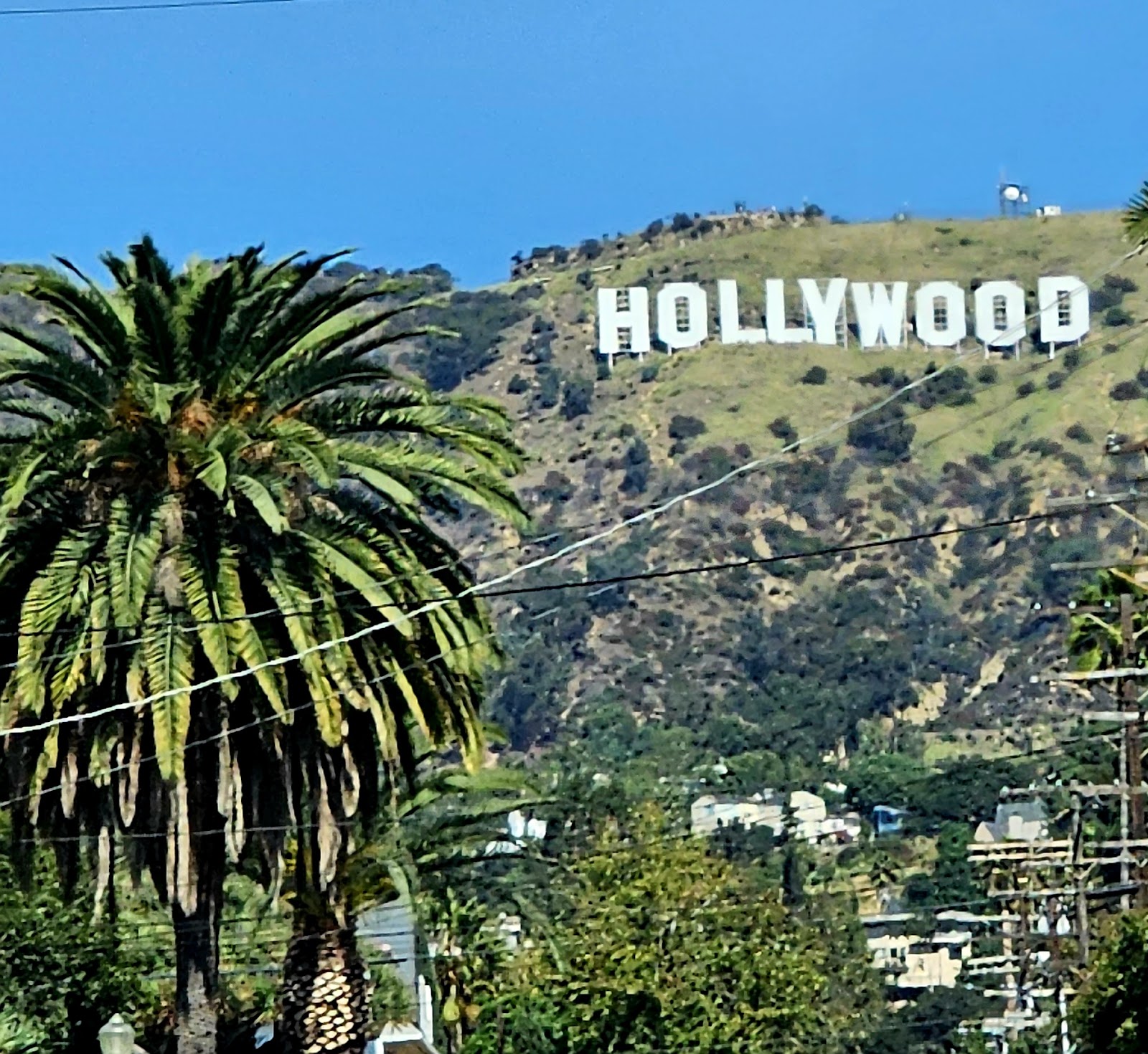
No admission fee for any of the hiking trails, which are open sunrise to sunset every day of the year. The DASH bus from the Vermont/Sunset Red Line station is the sanest way in — fifty cents, no parking headache. Griffith Observatory and the Hollywood & Highland overlook (levels 2–5) are the Trust-endorsed viewing spots if you'd rather not hike.
October through May is the practical window — cooler temperatures, lower smog, and better visibility across the basin. Summer mornings can work before the haze builds, but midday heat on exposed trails in July or August is genuinely punishing. Griffith Park sits in a high fire-risk zone; check conditions before any hike during dry spells.
Where is Hollywood Sign?
More tickets & tours for Hollywood Sign
Book directly at the provider
What travellers say about Hollywood Sign
Pretty tough hike, but well worth it. It’s difficult to find out where to park and when, but there’s numerous parking options. Each parking option will change the hiking distance, terrain, difficulty. All things considered, some of the most stunning views of LA you can get in one of the best parks ever.
My first time experiencing Hollywood as an adult… and WOW, what an experience! 🌴✨ From taking in the views at Griffith Observatory, to finally seeing the iconic Hollywood Sign in person, to exploring Downtown Los Angeles — every moment was full of energy, excitement, and unforgettable sights. The vibe is definitely high energy, fast-paced, and full of life. There’s so much going on everywhere you turn, and it really makes you feel like you’re part of something big. And here’s my little tip with some Melissa energy… go in with a smile and a “kill them with kindness” attitude 😊 It makes the experience even better and you’ll get that same energy right back. This trip was everything I hoped it would be and more. Already looking forward to the next visit! 💯✨
An iconic landmark that lives up to its legend The Hollywood Sign is one of those bucket list sights that genuinely delivers when you see it in person. Whether you spot it from the Griffith Observatory, Lake Hollywood Park or hike up close through Griffith Park, the experience is memorable and the views over Los Angeles are spectacular. The hike to get near the sign is accessible for most fitness levels and well worth the effort for the photo opportunities alone. That said, you can't actually touch or stand directly in front of the letters, the closest viewpoints are still some distance away, which surprises many first time visitors. Parking in the area can be a real headache, especially on weekends. Go early in the morning for the best light, fewer crowds and easier parking. A true LA icon not to be missed.
Observatory Park is the place you'll be visiting. Park along the street, and take a short hike up to the observatory. Great views, other bit crowded but worth it. You'll see the whole city including the skyline of LA.
Visited Lake Hollywood Park on a Monday morning to catch a view of the Hollywood Sign. The view is fantastic and makes for great photos, but be sure to check the weather misty mornings can affect visibility. Street parking is available but can get very busy, so plan ahead and be patient. The area around the park was a bit dusty, so comfortable shoes are recommended. Overall, it’s a worthwhile stop for anyone wanting a closer look at the iconic Hollywood Sign and a quick outdoor break.
More of Los Angeles
Discover where to stay, what to do and the best deals for your trip.
Explore Los Angeles →More attractions in Los Angeles
All of Los Angeles →


Background adapted from Wikipedia (CC BY-SA) · map data © OpenStreetMap contributors · ratings & place photos via Google · other photos with per-image credit. Ticket links may earn us a commission at no extra cost to you.