
Helgoland
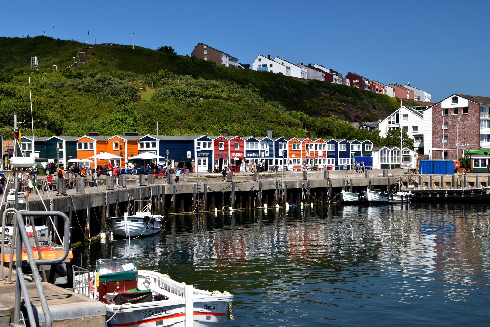
Helgoland sits alone in the North Sea, roughly 70 kilometres from the German coast, and the first thing you notice on arrival is the colour: red sandstone cliffs dropping straight into grey-green water, with the candy-striped Hummerbuden — the lobster huts built from 1954 — stacked along the harbour front. No cars are allowed here, no bicycles either, which gives the island a pace that feels genuinely different from anywhere else.
The upper plateau, the Oberland, and the lower harbour district, the Unterland, are connected by lift and staircase. Walk to the northern tip and you find Lange Anna, a 45-metre sea stack the island has used as its emblem since 1865. Spring brings tens of thousands of seabirds to the Lummenfelsen cliffs. The duty-free status means perfume and spirits in the shop windows, but the real reason to come is the strange, stripped-back solitude of a place rebuilt almost from scratch.
💛 What travellers fall for
People who return tend to time it for late April or May, when the guillemot colony on Lummenfelsen is at full noise and the light is long. They stay in the Oberland for the quiet, eat the local lobster while the season holds, and make a point of the Biological Institute on the harbour — the marine research station founded in 1892 still runs public aquarium tanks worth an hour of anyone's time.
Deals in Helgoland
Book directly at the provider


How Helgoland came to be
Helgoland began as Frisian grazing land before rising sea levels separated it from the mainland over 3,500 years ago. Saint Willibrord noted it around 700 AD as a site of Frisian worship. The island passed through the hands of Schleswig-Holstein dukes, then Denmark, before the British navy seized it in 1807. In 1890 Britain traded it to Germany in exchange for Zanzibar — one of history's more unequal swaps.
The twentieth century was brutal. Civilians were evacuated in 1914 to make way for the military. On 18 April 1945 an Allied air raid destroyed almost everything standing. Exactly two years later, 6,700 tonnes of munitions detonated in the island's underground installations — the largest non-nuclear explosion recorded to that point — reshaping the island's topography permanently. The town you see today was built in the 1950s and early 1960s, including the Hummerbuden (1954–55), the island hospital (1957–58), the James Krüss School (1959) and the town hall (completed 1961).
Who and what shaped it
People who shaped it
Landmark buildings
See Helgoland in motion
Plan your visit
On the map
When to go
The North Sea keeps temperatures moderate but the wind is rarely absent; summers sit around 17–19°C and winters seldom drop below freezing, though storms can be substantial. Late spring and early autumn offer the clearest light and smaller crowds; mid-summer brings the most visitors and the warmest swimming on the adjacent Düne sandbank.
Right now
Background & history adapted from Wikipedia (CC BY-SA) · specs from Wikidata (CC0) · weather from Open-Meteo · map data © OpenStreetMap contributors · photos from Wikimedia Commons / Unsplash with per-image credit. No third-party reviews or social posts reproduced.