
Église Saint-Pierre de Mont Saint-Michel
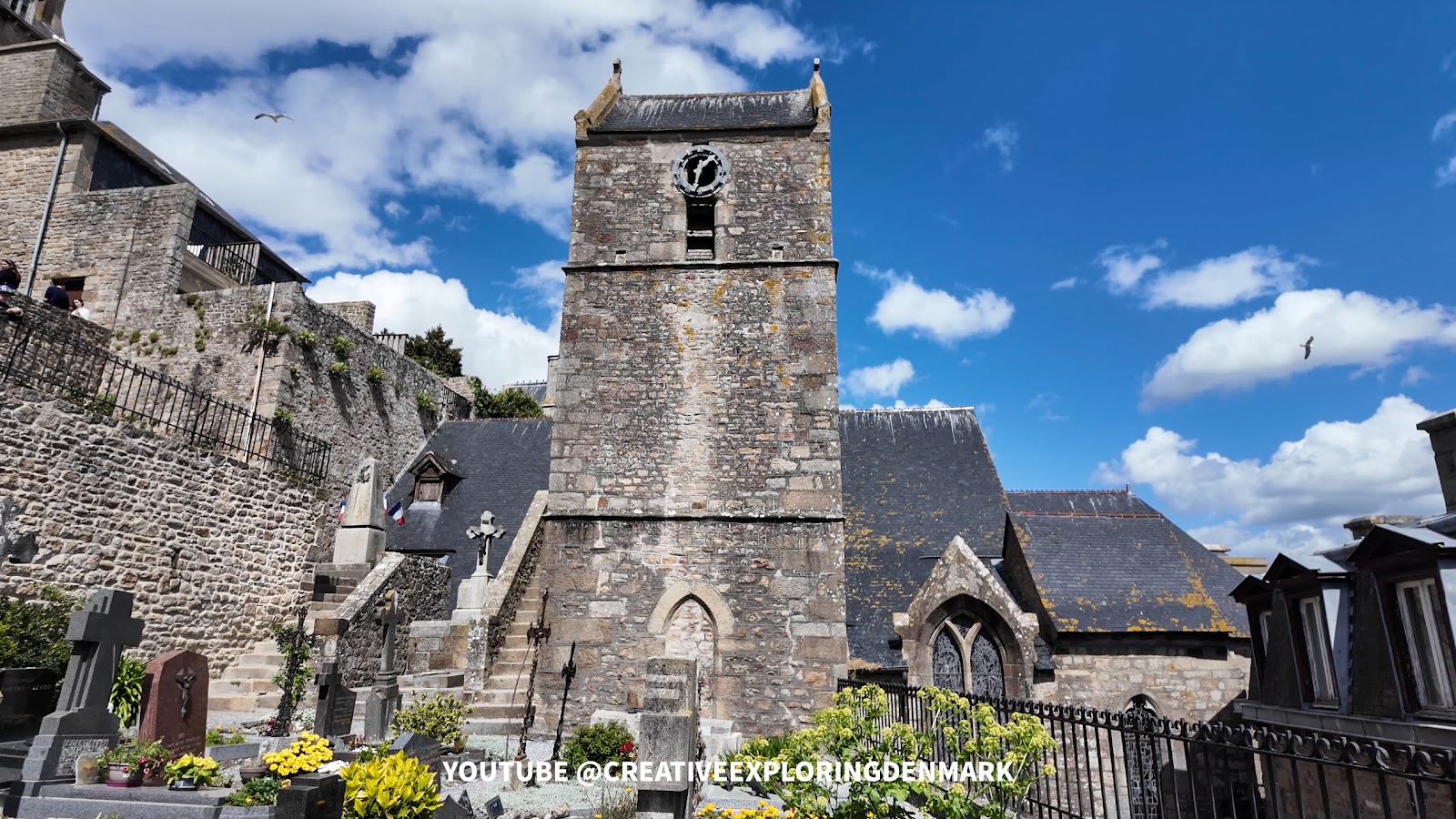
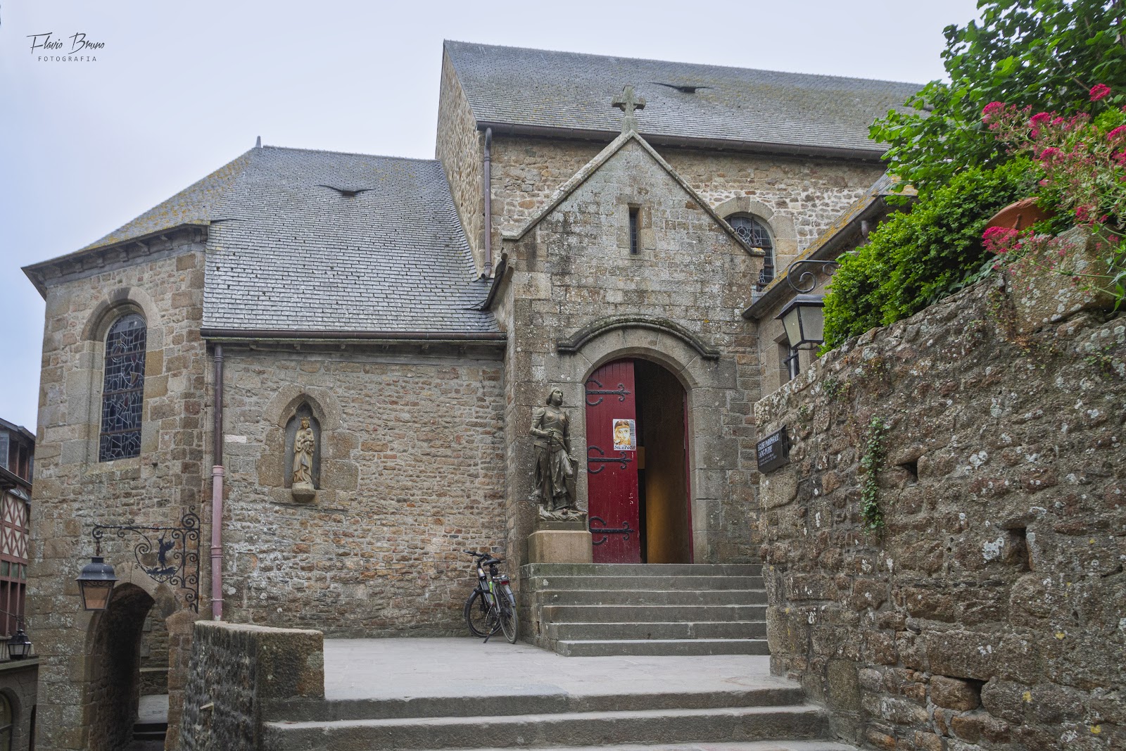
Halfway up the Grande Rue, before the crowds thin out near the abbey gates, a small church leans into the rock as if it has always been part of the stone itself. Église Saint-Pierre sits on the east flank of the mount, its asymmetric nave — one nave, one south aisle, no more — pressed against the granite behind it. Most visitors walk straight past.
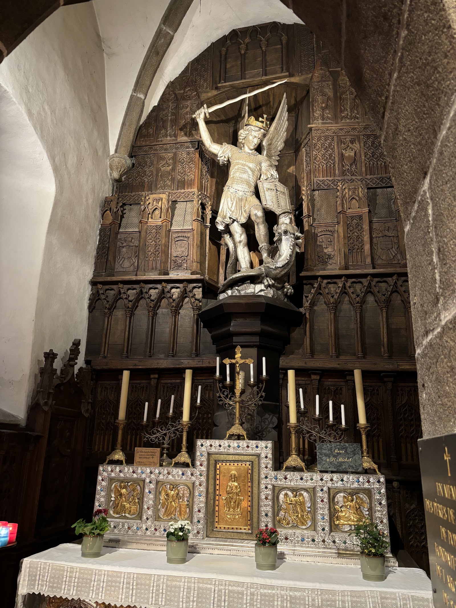
Inside, the light comes partly through a 1935 window of Saint Michael slaying the demon, and partly through older glass showing a calvary alongside Saint John the Baptist. A 15th-century statue of Saint Anne teaching the young Mary stands quietly in the interior. The carillon in the bell tower, installed in 1964, plays "Saint-Michel à votre puissance" on the hour.
💛 What travellers fall for
People who return to Mont Saint-Michel tend to stop here on the way up, before the abbey queues form. The cemetery terraces — one so narrow it holds only five tombs — are worth a slow look. The silver-repousse altar by Parisian goldsmith Jean-Alexandre Chertier, made in 1873, is easy to miss if you don't know to look for it.
The story behind Église Saint-Pierre de Mont Saint-Michel
The church traces its origins to the 8th century, when Saint Aubert — the bishop credited with founding the first sanctuary on the mount — established it as a burial place. It appears in a charter of 1022 and is formally cited in 1202. What you see today took shape across the 14th, 15th, and 17th centuries: the bell tower was built in the second half of the 14th century, its base later converted into a Chapel of Saint Michael after the original passage to the cemetery was sealed in the late 19th century.
On 4 November 1886, the church took on a new role when the pilgrimage cult of Saint Michael transferred here from the abbey, making Saint-Pierre the primary sanctuary for that devotion. It was classified as a historic monument on 15 March 1909. A 2017 utility project beneath the surrounding ground revealed the extent of a medieval cemetery that once spread 30 metres around the building.
Good to know
Entry is free and the church appears open during village hours. Shuttle buses drop you 400 metres from the island entrance; the church is roughly mid-climb. If time is short, it can be skipped — but it's the one place on the mount that isn't competing for your attention.
Where is Église Saint-Pierre de Mont Saint-Michel?
Location
- In Mont Saint-Michel
- 48.6352, -1.5113
- Open in Google Maps
Rating
4.6 ★ · 1,133 Google reviews
More tickets & tours for Église Saint-Pierre de Mont Saint-Michel
Book directly at the provider
What travellers say about Église Saint-Pierre de Mont Saint-Michel
As others have suggested, an easy to miss little church often hidden in the shadow of the abbey above. We happened upon it as a brief rain shower was coming over and ducked inside to avoid getting wet. What a great find and a lovely little church to view.
Lovely little church that would be easy to walk by and miss. The Mont is such a maze of little streets and passageways, and it's worth making this one of your places to visit here. Free to visit but as is common in many of the churches, you can pay a euros to light a candle.
An American citizen visiting this fortress for the purpose of self education, self religious reflection, and general tourism interest will see religious icons almost at every turn. When you enter the small doorway for this chapel, you see a flat bench pew area in the center, darkness on the right, and an altar on the left. Several elderly people will be in the pews, and I genuflected and sat down on one of them. Spiritual respect of the chapel and its holdings is not always given by visitors stumbling in. St Michael is the patron saint of all religious believing airborne military personnel and supposedly all law enforcement officers. I found my way to the Saint Michael statue after passing several votive candle areas adorned with small colorful candles fully lit in all respects. The way in is the way out.....in my opinion. A Catholic person could spend a full week here easy, learning about the icons and congregation. I was in the area from 1030 am to 1630 hours and attended one full French Catholic mass, ate one plate of mussels in white wine sauce and got man handled by two French women at a souvenir store....and then walked back to the parking lot.
A beautiful little church to enjoy. Free. See the statues. Light a candle and make a donation. Unfortunately the card reader wasn’t working properly.
The church was founded in the 8th century by Saint Aubert, to serve as a burial place (on the south side of the church is the cemetery). From the Romanesque period, the church preserves in particular the pillars of the impost at the entrance of the choir. It is dedicated to St. Peter, also note that on both sides of the entrance to the chapel of Saint Michel are St. Aubert and St. Roch, are wooden statues of the seventeenth century
More of Mont Saint-Michel
Discover where to stay, what to do and the best deals for your trip.
Explore Mont Saint-Michel →More attractions in Mont Saint-Michel
All of Mont Saint-Michel →
Background adapted from Wikipedia (CC BY-SA) · map data © OpenStreetMap contributors · ratings & place photos via Google · other photos with per-image credit. Ticket links may earn us a commission at no extra cost to you.