
Calanques National Park (Marseille sector)

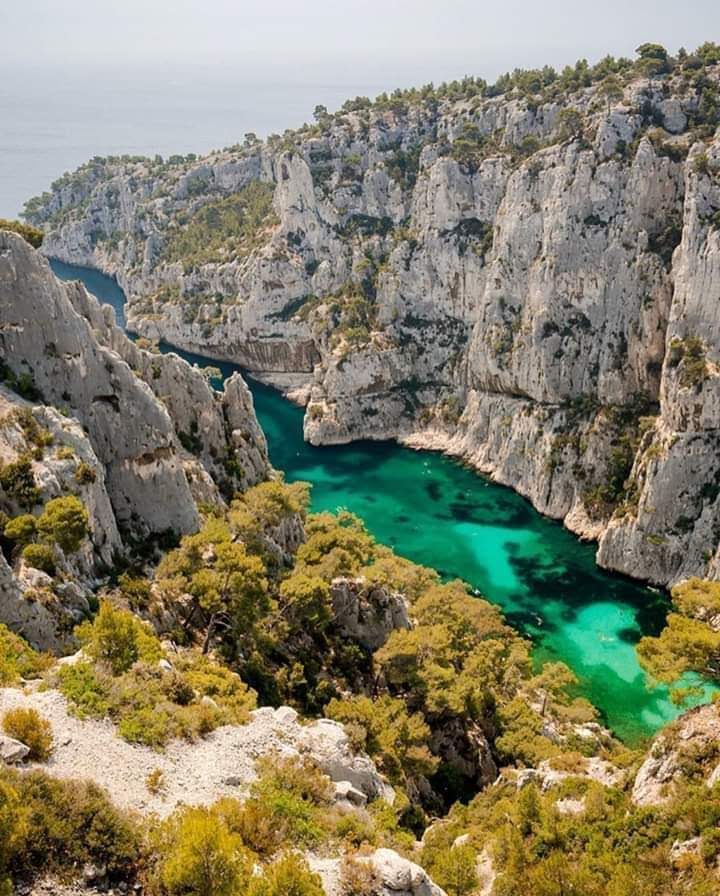
Twenty minutes from Marseille's metro, the city simply stops. The limestone drops into the sea in sheer white walls, the water below turns a colour somewhere between turquoise and ink depending on the hour, and the only sounds are gulls and the occasional clatter of a climbing rope. This is the Calanques — a 520-square-kilometre wedge of fjord-like inlets, scrub-covered ridges, and submerged prehistory that begins at Marseille's southern edge and runs east toward Cassis.
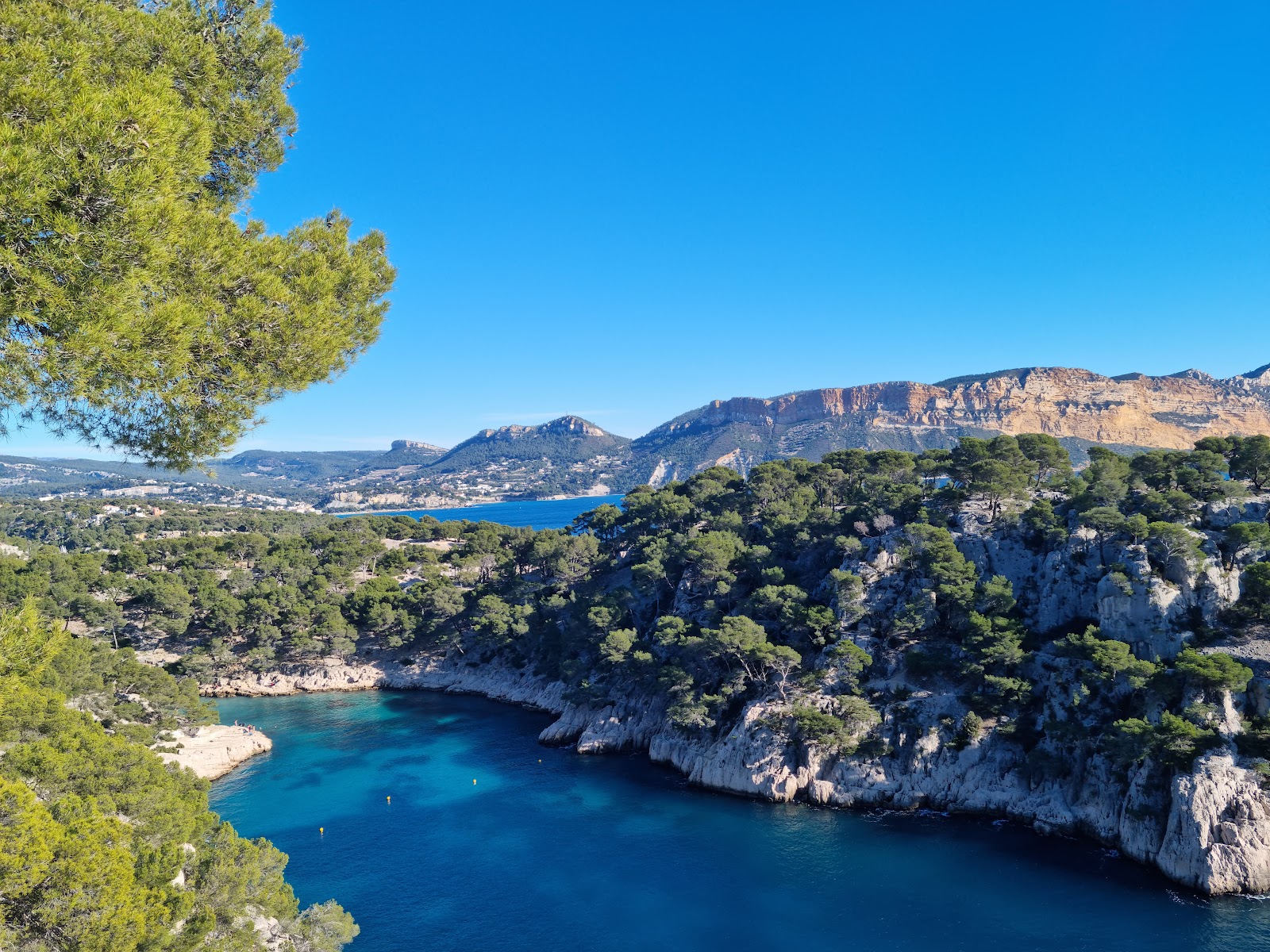
At 40 metres below the surface near Cap Morgiou, the Cosquer Cave holds paintings of auks, horses, and hands pressed against rock by the first humans in Provence — now sealed under the Mediterranean, accessible only to divers. Above water, the calanques of Sormiou, En-Vau, and Sugiton are what most people come for: narrow inlets where the rock glows white-hot at noon and the pines smell of resin.
💛 What travellers fall for
People who come back tend to arrive early — before 9am in summer, when the light is still soft and the parking restrictions haven't kicked in. Morgiou is the quieter choice over Sormiou on a weekend. The boat from Pointe-Rouge gives you En-Vau without the knee-punishing descent, and the 3h15 circuit covers twelve calanques in one go.
The story behind Calanques National Park (Marseille sector)
Local walkers were mapping these inlets long before any official protection existed. The Excursionnistes Marseillais hiking club established the first routes in 1897, and by 1923 the Comité de défense des Calanques had formed specifically to block industrial development at En-Vau — a fight that took decades.
Formal protection came gradually: listed status under France's 1930 natural monuments law arrived in 1975, a preparatory public body in 1999, and finally, on 18 April 2012, Prime Minister François Fillon signed the decree creating Calanques National Park — France's tenth, and the only national park in Europe that wraps land, sea, and island ecosystems around a major metropolitan area.
Good to know
Bus B1 from Place Castellane or Rond-Point du Prado drops you at Luminy, the main trailhead. Cars are banned on weekends from 10am and most weekday afternoons in summer — use transit. Bring 1.5 litres of water per half-day minimum: no taps, no bins, no shops once you're in. Check the Prefecture's daily fire-risk decision; between June and September the park can close at short notice.
July and August are the driest months — up to 12 hours of sun a day — but also when fire closures are most likely and crowds peak at the popular inlets. September pulls back the heat slightly (around 24°C) and brings occasional rain, but the light is excellent and the trails less crowded. Spring, from March through May, is the most reliable window: wildflowers on the scrub, cool enough to walk hard, and the sea still cold enough to be bracingly clear.
Where is Calanques National Park (Marseille sector)?
More tickets & tours for Calanques National Park (Marseille sector)
Book directly at the provider
What travellers say about Calanques National Park (Marseille sector)
On of the most memorable nature trips of my life. We took a boat tour from the port of Marseille and we could not believe our eyes, every corner was filled with the most amazing views. A must do when in Marseille.
Beautiful. But 4 starts as there are no toilets! So many people attending, there should be public toilets at the entrance. Luckily there is the Uni close by!
Did the La traversée des Calanques (1/3): Marseille - Luminy and what fantastic views, it was challenging but the perfect way to relax and unwind, especially woth no cell reception. I used Mes Calanques app to find a trail and the map worked perfectly.
Stunning place, rugged mountain cliffs perched above the mediteranean. Hiked the red-white trail from les Baumettes to Cassis, aprox 25km. Tough terrain, sometimes became quite exposed, not your average walk in the park, attention to the path and markings is key. Losing or missing a sign can lead you to the middle of nowhere. Bring plenty of water.
Visiting the Calanques National Park was an absolutely sublime experience. The turquoise waters are breathtaking, and the way the sea crashes against the mountains creates a powerful, almost overwhelming sensation. I had the chance to discover it on a yacht, which made the experience even more unique and luxurious, allowing me to fully enjoy the hidden coves and majestic cliffs. The contrast between the crystal-clear sea, the bright limestone rocks, and the calm Mediterranean atmosphere is unforgettable. A true natural wonder that I would highly recommend to anyone visiting Marseille.
More of Marseille
Discover where to stay, what to do and the best deals for your trip.
Explore Marseille →More attractions in Marseille
All of Marseille →
Background adapted from Wikipedia (CC BY-SA) · map data © OpenStreetMap contributors · ratings & place photos via Google · other photos with per-image credit. Ticket links may earn us a commission at no extra cost to you.