
Abbey of Mont Saint-Michel
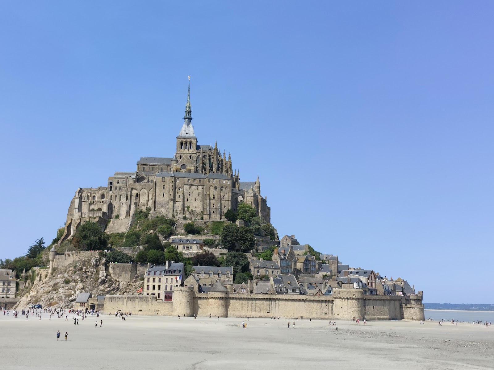
At the very top of the island rock, above the village rooftops and the tidal flats, the abbey sits where Bishop Aubert of Avranches placed the first sanctuary in 709 — because, the story goes, an archangel told him to, three times over. The granite climb is steep and the crowds are real, but once you step into the nave, something shifts. The proportions are serious. The light comes in at angles that feel considered across centuries.
What you're walking through is not one building but a thousand years of accumulation: Romanesque foundations, a Gothic choir rebuilt after the original collapsed, a gilded copper archangel on a spire added in 1897, and a pre-Romanesque church only rediscovered beneath the floor in 1898.

💛 What travellers fall for
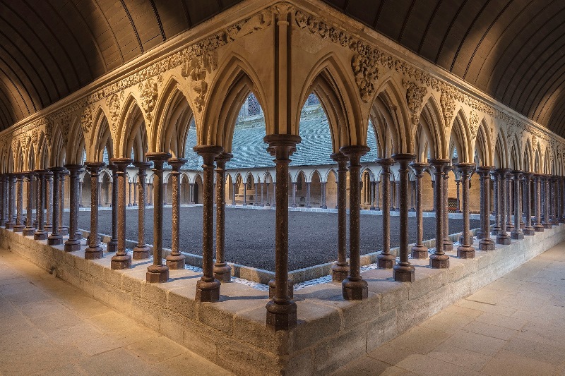
People who come back tend to arrive early — doors open at 09:00 in summer — before the shuttle crowd catches up. The cloister gets its own entry on Yeppa, and rightly so, but standing in the refectory of La Merveille, looking up at the lancet windows, is the moment most return visitors say they'd forgotten about and are glad to find again.
The story behind Abbey of Mont Saint-Michel
Bishop Aubert consecrated the first sanctuary here on 16 October 709, and in 966 Abbot Maynard I arrived from Saint-Wandrille to establish Benedictine rule — the date the abbey counts as its formal founding. Construction of the Romanesque church began in 1023 under the direction of William de Volpiano, an Italian architect commissioned by Richard II of Normandy. The nave dates to 1084; the Flamboyant Gothic choir was begun in 1448 to replace a Romanesque choir that had collapsed.
The French Revolution ended monastic life abruptly: the abbey became a prison in 1791 and stayed one until 1863. Victor Hugo campaigned for its restoration in the 1860s. It was classified as a Historic Monument in 1874, and Benedictine monks returned in 1969 — though by 2001 the Monastic Fraternities of Jerusalem had taken over. Between 2006 and 2015, a major engineering project replaced the old causeway with a bridge walkway and built a dam on the Couesnon River to reverse centuries of silting.
Good to know
Park 2.5 km out and take the free shuttle; the walk from the shuttle stop to the abbey entrance is another 45 minutes up through the village. Adult entry is €11; under-18s free. First Sundays of January, February, March, November and December are free for everyone. Last admission is one hour before closing.
Where is Abbey of Mont Saint-Michel?
Location
- In Mont Saint-Michel
- 48.6361, -1.5115
- Open in Google Maps
Rating
4.7 ★ · 15,094 Google reviews
More tickets & tours for Abbey of Mont Saint-Michel
Book directly at the provider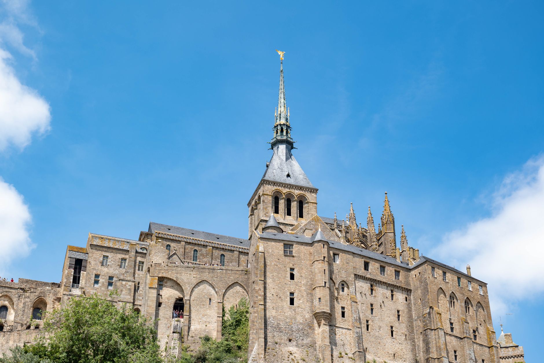
What travellers say about Abbey of Mont Saint-Michel
Amazing place. Just so busy, very crowded, however well organised. It's good idea to walk there and take the free bus back. You need hour or so to walk around the village ( walking round the village is free).
Mont Saint-Michel is amazing! Views from the fields are stunning. Arrive early at the abbey to avoid crowds. Shuttles run frequently, which is handy. Parking cost €20 for 5 hours. A small tip: eat outside the castle for better value. We had an interesting trip and highly recommend visiting here!
Highly recommend the audio tour. It was very interesting and gave great information you would not know just by walking through. Extremely busy place. We also dod the extra museums there and enjoyed them.
This is a place you have to see! There is a lot of steps here to climb but well worth it. Shops sideline the main entrance and there is always something to see. Toilets are just inside to the left and further up to the right. They are somewhat few and far between so use them as needed. The crowds are terrible as when groups, bus tours, school tours are in there. There, one must have patience. Weather can be unpredictable so take appropriate clothing as it is, and can be windy out there. Once parked, you can grab a shuttle which will take you closer, otherwise it can be a bit of a walk. Caution is to be taken as there is quicksand in the area when the tide is out, if you venture out that way. I think that you are required to have a guide if you go out there and it would be strongly suggested.
I visited Mont-Saint-Michel Abbey alone, which I had long wanted to do. It was truly wonderful and inspiring. The biggest issue in my life is my own death and the death of a loved one, which I will experience someday. I wanted to deepen my consideration about it, so I visited Mont-Saint-Michel Abbey and prayed silently. As I walked around the Abbey, I thought about this issue. Although I have not found an "answer" about this issue, the experience of praying at Mont-Saint-Michel Abbey gently enveloped me. This experience is a treasure of my life. I will never forget it. May God bless all the people of the world!
More of Mont Saint-Michel
Discover where to stay, what to do and the best deals for your trip.
Explore Mont Saint-Michel →More attractions in Mont Saint-Michel
All of Mont Saint-Michel →
Background adapted from Wikipedia (CC BY-SA) · map data © OpenStreetMap contributors · ratings & place photos via Google · other photos with per-image credit. Ticket links may earn us a commission at no extra cost to you.