
Yosemite National Park, USA
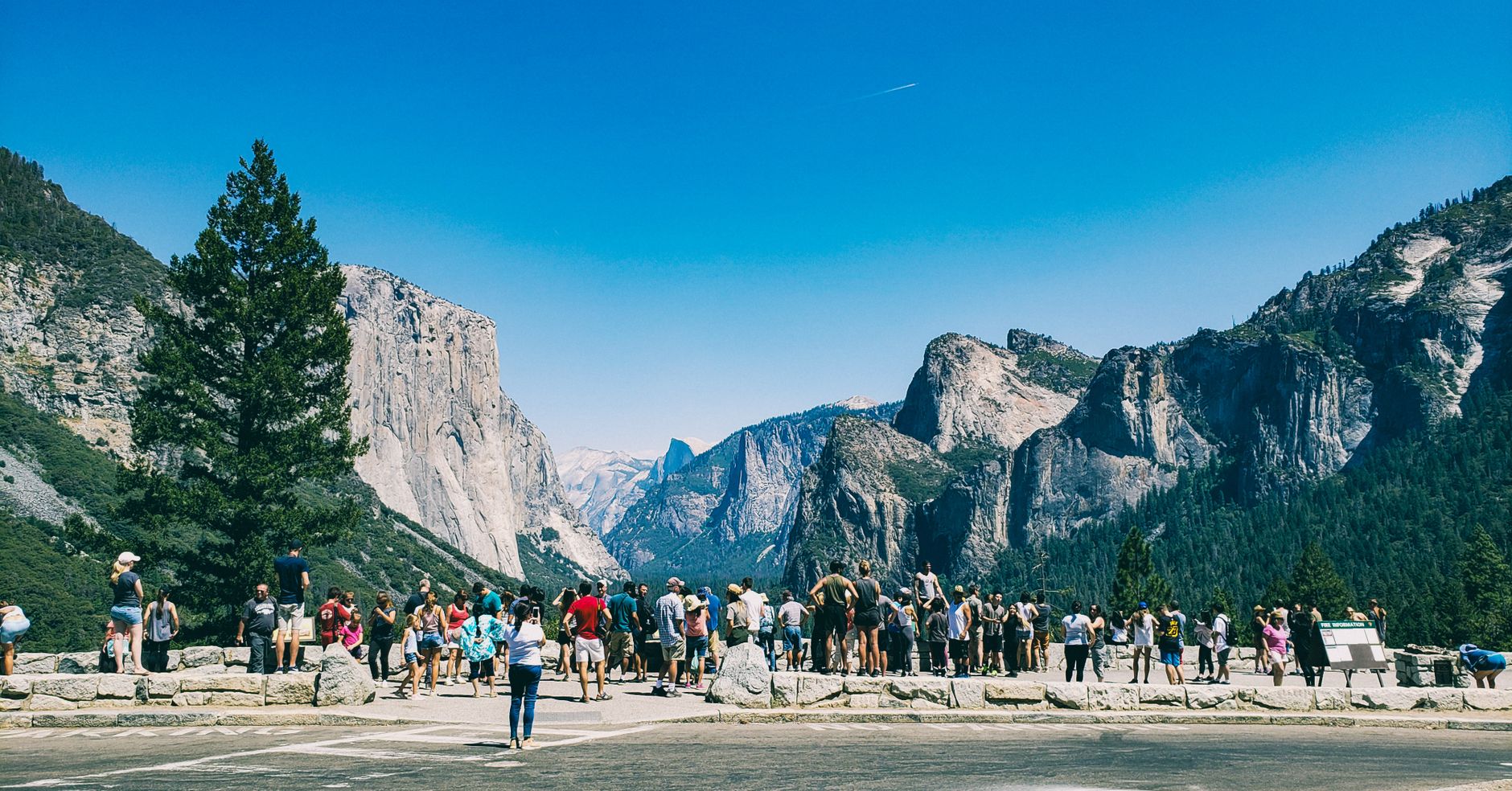


Stand at Tunnel View — the eastern mouth of the Wawona Tunnel — and the valley opens in front of you like a page being turned: El Capitan on the left, Half Dome anchoring the far end, Bridalveil Fall threading down the right wall. It is one of the most reproduced views in American photography, and it still stops people mid-sentence.
Yosemite covers nearly 1,200 square miles of the Sierra Nevada, but most visitors spend their time in seven of them — the valley floor, where the granite walls press close and the free summer shuttle loops between trailheads, meadows, and the 1927 Ahwahnee Hotel sitting square in its meadow with Glacier Point above.
💛 What travellers fall for
People who keep coming back tend to sort themselves out by timing. The ones who arrive before 9 am in summer walk to Mirror Lake in relative quiet. The ones who come in May catch Yosemite Falls at full roar — the Mist Trail earns its name, and a rain jacket is not optional. Winter regulars pack tire chains and get the valley nearly to themselves.
How Yosemite National Park, USA came to be
In 1864, Abraham Lincoln signed a bill granting Yosemite Valley and the Mariposa Grove sequoias to California as a public trust — the first time the federal government had set aside land specifically to protect scenery. It was a precedent more than a park. The full national park followed on October 1, 1890, the third in the country, shaped in large part by the lobbying of naturalist John Muir and magazine editor Robert Underwood Johnson.
The early decades were contested ones. Congress approved the Hetch Hetchy Dam in 1913, flooding a second valley that Muir considered the equal of Yosemite itself — a loss that galvanized the conservation movement for generations. Galen Clark served as the park's first Guardian for most of 35 years; Captain Charles Young became the first Black man placed in charge of a national park, his troops building the first trail to Mount Whitney. Ansel Adams began photographing the valley in the 1920s, and his images eventually became inseparable from the place itself.
Who and what shaped it
People who shaped it
Landmark buildings
See Yosemite National Park, USA in motion
Plan your visit
On the map
When to go
May and June are the clearest window: snowmelt swells the waterfalls to peak volume, Tioga Road reopens, and temperatures on the valley floor sit in the comfortable 50s–70s Fahrenheit. Summer (July–September) is warm and crowded; winter is quiet but requires tire chains and accepts the closure of most high-elevation roads.
Right now
Background & history adapted from Wikipedia (CC BY-SA) · specs from Wikidata (CC0) · weather from Open-Meteo · map data © OpenStreetMap contributors · photos from Wikimedia Commons / Unsplash with per-image credit. No third-party reviews or social posts reproduced.