
Suita
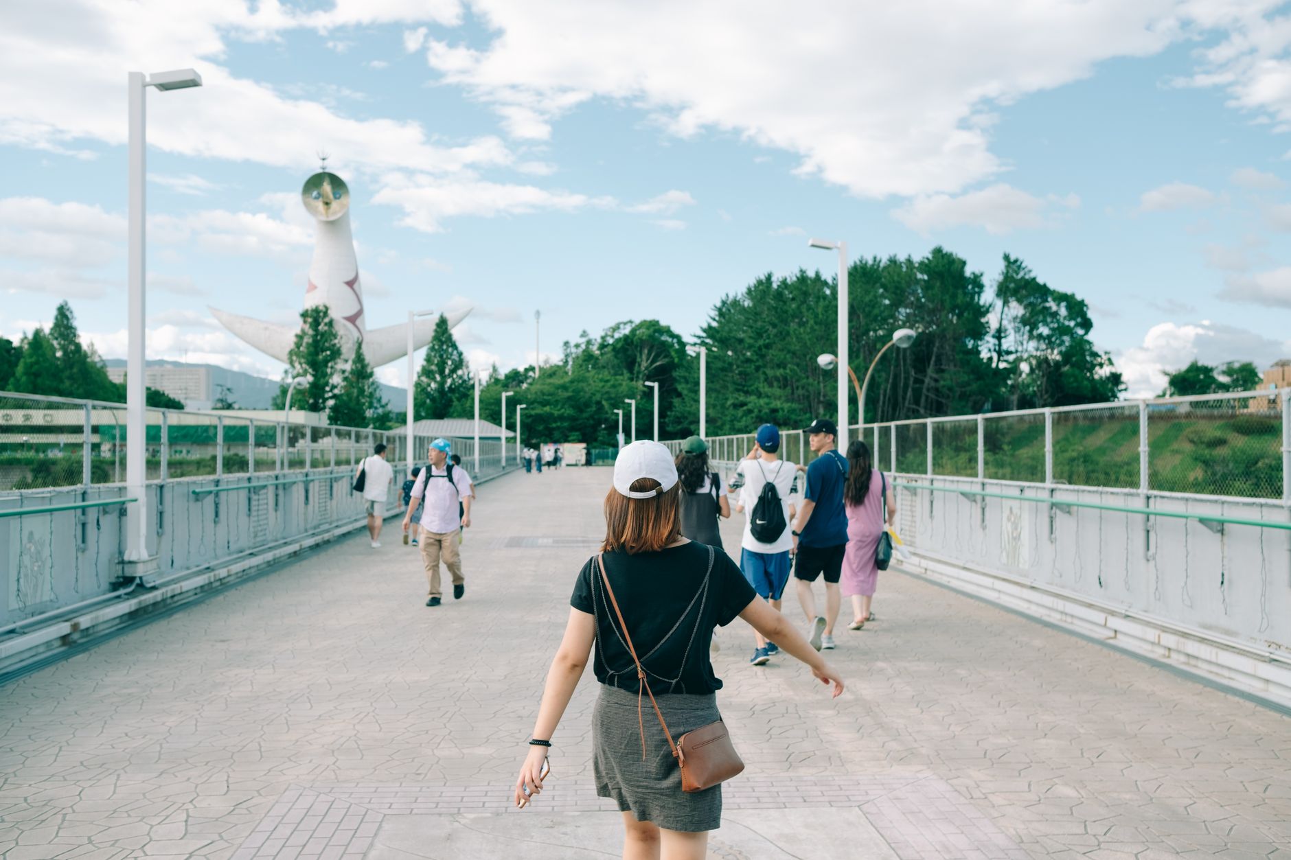
Suita sits just north of Osaka proper, close enough that Shin-Osaka is five minutes away by rail, yet distinct enough to have its own unhurried rhythm. The city's most recognisable landmark is Tarō Okamoto's Tower of the Sun — a concrete figure with three faces that has stood in Expo Commemorative Park since the 1970 World's Fair, arms raised as if it has been waiting for you since then.
Beyond the tower, Suita holds a freight yard that once made it a pivot of Kansai commerce, two major universities, a 40,000-seat football stadium, and the National Museum of Ethnology — a serious institution that tends to surprise people who wander in expecting a quiet afternoon.
💛 What travellers fall for
People who come back tend to arrive early at Expo Park before the tour groups, then cross to the National Museum of Ethnology for a few hours — it's far deeper than its low profile suggests. Late afternoon, the walk around the Japanese garden inside the park is genuinely calming. Esaka Station puts you back in central Osaka in under fifteen minutes.
Deals in Suita
Book directly at the provider

How Suita came to be
Suita's recorded story begins in 785 AD, when the court official Wake no Kiyomaro oversaw construction of a canal linking the Yodo and Kanzaki rivers — an act of engineering that shaped the city's identity as a transit node. Through the Heian and Edo periods, the land was divided between shōen estates of the nobility and holdings of the Tokugawa shogunate, eventually developing as a river port and post town along the old road network.
The modern city formalised in 1889, gained town status in 1898, and became a city in 1940. A large railway freight yard opened in 1923, cementing Suita's role in regional logistics. Then came 1970: the World's Fair transformed a stretch of the city into an international stage, leaving behind Okamoto's tower and the park that surrounds it — Suita's most lasting reinvention.
Who and what shaped it
People who shaped it
Landmark buildings
See Suita in motion
Plan your visit
On the map
When to go
Suita has a humid subtropical climate: summers run warm and humid with August averaging around 27°C, while winters are cool and mostly dry, with little to no snow. Spring and autumn are the most comfortable seasons for walking the park and outdoor sites.
Right now
Background & history adapted from Wikipedia (CC BY-SA) · specs from Wikidata (CC0) · weather from Open-Meteo · map data © OpenStreetMap contributors · photos from Wikimedia Commons / Unsplash with per-image credit. No third-party reviews or social posts reproduced.