
Sokcho and Seoraksan National Park
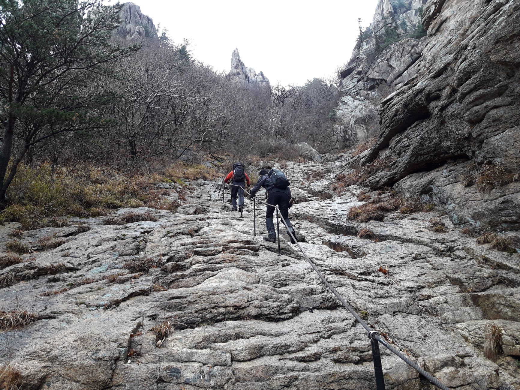


The east coast of South Korea ends here in granite. Seoraksan's peaks — including Ulsanbawi, a six-pronged rock formation that takes 888 steps to reach — rise directly from the coastal lowlands, so the change from sea-level fishing port to alpine wilderness happens in the space of a single bus ride. Sokcho itself sits on a narrow sandbar between the Yellow Sea and Lake Cheongchoho, a city shaped as much by the Korean War as by the tides.
Together they make an unusual pairing: a working port city where raw squid dries on racks outside the market, and one of South Korea's most visited national parks pressing right up against it. The two are genuinely inseparable — you sleep in Sokcho and hike in Seoraksan, and the contrast is part of the point.
💛 What travellers fall for
People who come back tend to split their days deliberately: mornings at Sinheungsa Temple before the cable-car crowds arrive, afternoons at Sokcho Tourist & Fishery Market for odeng fish cake and a bowl of something warm. The Dinosaur Ridge trail — 5.1 kilometres from Madeungyeong to Sinseonam — keeps drawing hikers back for the ridge-line views that the valley trails never quite give you.
How Sokcho and Seoraksan National Park came to be
Sokcho was a small fishing settlement on Lake Cheongchoho's shores until 1937, when it became a mineral transfer port. The Korean War reshaped it permanently: South Korean forces recaptured the city in August 1951, and roughly 6,000 refugees from North Korea's Hamgyeong Province settled on the sandbar during their retreat south, leaving a community whose descendants still live here. The armistice of 1953 placed Sokcho firmly in the South, and the Tourist & Fishery Market opened that same year.
Seoraksan carries older marks. The monk Jajang founded Sinheungsa Temple in 652 CE — originally called Hyangseongsa — and Wonhyo used Geumganggul Cave as an ascetic retreat in the same century. The mountain became South Korea's fifth national park in 1970 and a UNESCO biosphere reserve in 1982.
Who and what shaped it
People who shaped it
Landmark buildings
See Sokcho and Seoraksan National Park in motion
Plan your visit
On the map
When to go
Summers are warm and humid with occasional heavy rain; autumn (October into early November) brings sharp, clear days and vivid foliage across the slopes. Winters are cold and snowy — some trails close — but the granite peaks under snow have their own austere appeal. Spring arrives gradually, with the park reopening more fully by late April.
Right now
Background & history adapted from Wikipedia (CC BY-SA) · specs from Wikidata (CC0) · weather from Open-Meteo · map data © OpenStreetMap contributors · photos from Wikimedia Commons / Unsplash with per-image credit. No third-party reviews or social posts reproduced.