
Sagarmatha National Park (Everest Region)

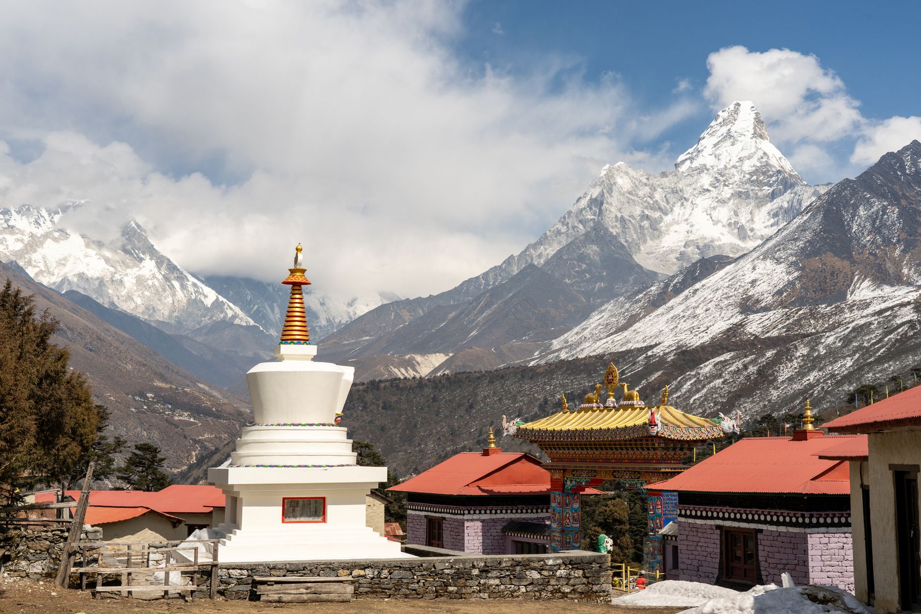


The number that defines this place is 8,848 — the metres from sea level to the summit of Everest, known here as Sagarmatha. But the park around it is its own world: 1,148 square kilometres of glaciated valleys, high-altitude wetlands, and ridge villages where Sherpa families have lived for roughly 500 years. You arrive through Lukla, a short flight from Kathmandu, and walk from there — two days before you even reach the park entrance.
Nameche Bazaar, arranged in tiers around a natural amphitheatre, is where most trekkers slow down and acclimatise. Above it, the peaks multiply: Lhotse, Ama Dablam, Pumori, Cho Oyu. The Gokyo Lakes, between 4,700 and 5,000 metres, form the highest freshwater lake system on earth.
How Sagarmatha National Park (Everest Region) came to be
The park was formally established on 19 July 1976, its creation announced three years earlier at the WWF's International Congress in Bonn. In 1979 it became Nepal's first natural site inscribed as a UNESCO World Heritage Site. A 275-square-kilometre buffer zone was added in January 2002, and in 2007 the Gokyo Lakes were designated Ramsar Wetlands of International Importance — recognition of an ecosystem that had been sustaining life at altitude long before any official designation.
The Sherpa communities who migrated from eastern Tibet around 500 years ago built the monasteries at Tengboche and Thame that still anchor cultural life here. Edmund Hillary and Tenzing Norgay summited Everest together in 1953; Hillary later funded the Khumjung school, built in 1961 by his Himalayan Trust.
Who and what shaped it
People who shaped it
Landmark buildings
See Sagarmatha National Park (Everest Region) in motion
Plan your visit
On the map
When to go
Autumn — late September through November — brings stable skies and the clearest mountain views, with daytime temperatures comfortable at lower elevations and nights dropping sharply to around -10°C as altitude rises. Spring (March to May) is the other reliable window, warmer and coloured by rhododendrons, though summit-season crowds concentrate on the trails; the monsoon months of June through August drench the paths and close off most high views, while winter brings heavy snowfall and daytime temperatures that rarely climb above freezing.
Right now
Background & history adapted from Wikipedia (CC BY-SA) · specs from Wikidata (CC0) · weather from Open-Meteo · map data © OpenStreetMap contributors · photos from Wikimedia Commons / Unsplash with per-image credit. No third-party reviews or social posts reproduced.