
Region

Puerto Plata

Puerto Plata
Photo by Carlos Corporan on Pexels
Puerto Plata
Photo by Carlos Corporan on Pexels
Puerto Plata
Photo by Vika Glitter on Pexels
Puerto Plata
Photo by Hiraldo Photos on Pexels
Puerto Plata
Photo by Caleb Oquendo on Pexels
Puerto Plata
Photo by Samuel Nuñez on Pexels
City break Culture & history Beach & sun

Puerto Plata announces itself with iron and amber. The north coast's main city wears its Victorian streetscapes — rebuilt after an 1863 fire levelled the original town — alongside a Spanish fort that has stood at the mouth of the bay for over four centuries. A cable car climbs to nearly 800 metres above sea level, the beaches run wide and Atlantic-rough, and the rum distillery founded by a Catalan immigrant in 1888 still operates in the same city.

This is the gateway to the Dominican Republic's north coast: a working port city with a genuine historic centre, a 4-kilometre Malecón, and a mountain at its back.

Good to know
Fly into Gregorio Luperón International Airport (POP), 19 km from the centre. Gua-gua buses are cheap and reliable until around 6 pm; motoconchos work for short hops — look for the licensed drivers in neon vests. November is the wettest month; June is the driest.
The story

How Puerto Plata came to be

The city was founded around 1502 by Nicolás de Ovando, though the exact year remains debated among Dominican historians. It was destroyed in 1606 as part of a colonial depopulation policy and sat largely abandoned until 1736. After the Restoration War against Spain, arson gutted it again in 1863 — and it was the rebuilding that followed, from 1865 onward, that gave Puerto Plata its Victorian character: at its peak, an estimated 375 Victorian homes lined its streets.

In the early 1970s, a presidential decree redirected the city toward tourism. Playa Dorada opened in 1972, the cable car to Mount Isabel de Torres in 1974, and Gregorio Luperón International Airport in 1979 — a compressed transformation that shaped the city visitors find today.

People & landmarks

Who and what shaped it

People who shaped it

General Gregorio Luperón
Born in Puerto Plata; led Dominican independence restoration war (1861–1865) and served as interim president.
Andrés Brugal Montaner
Catalan immigrant who founded Brugal & Co. rum distillery in Puerto Plata in 1888.
Emilio Prud'Homme
Puerto Plata-born lawyer and writer (1856–1932); authored lyrics to Dominican Republic National Anthem.
Eduardo Brito
Opera and zarzuela singer (1906–1946) from Puerto Plata; considered national singer of Dominican Republic.
Al Horford
Professional basketball player born 1986; first Dominican to win NBA championship; five-time NBA All-Star.

Landmark buildings

Fortaleza San Felipe
Spanish fort commissioned 1577; overlooks port at Malecón tip; named national monument 1980.
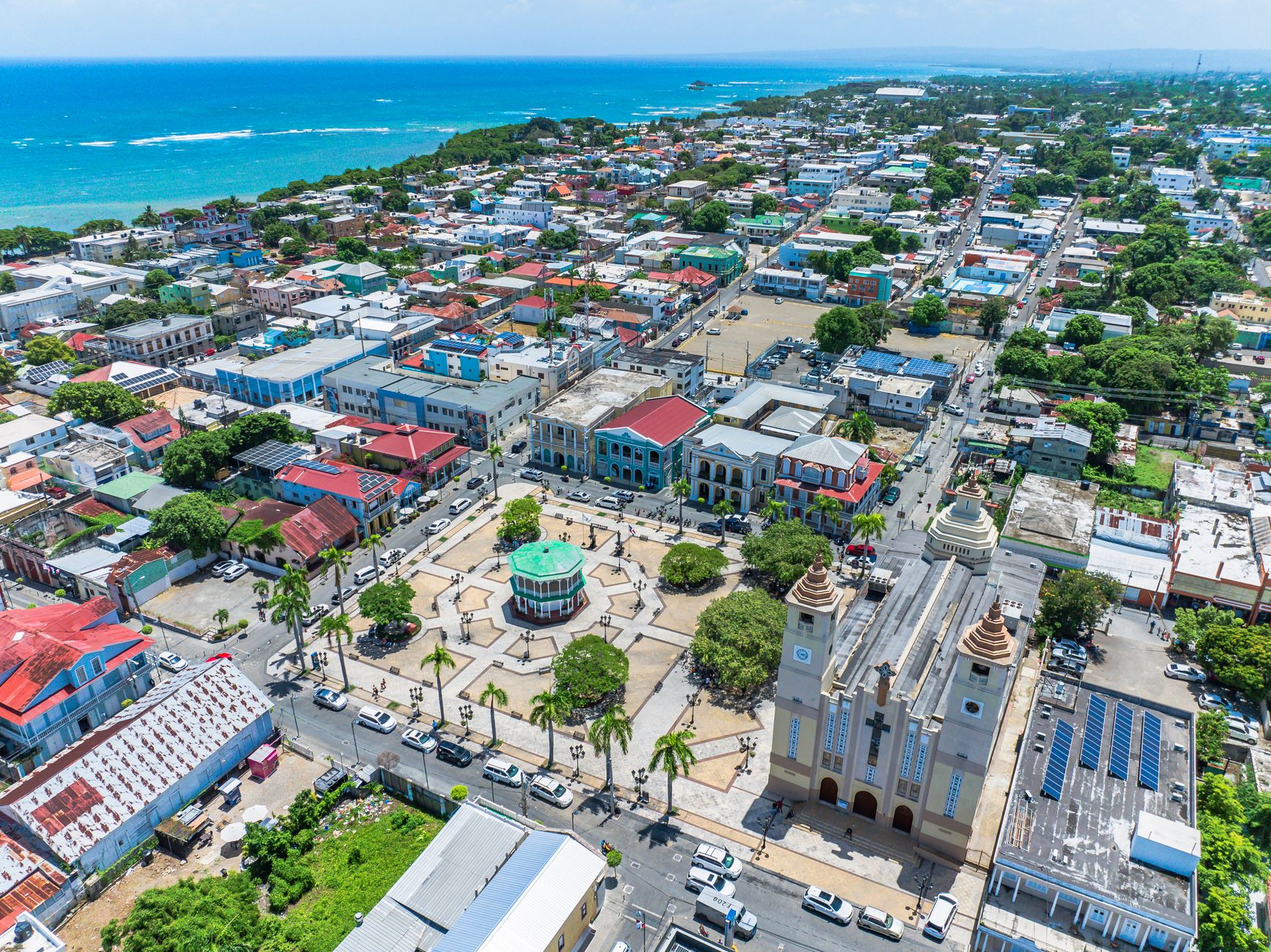
San Felipe Apóstol Cathedral
Foundation dates to 1502; current structure rebuilt 1929–1956; restored after 2003 earthquake damage, completed 2008.
Cast-Iron Lighthouse
Built 1879 under Gregorio Luperón; 137 feet high; restored 2004 with American Express funding.
Mount Isabel de Torres Cable Car (Teleférico)
Caribbean's first aerial tramway; ascends 793 meters (2,600 feet); operates 8:30 AM–5:00 PM daily; US$10–US$15 round trip.
Amber Museum (Museo del Ámbar Dominicano)
Founded 1982 in Villa Bentz (1918 hotel); Dominican Republic's first amber museum.
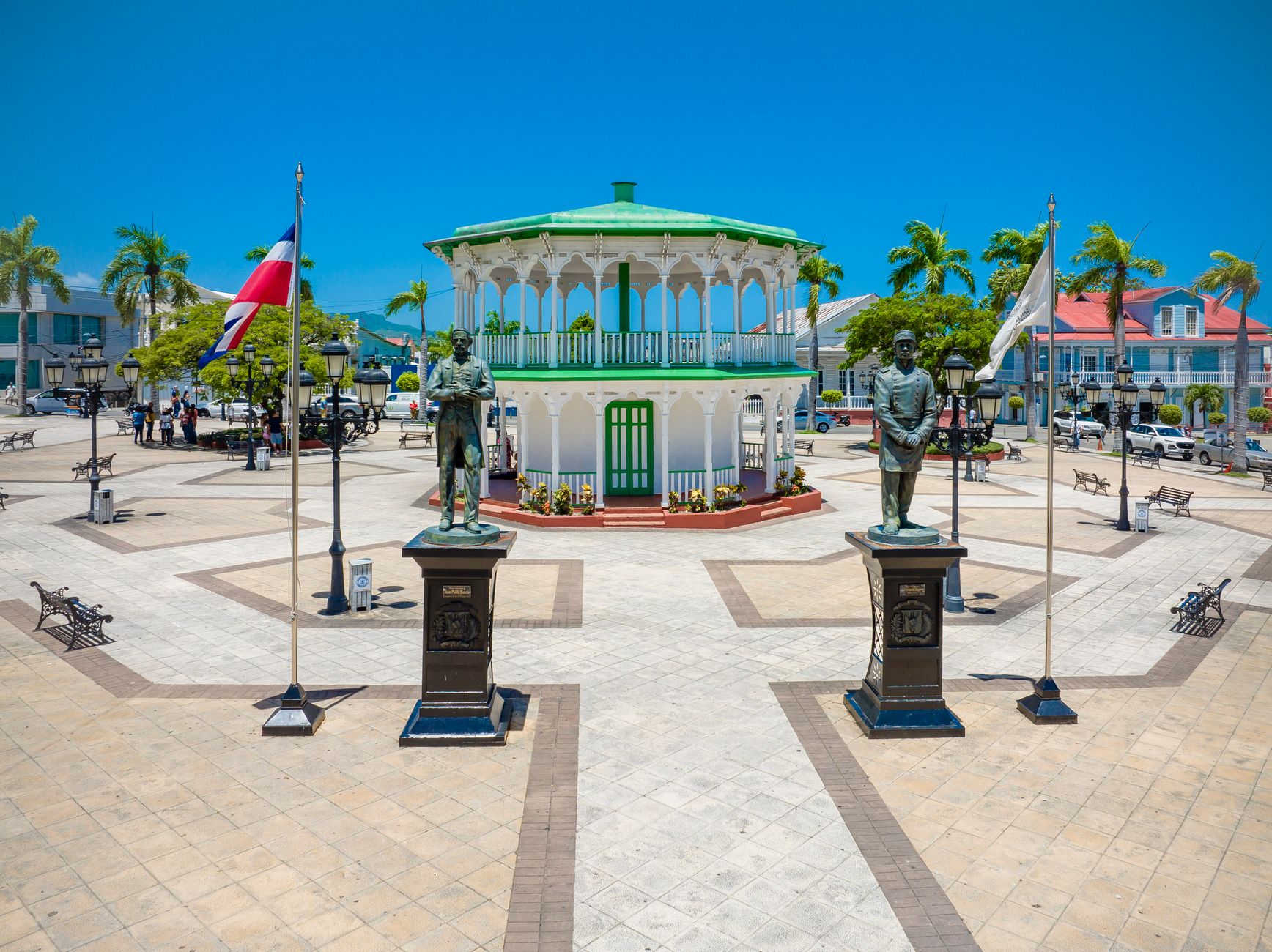
Parque Independencia (Central Park)
Victorian-surrounded central park; home to Cathedral of San Felipe; octagonal gazebo recreated 1983 from 1919 original.
Victorian Historic Center
Rebuilt after 1863 arson fire; Victorian style initiated 1857, reconstruction 1865 onward; estimated 375 Victorian homes at peak.
Malecón
4-kilometer scenic waterfront promenade with ocean views and monuments.
Practical

Plan your visit

On the map

When to go

Temperatures stay between 28°C in January and 31°C in August, so the north coast never turns cold. The wettest stretch runs into November; if you want drier days and calmer skies, plan around June.

Right now

☀️
28°C
Clear
Fri
🌧️
30°
25°
Sat
🌧️
30°
25°
Sun
🌧️
29°
25°
Mon
31°
25°
Weather data: Open-Meteo

Background & history adapted from Wikipedia (CC BY-SA) · specs from Wikidata (CC0) · weather from Open-Meteo · map data © OpenStreetMap contributors · photos from Wikimedia Commons / Unsplash with per-image credit. No third-party reviews or social posts reproduced.

Top