
Phong Nha-Ke Bang National Park


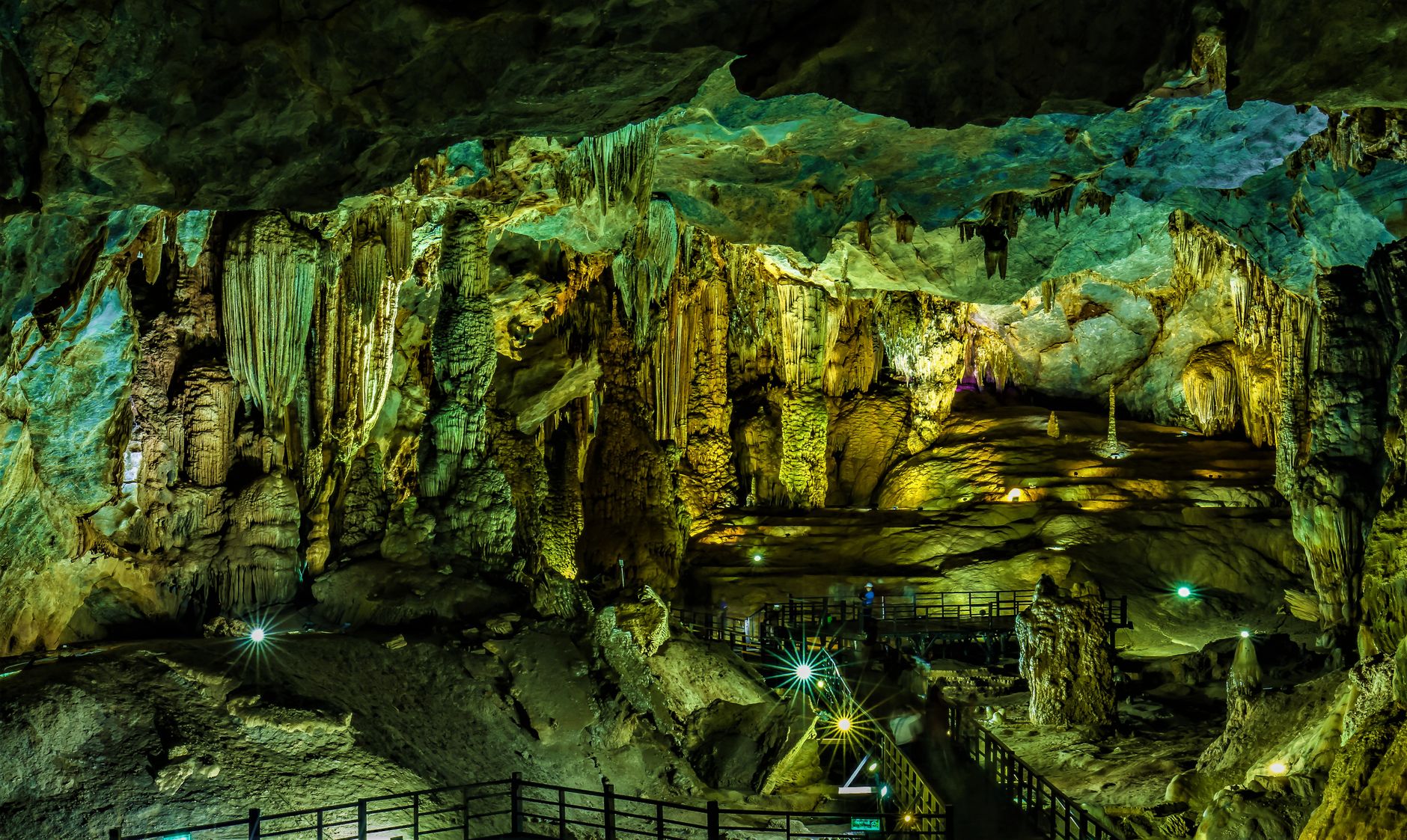


The numbers alone are hard to process: a cave so large it contains its own weather system, its own jungle, its own clouds forming near the ceiling. Son Doong, the largest known cave on earth, sits inside Phong Nha-Ke Bang, a limestone karst park in central Vietnam where the mountains are riddled with more than 300 surveyed caves and the rivers sometimes vanish underground for kilometres before surfacing again.
Most visitors never set foot inside Son Doong — access is capped at 1,000 people a year — but the park holds enough to fill several days regardless. Phong Nha Cave runs more than 7,700 metres and is reached by boat along the Son River. Paradise Cave stretches 31 kilometres and rises 60 metres high inside. The base is Son Trach village, a small town with guesthouses, food, and an ATM.
💛 What travellers fall for
People who return tend to say the same thing: book Oxalis for Son Doong far earlier than you think necessary — the waitlist runs up to two years. In the meantime, Dark Cave's zipline-into-mud-bath sequence is genuinely worth a morning, and the boat ride into Phong Nha Cave at low season, when the water is clear and the crowds thin, is its own reward.
How Phong Nha-Ke Bang National Park came to be
The caves were known locally for centuries, but the wider world's attention arrived in 1899 when French missionary Léopold Cadière surveyed the Son River valley and its inhabitants. Systematic scientific exploration came much later: the British Cave Research Association and Hanoi University began documented work in the 1990s, and in late 1990 a local man discovered the entrance to Son Doong, though it wasn't fully explored until a British-Vietnamese expedition returned to it. Paradise Cave, 31 kilometres of dry passage, was found by British scientists in 2005.
The park itself took shape in stages — a 5,000-hectare special-use forest designated in 1986, expanded to over 41,000 hectares as a nature reserve in 1993, then elevated to national park status in 2001. UNESCO recognised it as a World Natural Heritage Site in 2003, with a second designation following in 2015 for its biodiversity.
Who and what shaped it
People who shaped it
Landmark buildings
See Phong Nha-Ke Bang National Park in motion
Plan your visit
On the map
When to go
The driest and most reliably accessible months run from February through August; the park sits in a zone that catches heavy rainfall from September through November, when flooding can temporarily close individual caves. If you're planning around Son Doong specifically, the expeditions typically run in the dry season window.
Right now
Background & history adapted from Wikipedia (CC BY-SA) · specs from Wikidata (CC0) · weather from Open-Meteo · map data © OpenStreetMap contributors · photos from Wikimedia Commons / Unsplash with per-image credit. No third-party reviews or social posts reproduced.