
Masaya
Masaya sits about halfway between Managua and Granada, close enough to both that many travelers pass through without stopping — which is their loss. The city wears its craft traditions openly: the 1888 market building, all Gothic stone and fortress proportions, fills daily with hammocks, leather goods and woodwork made in the surrounding workshops. The lagoon at the edge of town is a flooded volcanic crater, and on a clear day you can see the volcano's cone from the waterfront promenade.
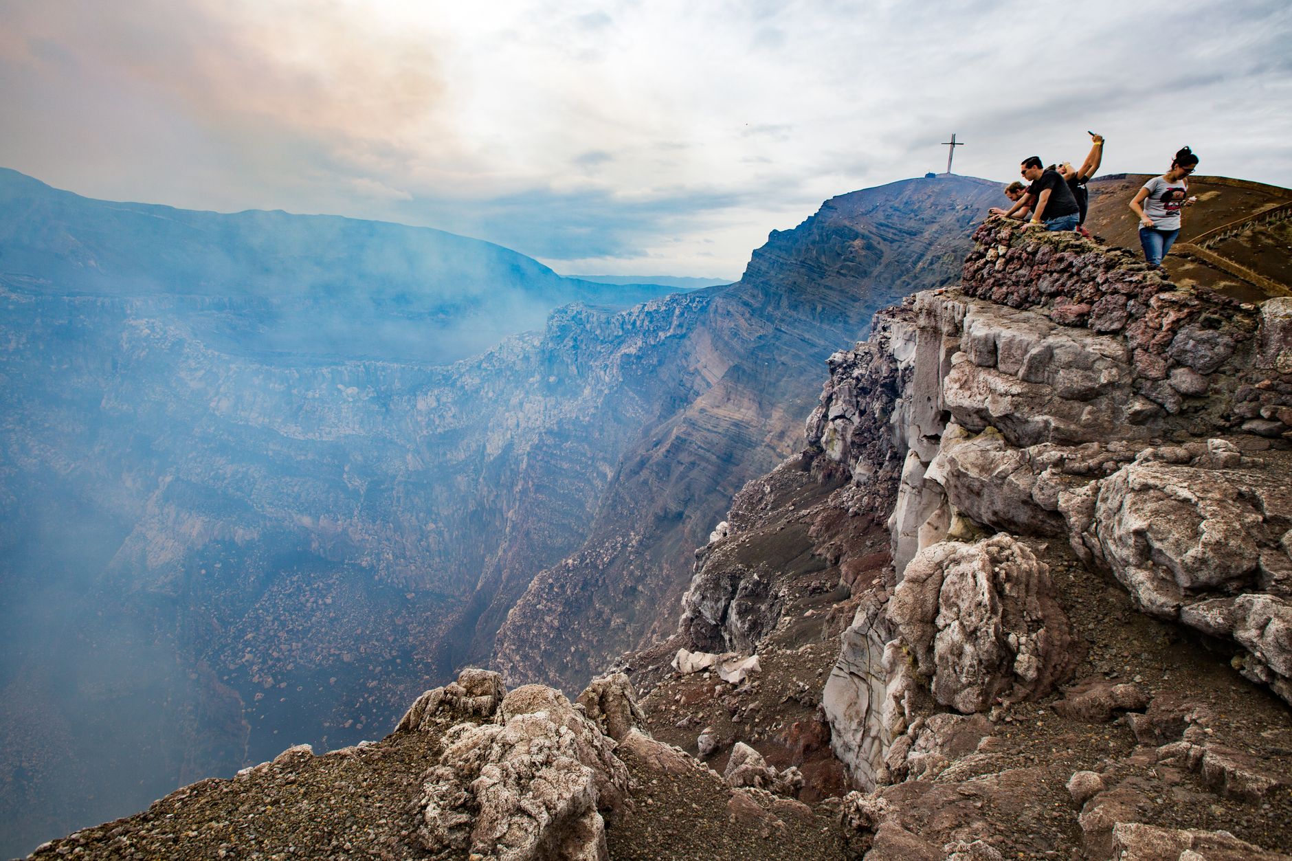
The department shares its name with Nicaragua's first national park, built around an active volcano whose lava lake has gone quiet since a 2024 landslide but whose craters and sulfurous air remain as arresting as ever. This is a place where indigenous history, colonial architecture and raw geology sit within a few kilometers of each other.
How Masaya came to be
The Nicarao and Chorotega peoples were already settled here — in communities like Nindirí, Niquinohomo and Monimbó — when the Spanish arrived in the early 16th century. Spain formalized its regard for the place in 1819, when Ferdinand VII granted it the title "Very Noble and Loyal Village Faithful to San Fernando of Masaya," and the city was officially declared as such on 2 September 1839. The department followed in 1883.
The fortress of Coyotepe, built under President Zelaya at the turn of the 20th century, was the site of a pitched battle in October 1912, when General Benjamín Zeledón's rebel forces held the hilltop against government troops. A week later, in September of that same year, American Marines passing through the city came under fire — an episode remembered as the Battle of Masaya. In 2016, the city was declared Cultural Heritage of the Nicaraguan Nation.
Who and what shaped it
People who shaped it
Landmark buildings
See Masaya in motion
Plan your visit
On the map
When to go
Masaya is hot year-round, with temperatures running between roughly 20°C and 33°C. The dry season stretches from around January through May, with November and December also reliable; October brings the heaviest rainfall, and the months from June through September are overcast and wet.
Right now
Background & history adapted from Wikipedia (CC BY-SA) · specs from Wikidata (CC0) · weather from Open-Meteo · map data © OpenStreetMap contributors · photos from Wikimedia Commons / Unsplash with per-image credit. No third-party reviews or social posts reproduced.