
Jacks Point
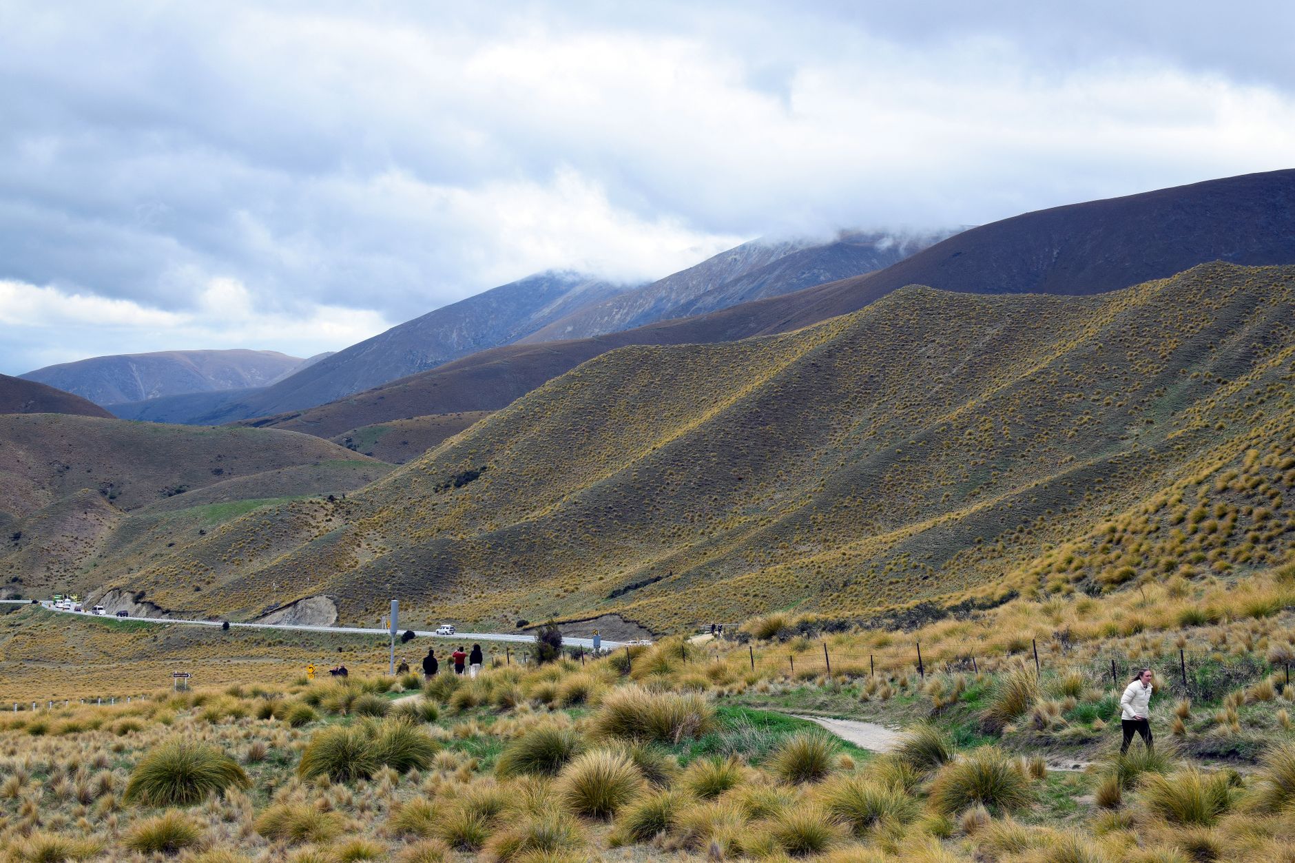

The first thing you notice at Jacks Point is the tussock — pale gold and wind-bent, running right up to the edges of the fairways as if the golf course has been politely inserted into the landscape rather than imposed on it. Lake Tewa sits at the centre of things, fed by glacial water from Lake Wakatipu, and the Remarkables form the backdrop with the kind of bluntness that makes you stop mid-sentence.
This is a planned community, deliberately so, built around a championship golf course that opened in 2008 and has since grown into six residential neighbourhoods, 25 kilometres of walking trails, restored wetlands, and a working farm that has been in the Jardine family for four generations. It sits 20 minutes from Queenstown's centre, ten from the airport — close enough to be convenient, far enough to feel like somewhere else entirely.
💛 What travellers fall for
People who come back tend to book Jack's Restaurant early — it sits right on the edge of Lake Tewa and the light on the Remarkables at lunch is worth planning around. The walking trails are the other thing regulars mention: the full Jacks Point Track takes around four hours and earns its steep sections.
Deals in Jacks Point
Book directly at the provider

How Jacks Point came to be
The name comes from Jack Tewa — known locally as 'Maori Jack' — a Māori station-hand who, on 9 August 1862, pulled a European named Mitchell from Lake Wakatipu during a storm. That same year, Tewa is credited with the first discovery of gold in the Arrow River at Arrowtown, a find that set off one of New Zealand's significant gold rushes. The land itself was part of Remarkables Station, established by William Rees at the time of first European settlement.
Dickson Jardine bought Kawarau Station — which included Jacks Point — in 1922, and the Jardine family farmed it for the better part of a century. In 1999, 420 hectares were sold to Jacks Point Limited, and by the early 2000s, land planner John Darby and golfer Sir Bob Charles had begun routing a course through the tussock and schist. Construction started in 2006; the course opened in 2008. Darby Partners has guided the master plan ever since.
Who and what shaped it
People who shaped it
Landmark buildings
See Jacks Point in motion
Plan your visit
On the map
When to go
Summer (December to February) is warm and dry — temperatures reach around 22°C, with low humidity and the occasional afternoon shower. Autumn sharpens into crisp, clear days ideal for walking and photography, while winter brings genuine cold, sometimes dropping to -6°C with snow on the surrounding ranges.
Right now
Background & history adapted from Wikipedia (CC BY-SA) · specs from Wikidata (CC0) · weather from Open-Meteo · map data © OpenStreetMap contributors · photos from Wikimedia Commons / Unsplash with per-image credit. No third-party reviews or social posts reproduced.