
Gracias
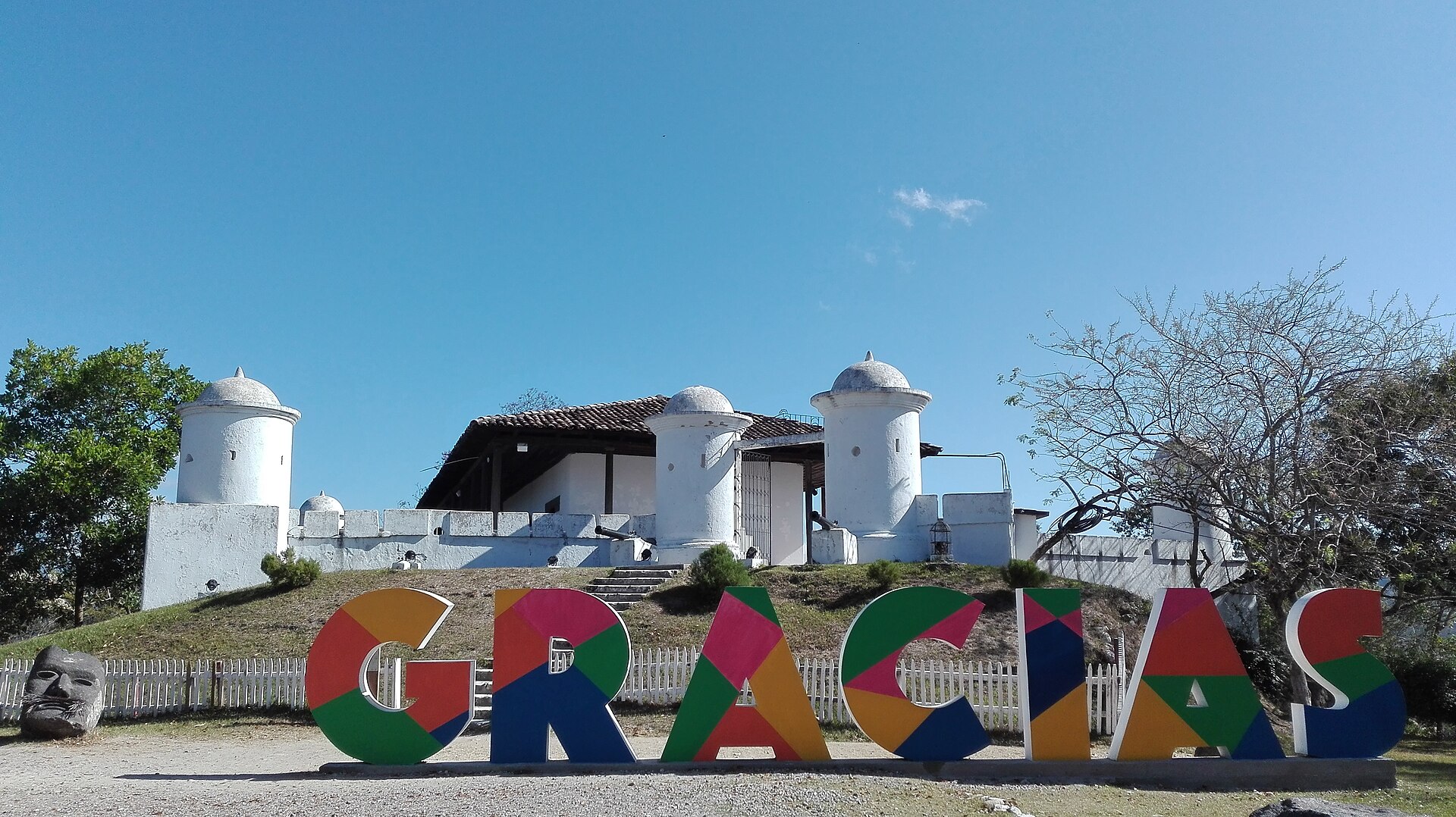
The name itself tells you something. When Spanish explorers finally stumbled out of the mountains onto the valley floor in 1536, the story goes they exhaled: "Gracias a Dios hemos llegado a tierra plana" — thank God we've reached flat land. The name stuck. Today, Gracias is a small Honduran city that still earns that sense of arrival: colonial facades in faded ochre and white, wooden balconies overhanging narrow streets, and the Fortaleza de San Cristóbal keeping watch from its hill above the rooftops.
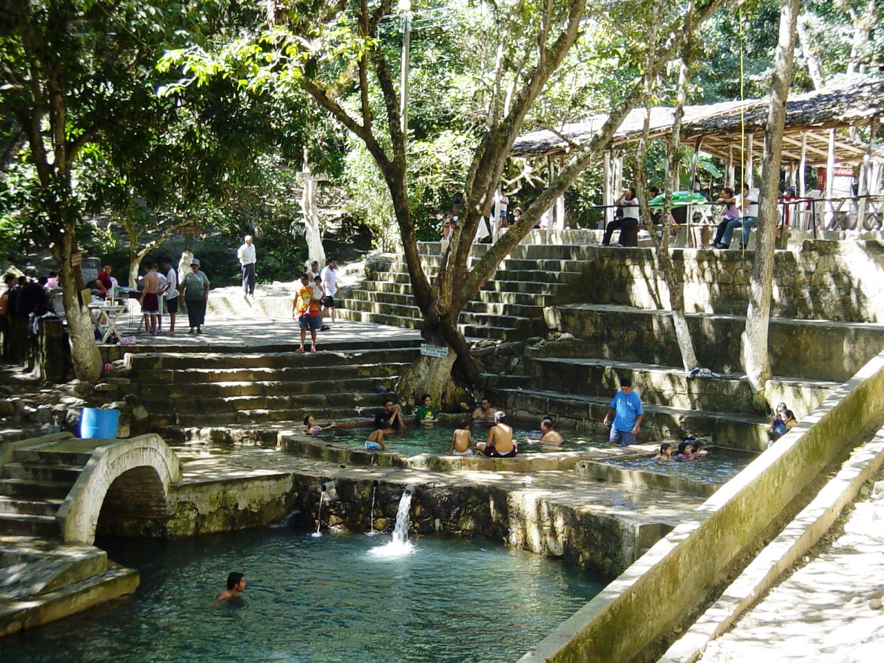
This is the gateway to Celaque National Park and Honduras's highest peak, but Gracias holds its own weight. The Parque Central fills with street vendors and kids in the afternoons, the coffee is serious, and the hot springs at Arcilaca draw locals and visitors alike into 93°F water at the end of a long day on mountain trails.
💛 What travellers fall for
People who return tend to time their visit around the Guancasco in January — a Lenca peace celebration nearly five centuries old that takes over the town in ways no guidebook quite captures. They also mention the Casa Galeano museum, thirty lempiras to get in, where the botanical garden in the courtyard is quieter than almost anywhere else in the city center.
How Gracias came to be
Gonzalo de Alvarado y Chávez founded Gracias in October 1536 in a place then called Opoa, near the Higuito River — the same year the Lenca leader Lempira was organizing fierce resistance against the Spanish advance. The town was formalized as a municipality in 1539 and then, briefly, became the seat of real colonial power: the Royal Court of the Confines established here in 1544 made Gracias the judicial capital of Central America. That status lasted only five years before the Audiencia relocated to Santiago de Guatemala in 1549, and Gracias settled into a quieter existence.
The Fortaleza de San Cristóbal was built in 1863 on orders from President José María Medina; Juan Lindo, who had served as president of both El Salvador and Honduras, spent his final years here and is buried within its walls. An earthquake in 1915 reshaped parts of the town, but the historical center was granted national monument status in 1957 — which is why the facade of the Iglesia de la Merced, dating to the early 1600s, still stands a block north of the main plaza.
Who and what shaped it
People who shaped it
Landmark buildings
See Gracias in motion
Plan your visit
On the map
When to go
Gracias sits at elevation, which keeps temperatures mild year-round — expect daytime highs around 80°F and cool evenings. The wet season runs roughly June through September with heavy afternoon rain; February and March are the clearest and driest months to visit.
Right now
Background & history adapted from Wikipedia (CC BY-SA) · specs from Wikidata (CC0) · weather from Open-Meteo · map data © OpenStreetMap contributors · photos from Wikimedia Commons / Unsplash with per-image credit. No third-party reviews or social posts reproduced.