
Göbekli Tepe
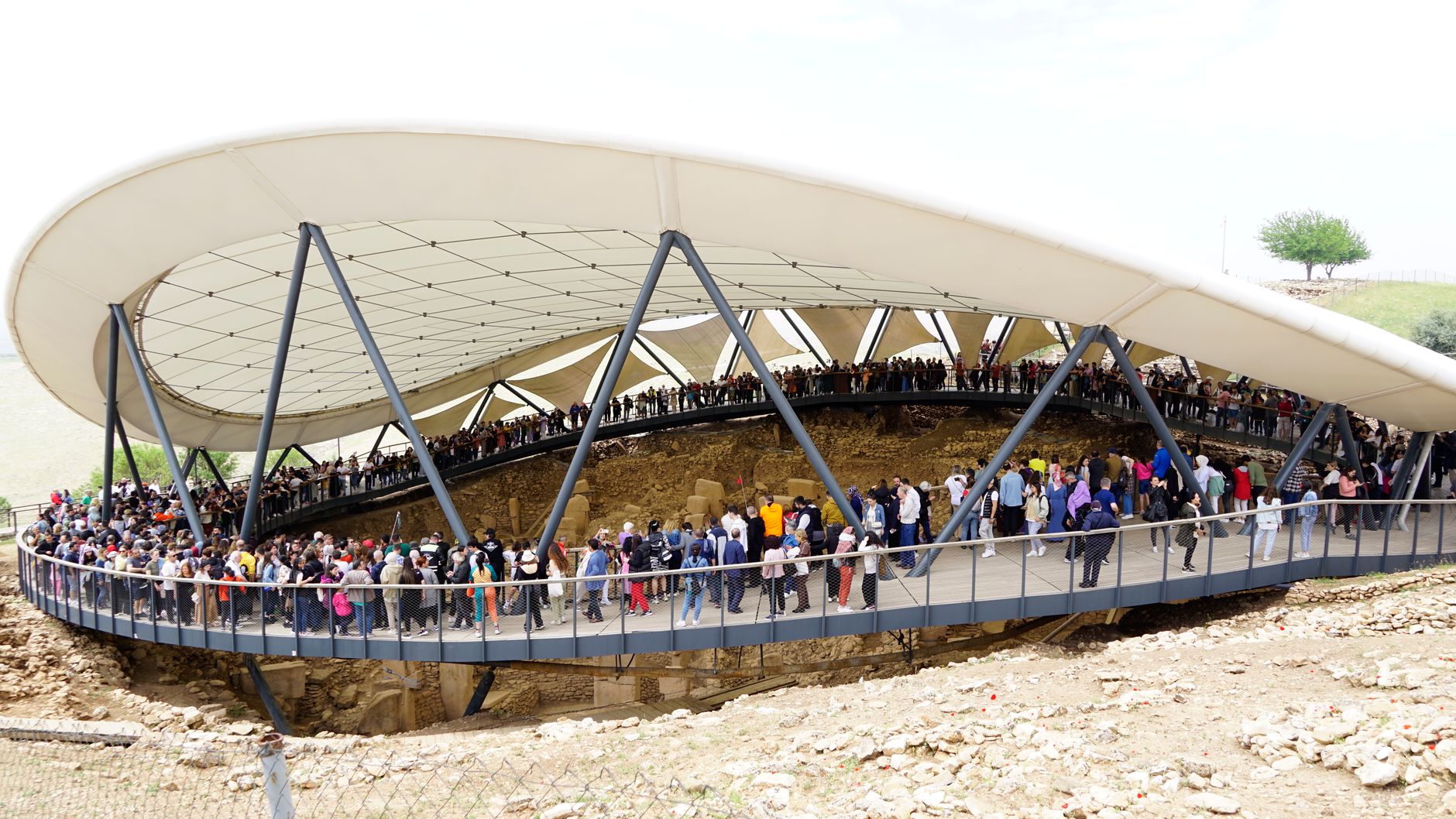
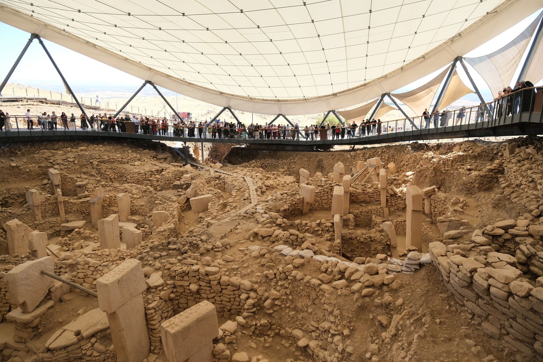
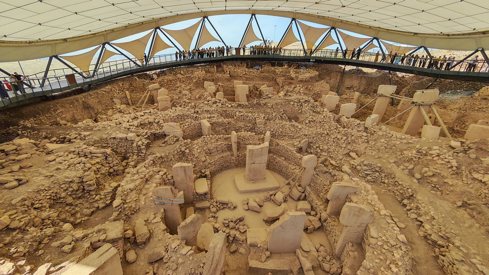
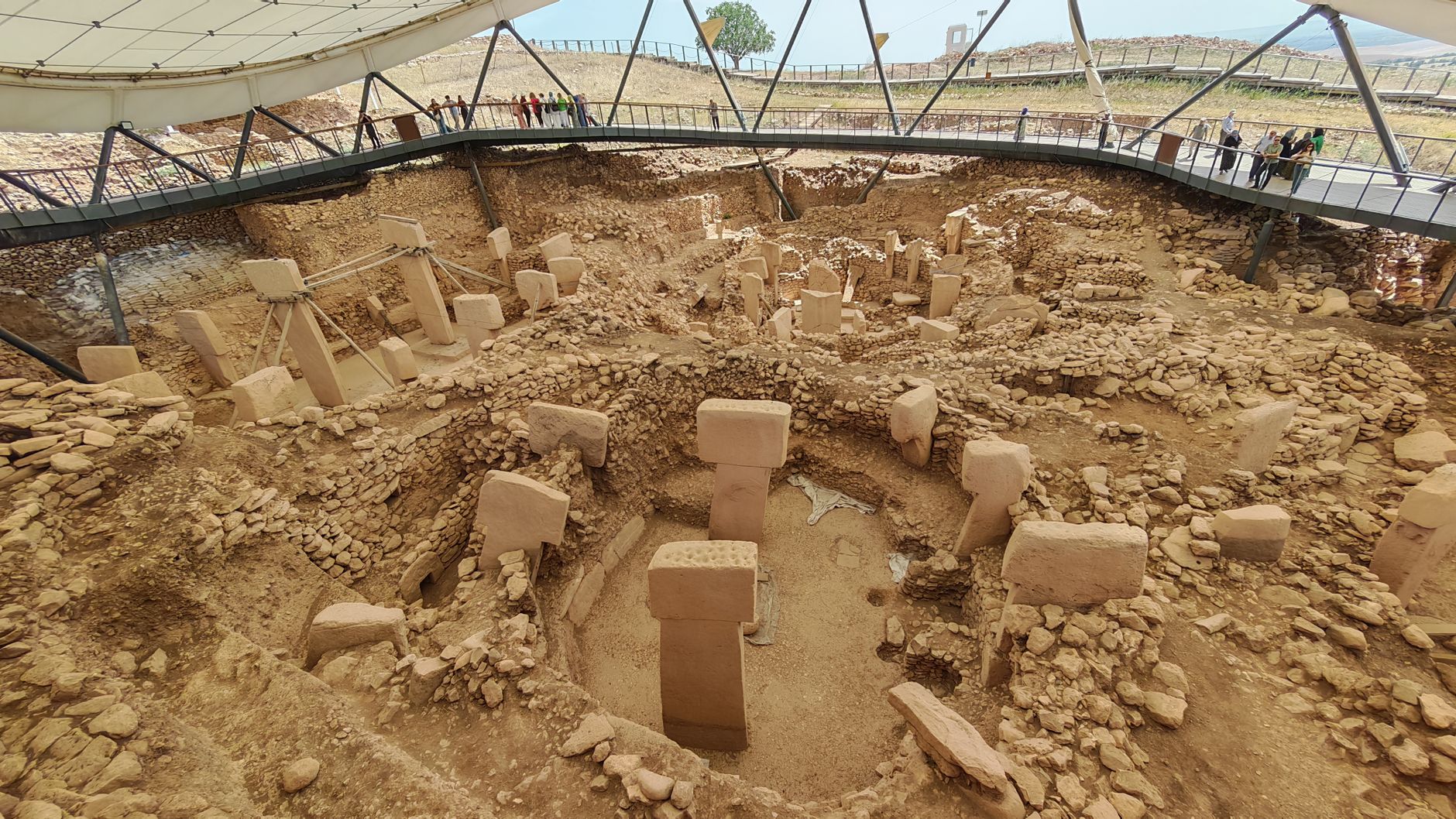
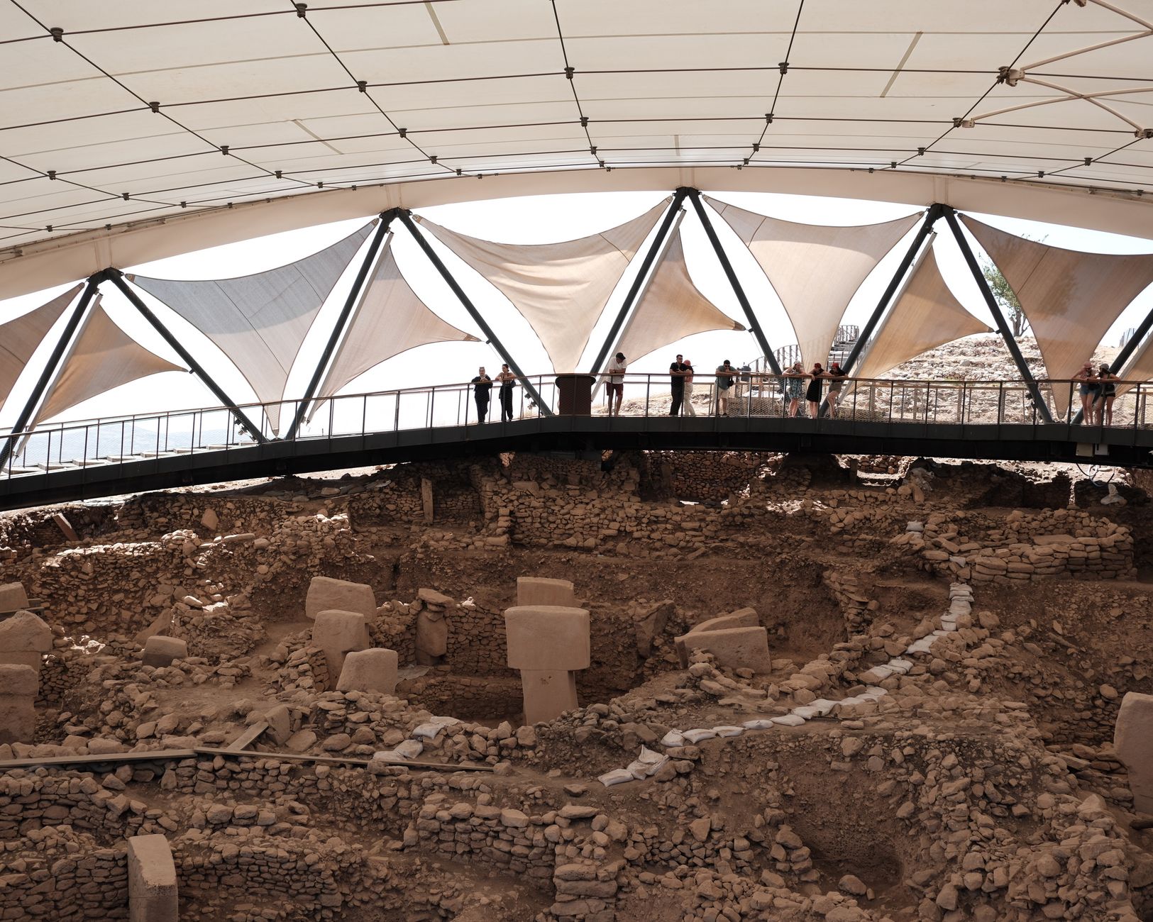
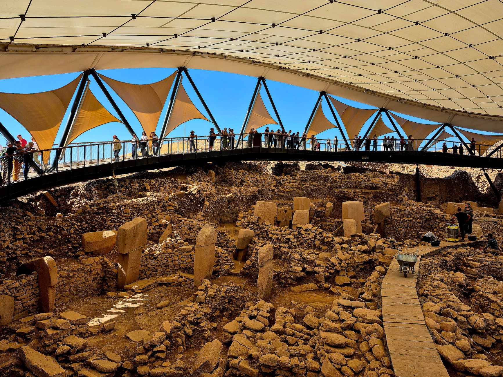
The pillars were already ancient when the pyramids were a thought no one had yet thought. At Göbekli Tepe, a limestone ridge 16 kilometres northeast of Şanlıurfa, hunter-gatherers quarried and raised T-shaped stones up to 5.5 metres tall and 10 tonnes in weight — and did so around 9500 BCE, roughly six millennia before Stonehenge. The figures are not abstract: carved into the shafts you can make out arms, hands, belts, even fox-pelt accessories, as though the stones are beings wearing clothes.
Less than five percent of the site had been excavated as of 2021, meaning the twenty-odd circular enclosures uncovered so far represent a fraction of what the hill still holds. A large canopy shelters the main dig; beyond its shadow, the plateau stretches toward the horizon, unremarkable-looking and almost certainly full of answers.
How Göbekli Tepe came to be
When a German archaeological team passed through in the 1960s, they logged the site as a medieval cemetery and moved on. It took Klaus Schmidt, visiting in 1994, to recognise what the scattered limestone fragments actually were. Schmidt spent the next two decades directing excavations jointly with the Şanlıurfa Museum and the German Archaeological Institute, and the picture that emerged overturned a foundational assumption: that organised religion followed agriculture. Here, it appears to have preceded it — communities travelling up to 200 kilometres to gather for rituals, then returning to lives that were only partly settled.
Schmidt died in 2014; leadership passed to Lee Clare. In 2018 UNESCO added the site to its World Heritage List. Building D, the largest complete enclosure at 30 metres across, has produced the oldest radiocarbon date on site: 9530 BCE.
Who and what shaped it
People who shaped it
Landmark buildings
See Göbekli Tepe in motion
Plan your visit
On the map
When to go
Southeastern Turkey runs hot and dry from June through August — midday temperatures on the exposed ridge regularly exceed 38°C. Spring (March–May) and autumn (September–October) offer the most comfortable conditions, with clear skies and manageable heat; winters are cold and occasionally wet but rarely crowded.
Right now
Background & history adapted from Wikipedia (CC BY-SA) · specs from Wikidata (CC0) · weather from Open-Meteo · map data © OpenStreetMap contributors · photos from Wikimedia Commons / Unsplash with per-image credit. No third-party reviews or social posts reproduced.