
Cilaos
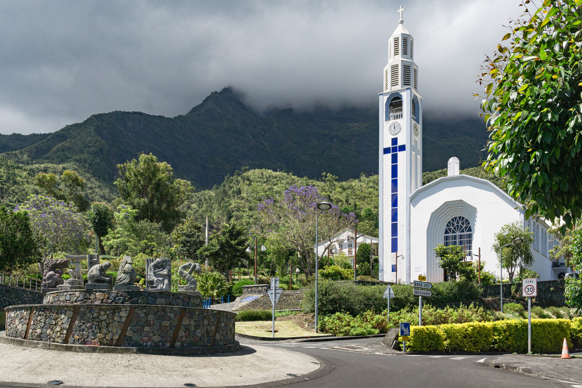


The road up to Cilaos takes around 400 bends to cover 37 kilometres — a number that sounds like hyperbole until you're an hour in, watching the valley floor disappear behind volcanic walls that close around the car like a slow embrace. At 1,214 metres, the town sits inside a near-circular amphitheatre of peaks, a place whose Malagasy name, Tsilaosa, translates roughly as 'the place one does not abandon.'
Up here, the air is cooler than the coast, lentils grow in terraced fields around the hamlet of Ilet à Cordes, and the only wine produced on Réunion comes from vines planted between 600 and 1,300 metres. The thermal springs have been drawing people since the 1880s. The drawn-thread embroidery — delicate white-on-white work called jours — is still made by hand.
💛 What travellers fall for
People who come back tend to time it around the Sunday market on the central plaza, then spend the afternoon at the thermal baths — spring Irénée sits at a steady 37°C. The Chai de Cilaos winery is worth the detour for the rosé alone. La Roche Merveilleuse at 1,437 metres gives you the whole cirque in one view, best in the morning before cloud fills the bowl.
Deals in Cilaos
Book directly at the provider
How Cilaos came to be
Cilaos began as a refuge. In the 18th century, enslaved people who escaped the coastal plantations — known as marrons — found shelter in this near-inaccessible cirque. The steep volcanic walls that make the road so dramatic were also what made the place survivable for those who had nowhere else to go.
Official settlement came around 1850, and with it a spa station; by 1866 the population had reached 960. The thermal springs were formalised around 1880. The road — the famous 400 bends — wasn't completed until 1932, and Cilaos didn't become its own municipality until 1965. The cirque, along with Réunion's other volcanic landscapes, received UNESCO World Heritage status in 2010.
Who and what shaped it
People who shaped it
Landmark buildings
See Cilaos in motion
Plan your visit
On the map
When to go
The austral winter — mid-May through October — brings the driest, mildest conditions, with July and August averaging around 17°C at altitude. The wet season from December through April can deliver extraordinary rainfall; the cirque holds the world record for 24-hour precipitation: 1,870 mm fell on 15–16 March 1952.
Background & history adapted from Wikipedia (CC BY-SA) · specs from Wikidata (CC0) · weather from Open-Meteo · map data © OpenStreetMap contributors · photos from Wikimedia Commons / Unsplash with per-image credit. No third-party reviews or social posts reproduced.