
Al Ain
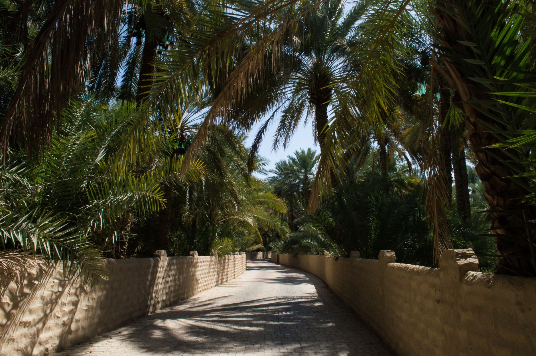
Al Ain sits at the edge of the Empty Quarter, a city built on water in one of the driest places on earth. The falaj channels that thread beneath its date-palm groves have been running since roughly 2500 BC — gravity-fed, hand-dug, still working. That continuity is the thing that sets Al Ain apart from every other city in the UAE: the past here is not reconstructed, it is ongoing.
This is where Sheikh Zayed bin Sultan Al Nahyan grew up, governed, and began the reforms that would eventually shape a nation. The forts, the oasis, the Bronze Age tombs at Hili — they are not exhibits so much as a layered record of the same place across eight millennia. Al Ain became the UAE's first UNESCO World Heritage Site in 2011, and walking it, you understand why.
How Al Ain came to be
People have lived around this oasis for close to 8,000 years. The beehive tombs at the foot of Jebel Hafeet date to around 3000 BC; by the Hili period, roughly 500 years later, there were agricultural villages and the first falaj irrigation networks. That same system of underground channels, refined over millennia, is what made the oasis viable — and what made it worth defending.
In 1891, Sheikh Zayed I built Al Jahili Fort from mud, straw, and palm fibre to protect the groves and water sources. His grandson, Sheikh Zayed bin Sultan Al Nahyan, was born here around 1918 at Qasr Al Muwaiji and served as the region's governor from 1946, modernising the falaj, building the first schools and hospitals. The palace he lived in until 1966 is now a museum. So is the fort. The oasis itself is still producing dates.
Who and what shaped it
People who shaped it
Landmark buildings
See Al Ain in motion
Plan your visit
On the map
When to go
From November to March, days are warm and clear — often in the low-to-mid twenties Celsius — and evenings cool noticeably. From May through September, daytime temperatures regularly exceed 40°C; outdoor sites like the oasis and Hili Park are best left for early morning if you visit at all during those months.
Right now
Background & history adapted from Wikipedia (CC BY-SA) · specs from Wikidata (CC0) · weather from Open-Meteo · map data © OpenStreetMap contributors · photos from Wikimedia Commons / Unsplash with per-image credit. No third-party reviews or social posts reproduced.